There are essential books: Don Quixote, A Christmas Carol, To Kill a Mockingbird. And then there are essential books: an encyclopedia, a dictionary, an atlas. Okay, so the Internet has made the encyclopedia irrelevant. The dictionary has become less precious, although I would welcome an online equivalent of the Canadian Oxford. And the atlas is now less than absolutely necessary. Sometimes it’s hardly fit to exist, what with GPS-driven maps in cars, and online maps that help you locate just about any business you can name.
But I still covet old maps that have been carelessly folded. Artifacts like that are magic to me. Perhaps it’s because of that childhood sleeping bag lined with the flannel map of Camp Wigwam. Perhaps it’s because my grandfather made and collected maps of mining claims. Perhaps it’s because maps crystallize our understanding of the space around us -- its history and possibility -- in a way that nothing else can.
A map is better than a story? Often for me it is, although I particularly like maps that come with a story. Blame the Hardy Boys and old National Geographics.
It seems some other people like maps as well. Publishers are producing books of maps like never before, notwithstanding the influence of the Internet. How do I know this? I don’t have the statistics mapped out. I do, however, have a list of recent books of maps that have drawn me into their other world. Remarkably, every one of them is from a British Columbia publisher.
Besides, it’s Christmas, and nothing says Christmas more than an atlas from your parents. Hey, mine have given me at least three, counting only the standard global National Geographic–style iterations. Turnabout is also fair play, and if you give atlases to your parents there’s the added benefit that you might one day inherit them.
So here are a few atlases (and a couple of these newfangled websites) you may wish to consider deploying in this Christmas season. Or perhaps, if there’s an atlas you covet, you’d prefer to drop Santa a note. He can be reached at the North Pole, I’ve been told -- wherever that is.
Vancouver: A Visual History By Bruce Macdonald (Talonbooks, 1992) Nothing better summarizes the astonishing accomplishment and loss involved in the development of the City of Vancouver than this landmark book. The foreward talks about the change in map-making that the book so ably represents: that maps have become more local and idiosyncratic and annotated. Just a few seconds spent flipping through the decade-by-decade maps of the city’s development -- created for the book -- gives an astonishing impression of the scope and pace of change.
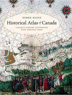
The Historical Atlas of Canada By Derek Hayes (Douglas & McIntyre, 2002) We’re lucky in British Columbia to have a guy who is completely obsessed with maps and knows how to use them. Derek Hayes produced the Historical Atlas of British Columbia and the Pacific Northwest (Cavendish) in 1999. Now he has seven books with the word atlas in the title, and a few more besides, on subjects ranging from America to the Arctic. The making of maps provides a compelling lens to examine the European settlement of North America, and Hayes deftly employs that lens to tell the story. It’s easy to lose an evening browsing The Historical Atlas of Canada, which has just been reprinted in softcover for the budget-minded among us.
The Historical Atlas of Vancouver and the Lower Fraser Valley By Derek Hayes (Douglas & McIntyre, 2005) Why pick these two Hayes atlases when he’s written so many? Because I have read them. Municipal mergers and subdivision hype may not make for the most compelling storytelling; Hayes is at his best when he’s writing about those who ventured into the unknown to make maps. But the artifacts in this atlas offer the natural complement to the new maps of the city’s development contained in Vancouver: A Visual History. And hey, the book is full of old maps of my hometown. It is, in the words of one fellow map lover, a must-have double-bag item.
A Sto:lo Coast Salish Historical Atlas Edited by Keith Thor Carlson (Douglas & McIntyre, 2001) How we see the world depends on who makes the maps. Some famous person should have said that. The point is, European nations once spent enormous amounts of money on explorers and mapmakers to claim land. Maps have always been motivated mainly by real-estate plays. Too bad the Sto:lo didn’t have a copy of A Sto:lo Coast Salish Historical Atlas 150 years ago, when they most needed to be able to walk into a government office or a courtroom and point to what was theirs. As the atlas’s moving foreward and any number unresolved land claims or sacred-site desecrations also make clear, we still don’t properly honour rights and history that doesn’t show up on our maps. This Sto:lo community project was an effort to provide a freely available record of their place and history. The library of anyone who wants to understand the Fraser River delta is incomplete without it.
Islands in the Salish Sea: A Community Atlas Edited by Sheila Harrington and Judi Stevenson (TouchWood, 2004) Maps can be nothing more than roads and rivers and topography, with the odd lake or ocean thrown in for colour. Where are the maps that outline special places, secret trails, and eagles’ nests? Where are the maps that emerge from community values? Local planning is, by and large, so new to many B.C. communities that official maps are only beginning to address the challenge. Too often, engineers control all the maps. Too often, precious things get build on or dug up or sold because nobody in charge had the faintest idea. That’s why this atlas project, wherein island communities in the Gulf of Georgia were invited to create pictorial maps that reflected personal views of their geography, sets such an important example. Some of the maps are beautiful. Others are rendered in a style that may make you feel strangely compelled to go out and purchase ugly 1970s pottery -- but old hippies can still be good people, and they know where the special places are.
The Geist Atlas of Canada By Melissa Edwards (Arsenal Pulp Press) Geist magazine’s trademark place-name maps of Canada have been collected in one volume, subtitled Meat Maps and Other Strange Cartographies. You’ve got your Canadian Map of Loudmouths and Outbursts, a map of Crime and Punishment, an Angst Map and a Beer Map. All your cousins in Dismal Creek and Beavermouth will be wanting one. The maps are annotated with the sort of eccentric history that will appeal to anyone who fondly remembers the year in which the former BC Tel put a photograph of Yahk Mountain on the cover of the phone book. Come to think of it, maybe this atlas is not for all your cousins in Beavermouth. But you will know someone who’ll appreciate its droll humour, and if you’ve read this far you probably deserve a copy for yourself.
Google Earth Okay, some of these books are expensive, although the Geist atlas lists for a mere $24.95. Let’s say you’ve got too much time on Christmas afternoon, and you didn’t buy Uncle Fred so much as a box of waxy chocolates, and he’s falling in and out of sleep and occasionally snoring on the couch, and you can’t stand it any longer. Show the old book-codger something he can get for free when he learns how to use the computer. Show him Google Earth. Or show it to your three-year-old nephew who would otherwise ignore you completely. In seven mouse clicks, they can go from a view of the planet to a view of the roof of their house. You might even show Uncle Fred how to find a place to live way on the other side of town from you, with HousingMaps.com, which uses Craigslist and Google maps to pinpoint on a map all the places for rent in major cities, including Vancouver and Victoria. If the prospective landlord has the average technical ability and interests of a nine-year-old, Uncle Fred can also click on a location and see photos of the property. You can’t do that with a Reader’s Digest atlas. ![]()