Marking 20 years
of bold journalism,
reader supported.
Culture
Photo Essays

Snapshots of Vancouver’s Many Mount Pleasants

The neighbourhood as heritage, then hipster, then Hootsuite. Its greatest change may be to come.

Christopher Cheung 10 Jul 2019TheTyee.ca

Christopher Cheung reports on urban issues for The Tyee. Follow him on Twitter at @bychrischeung or email him here.

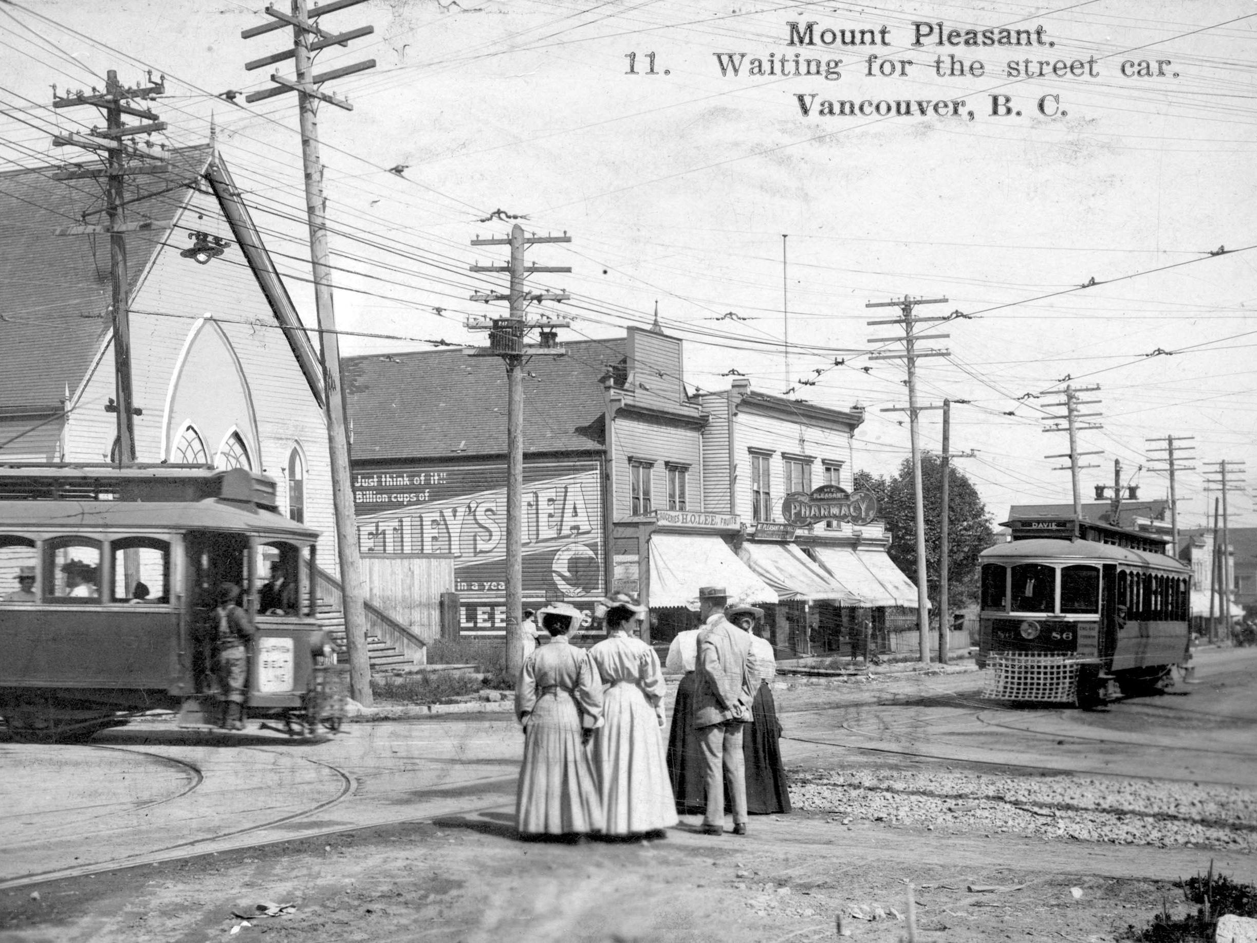
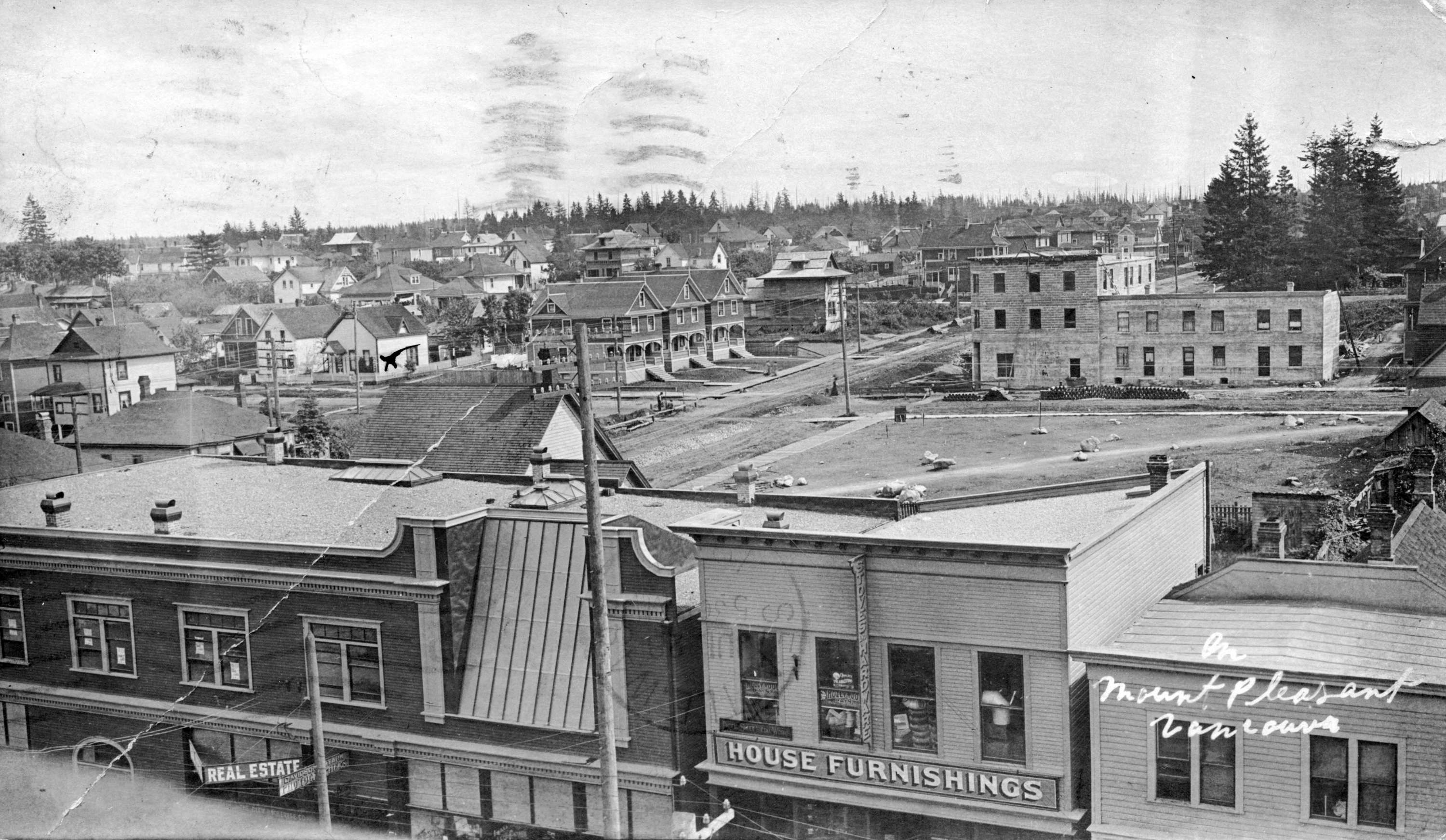
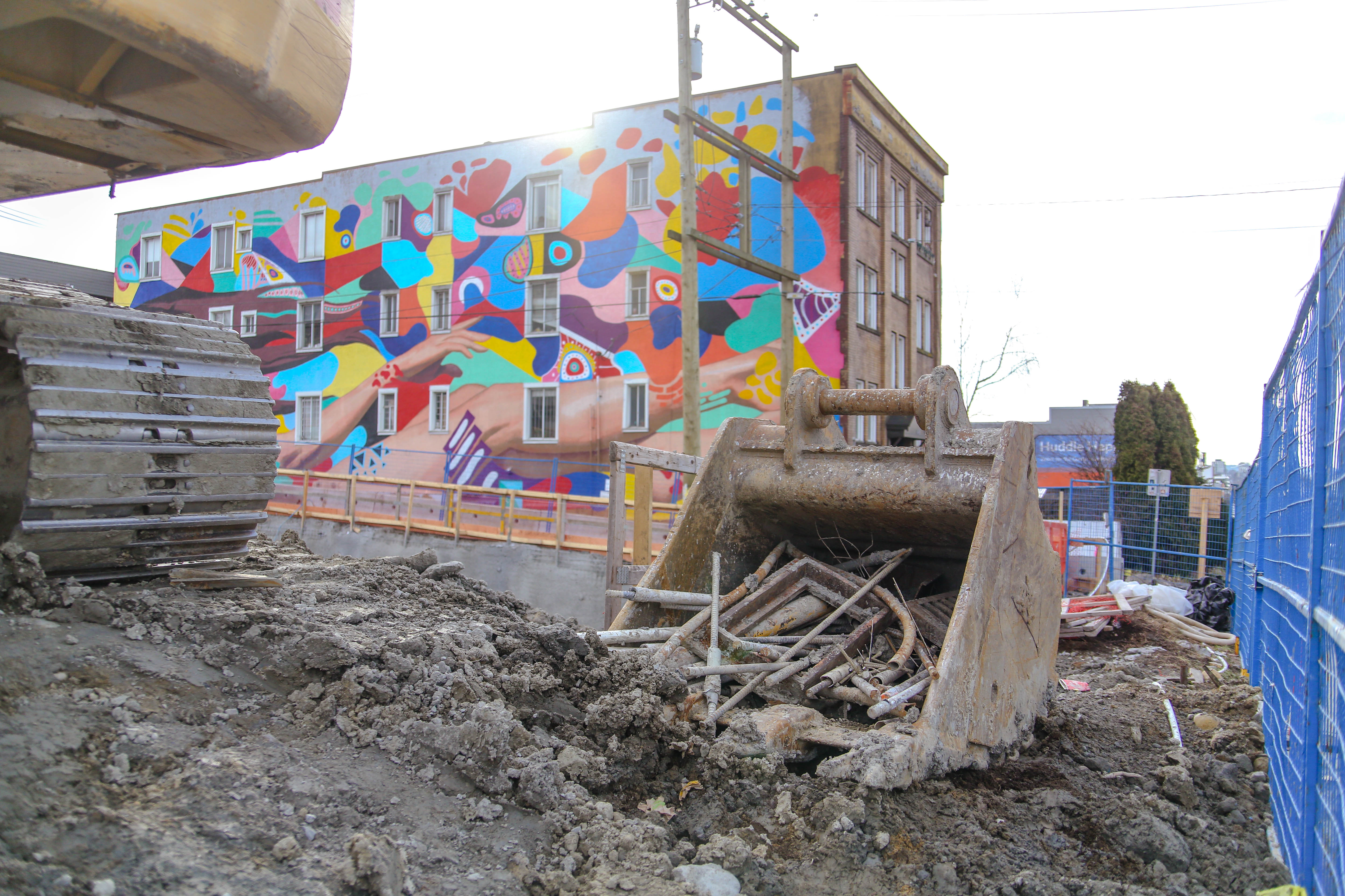
At the top of Heritage Vancouver’s annual watch list of vulnerable places is the heart of the Mount Pleasant neighbourhood. This commercial hub of Vancouver’s first suburb is well over a century old, blossoming in the late-1880s around the nexus of Main, Broadway and Kingsway.

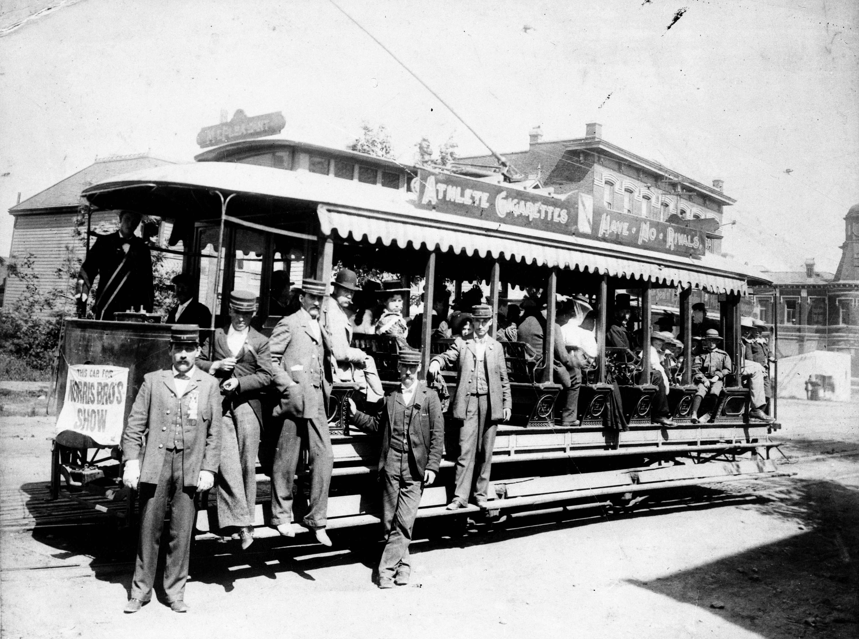
If you lived here in the early 20th century the hub had all your staples, with grocers, clothing shops, butchers and banks. Streetcars brought people to the stores then. Today a different kind of transit project is on track for the neighbourhood. And it’s one of the factors threatening the neighbourhood’s heart.

The Broadway subway plan calls for a station here in 2025. The city has already launched planning efforts for a six-kilometre stretch of Broadway, from the east side’s Clark Drive to the west side’s Vine Street.

And, banking on the increasing desirability of the area, nicknamed Mount Pixel for its tech boom and the upscaling that comes up with it, a few developers have been amassing small properties for larger future projects.

Whether you hold dear the historic 1890s Mount Pleasant, when it welcomed the streetcar, or the hipster 1990s Mount Pleasant, when it became a destination for eclectic shopping, Heritage Vancouver warns development pressures might smash or squeeze out what makes the neighbourhood special.

That includes its built heritage, but also its diverse demographics and intimate streetscape, a legacy of its pre-car pedestrian and streetcar days.

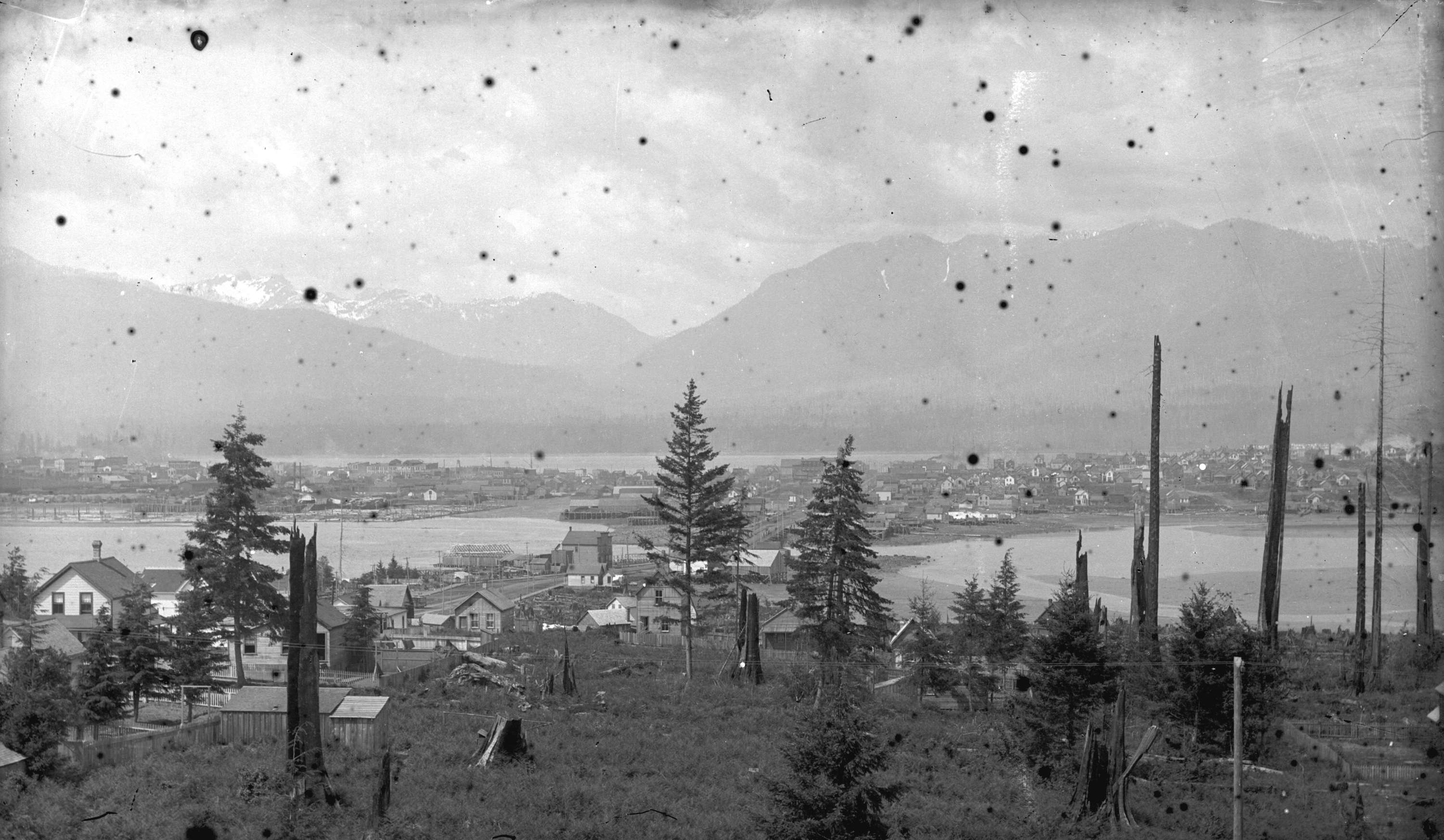
Settler history aside, Mount Pleasant’s Indigenous heritage stretches back millennia, when the area was mostly a dense rainforest of huge fir, cedar and hemlock, bisected by the ancient trail that would become Kingsway. A creek held trout and spawning salmon, elk and bears roamed the woods and plants like berry bushes and Labrador Tea (later enjoyed by British settlers) made this an area of natural abundance.

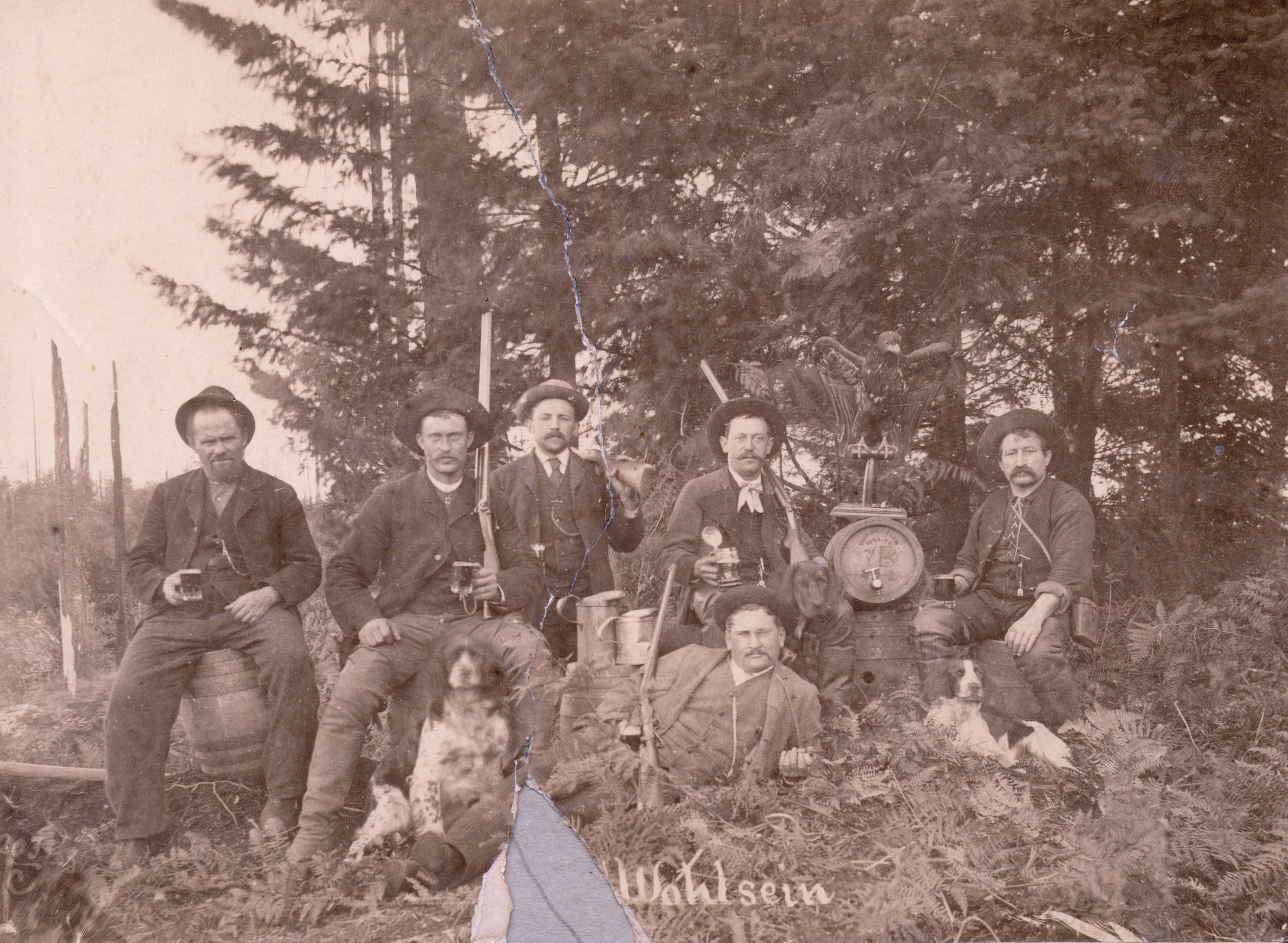
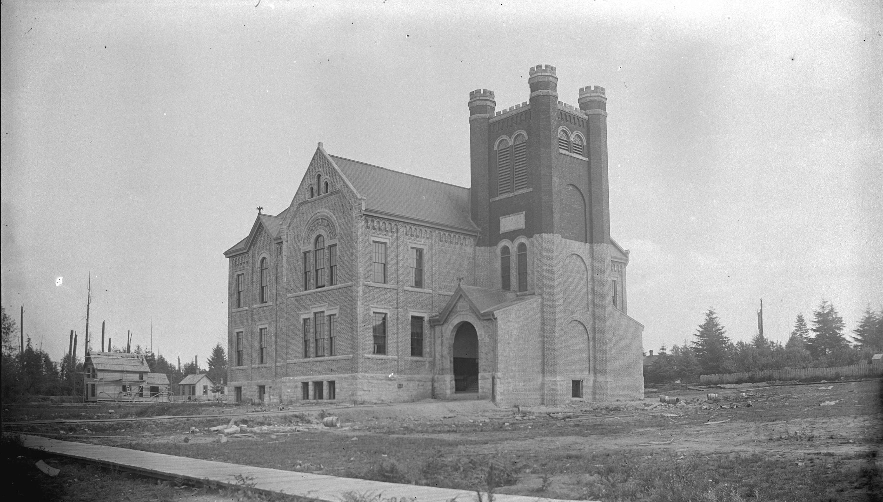
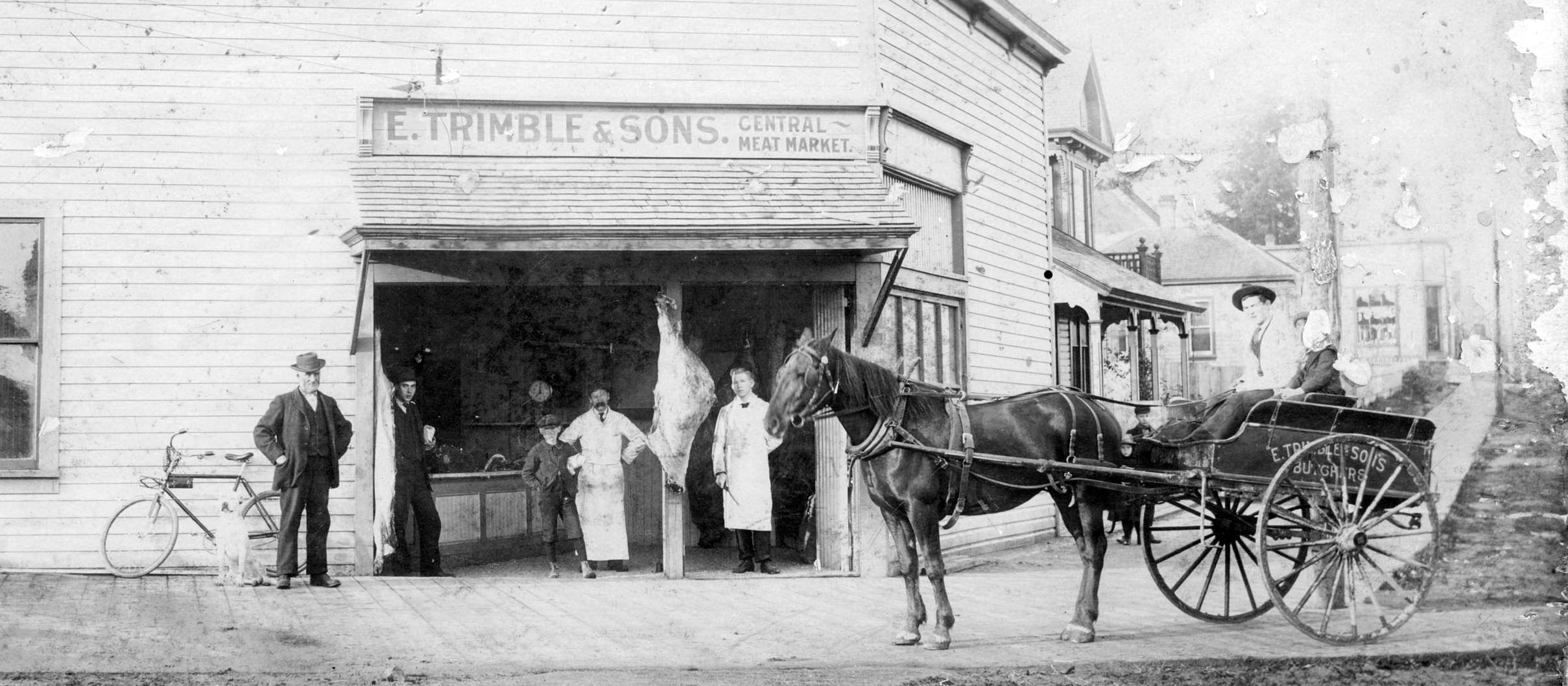
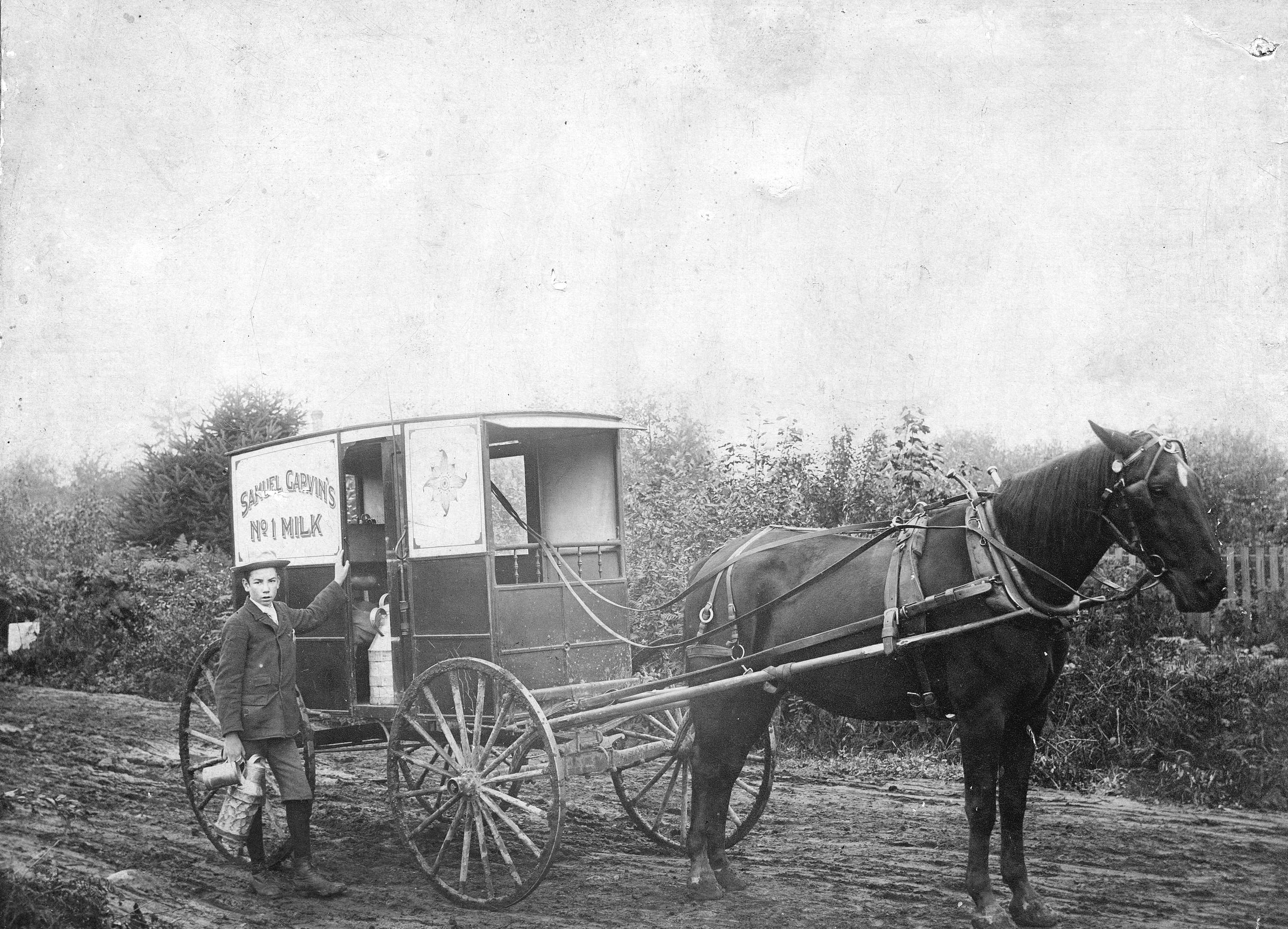
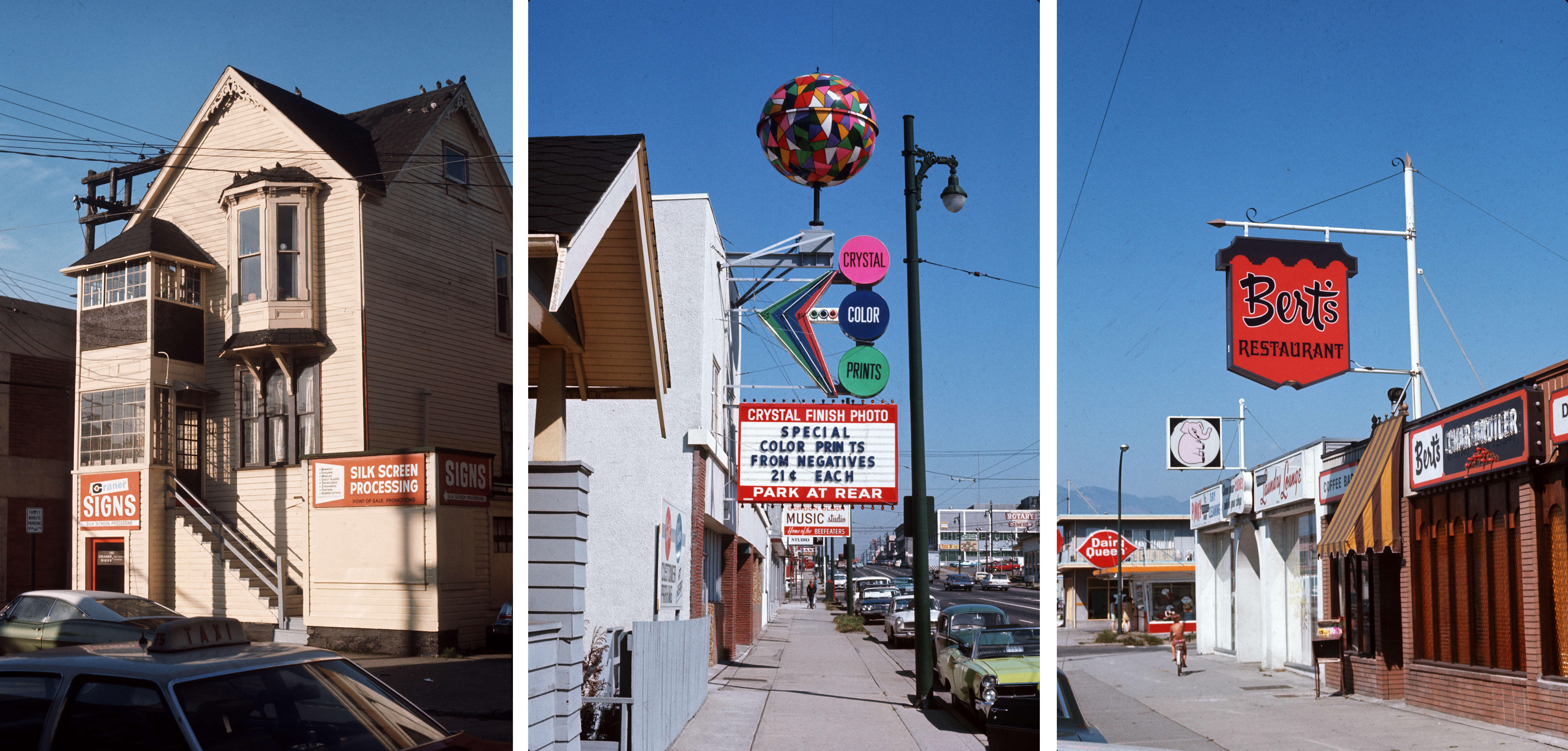
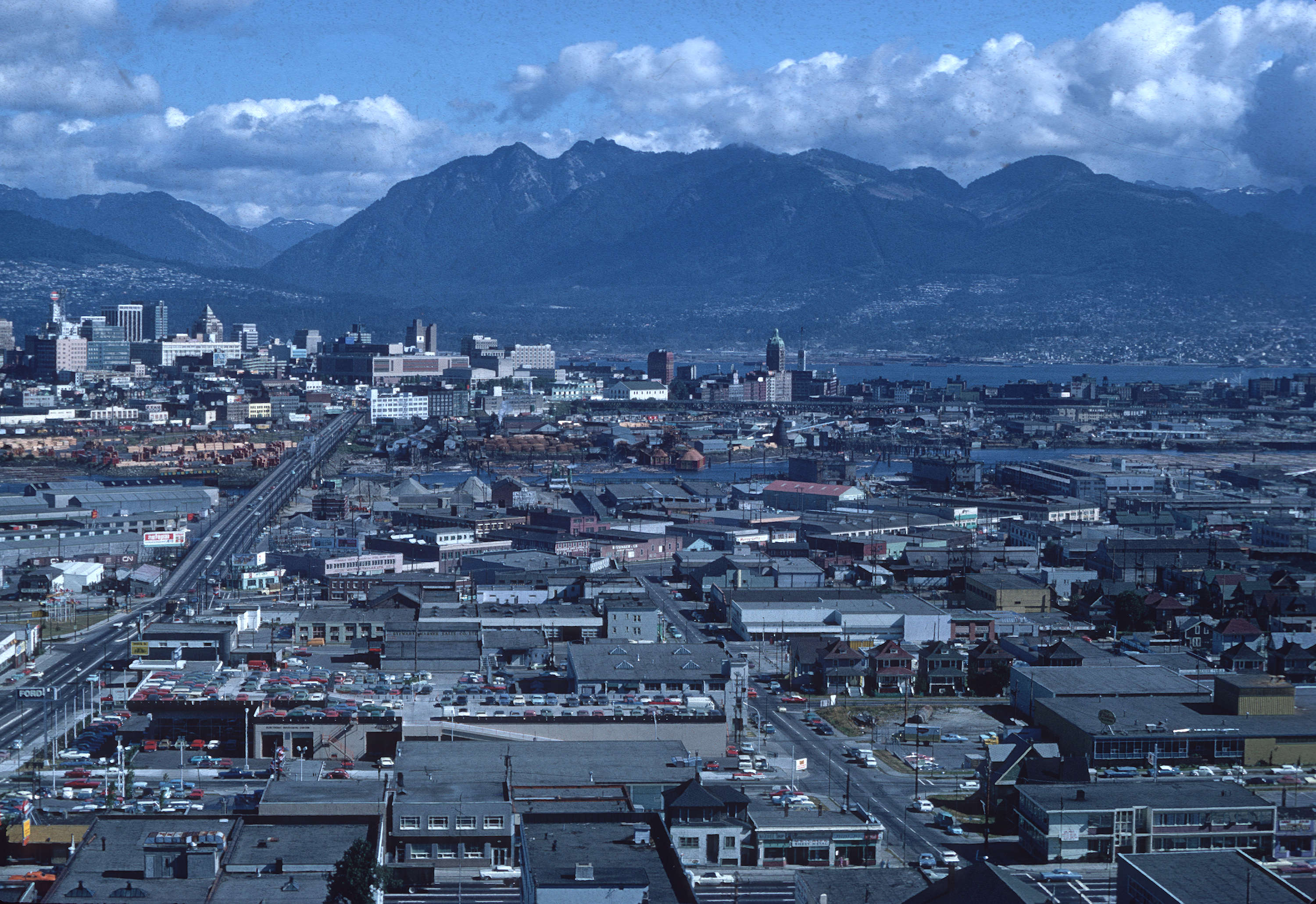
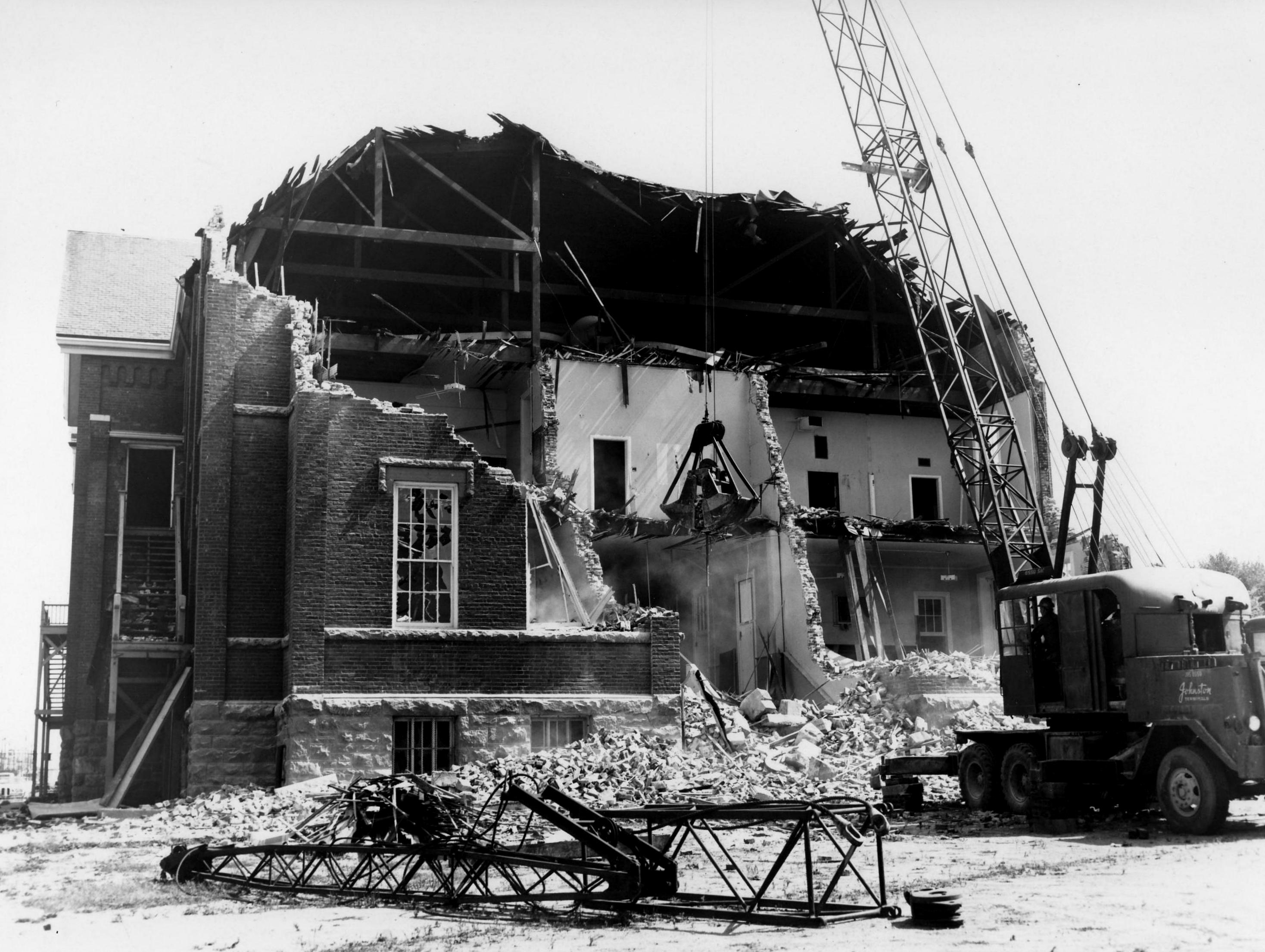
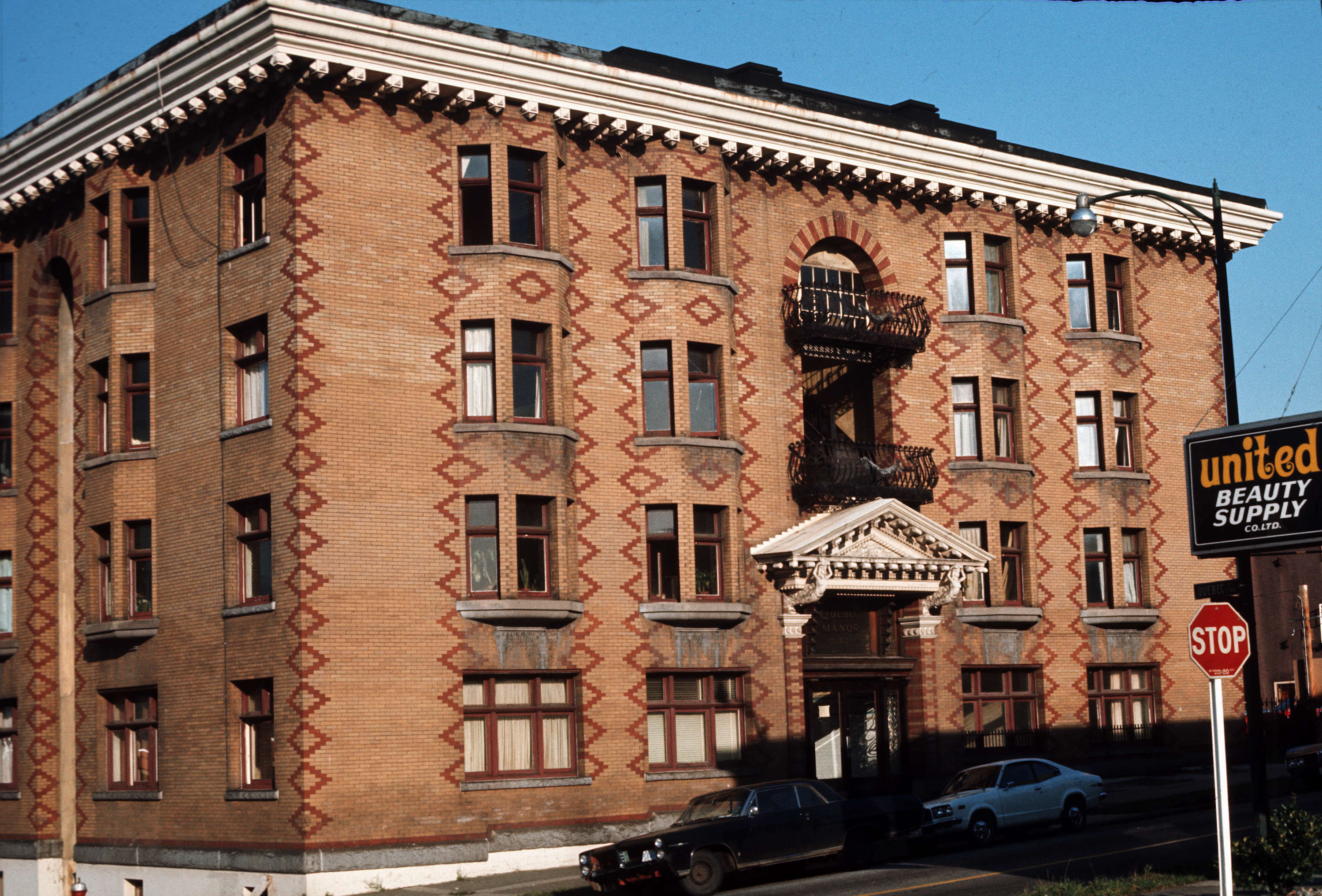
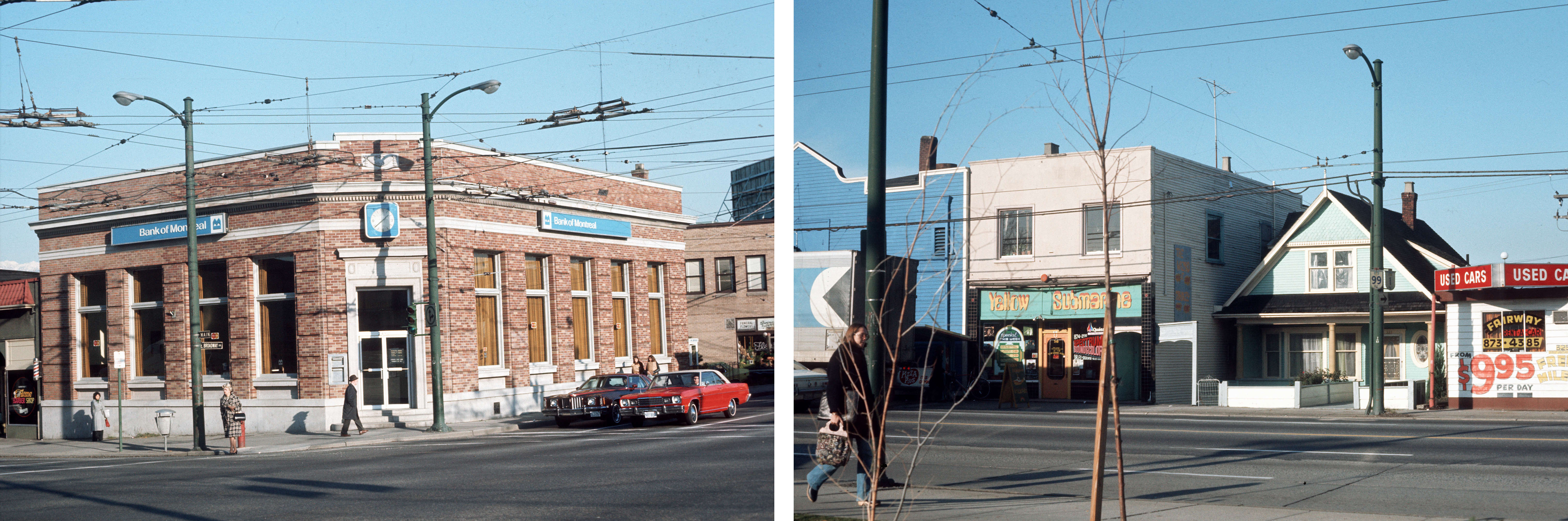
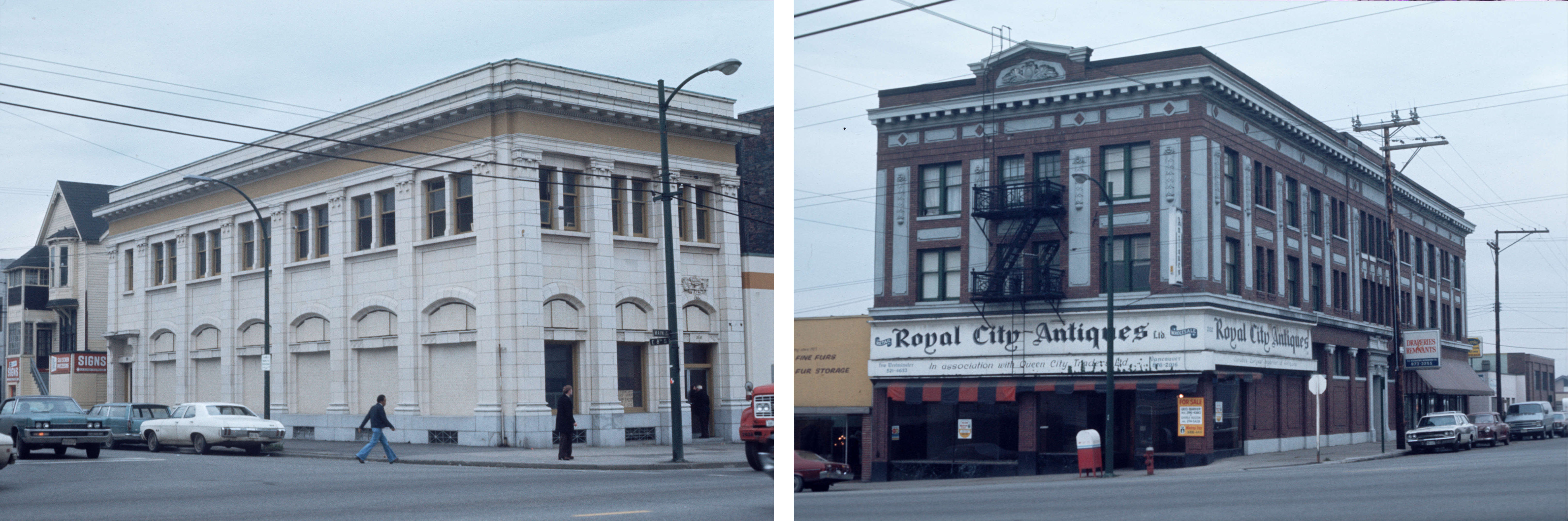
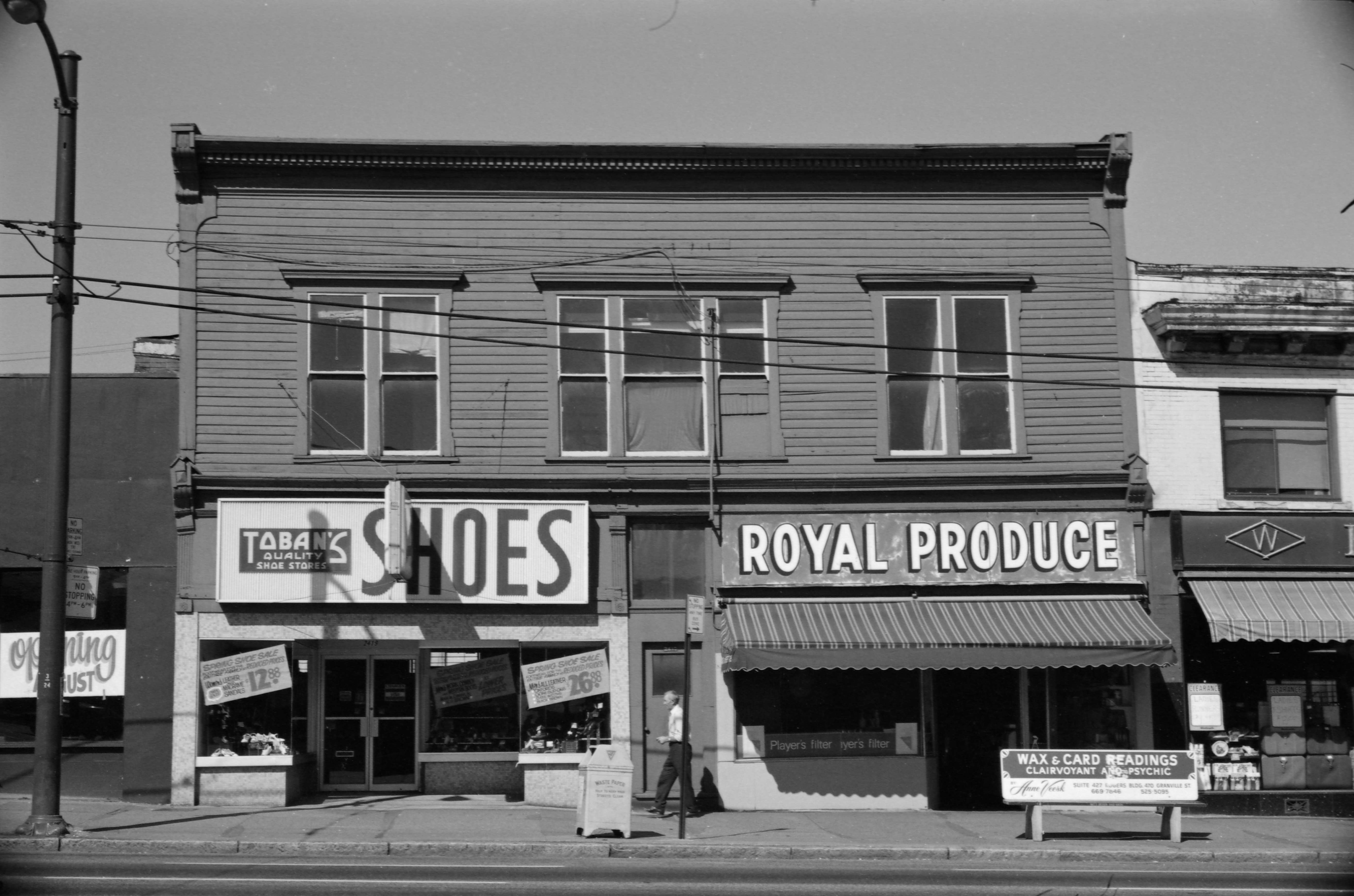
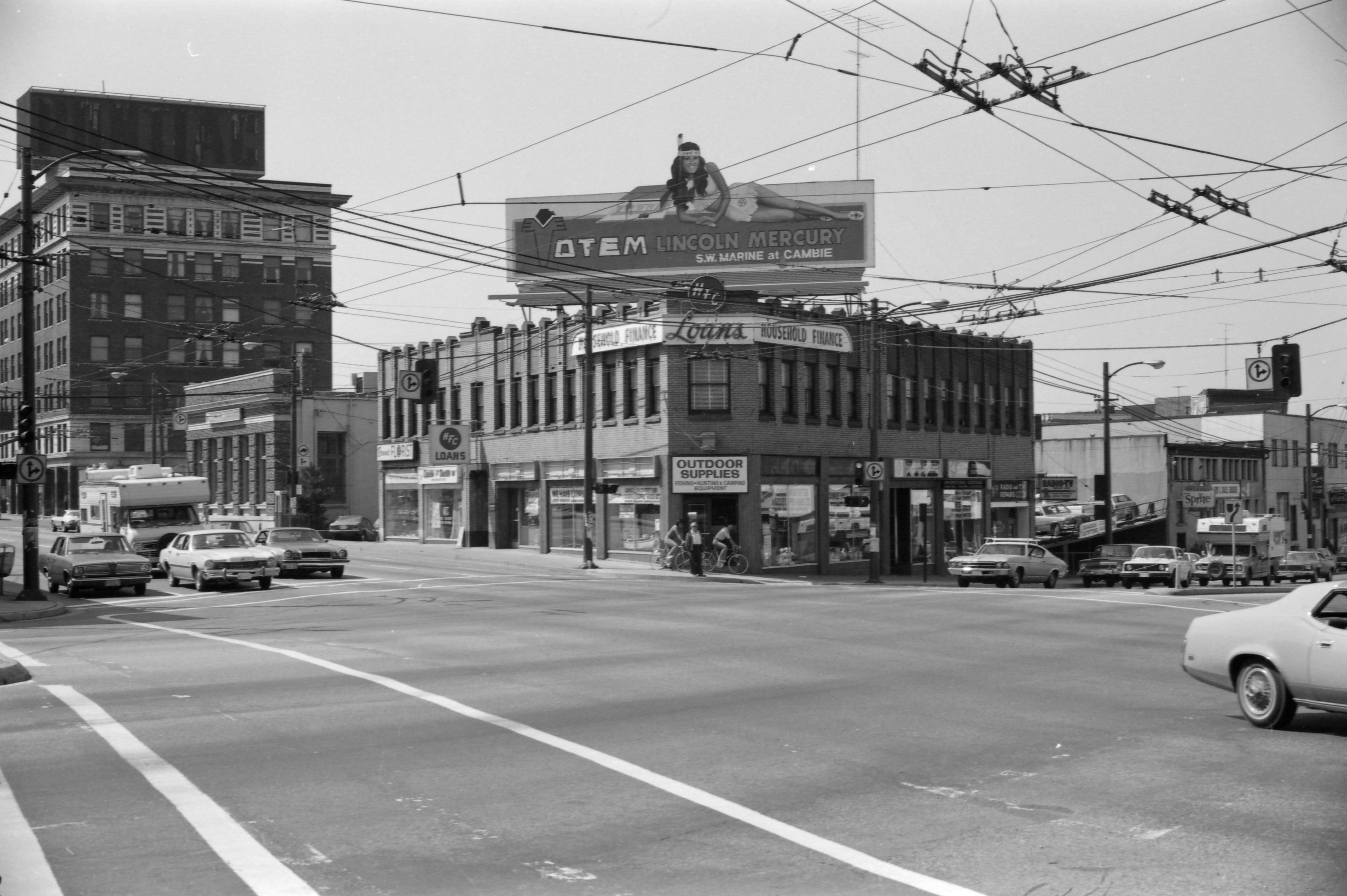
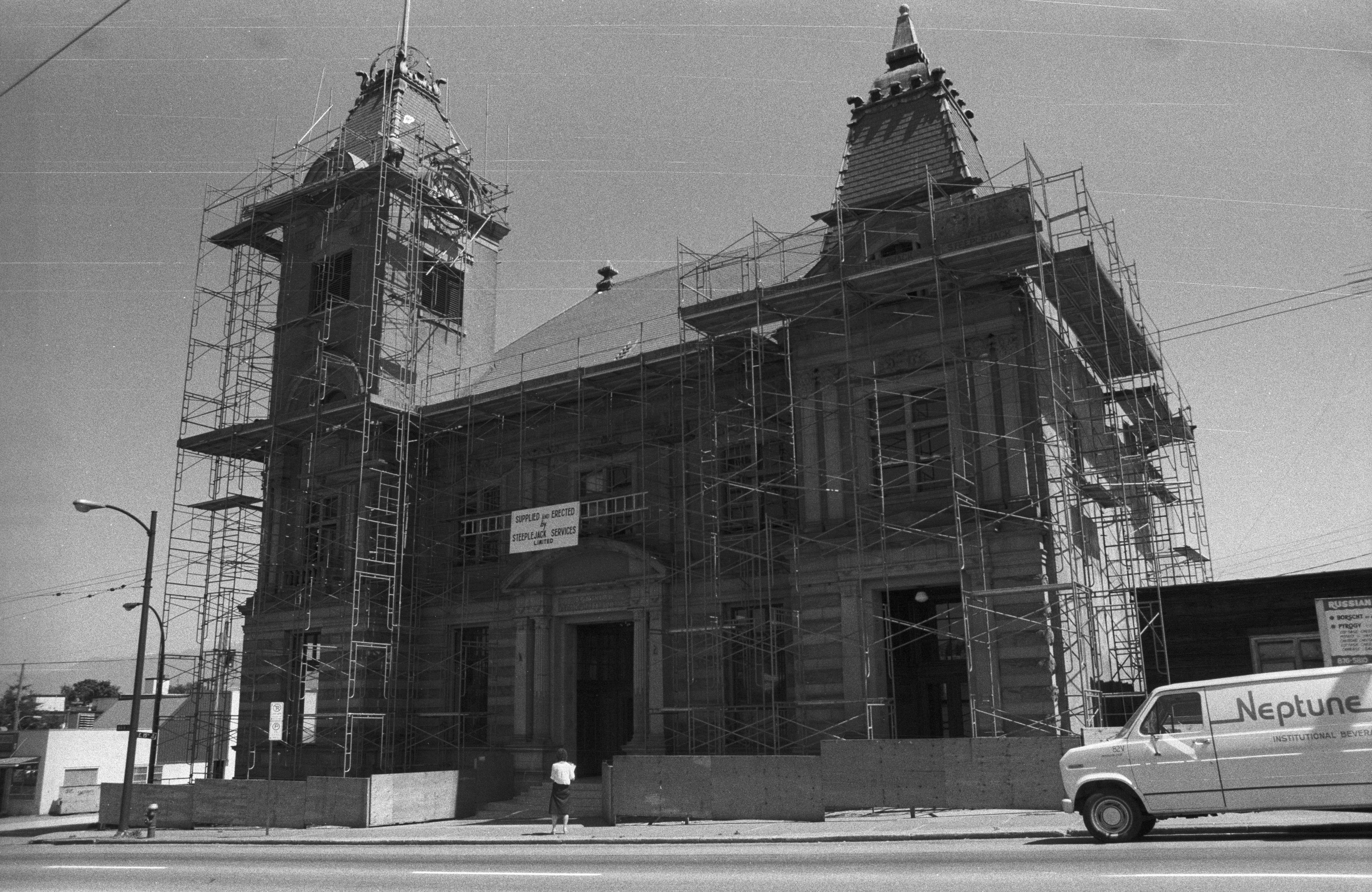
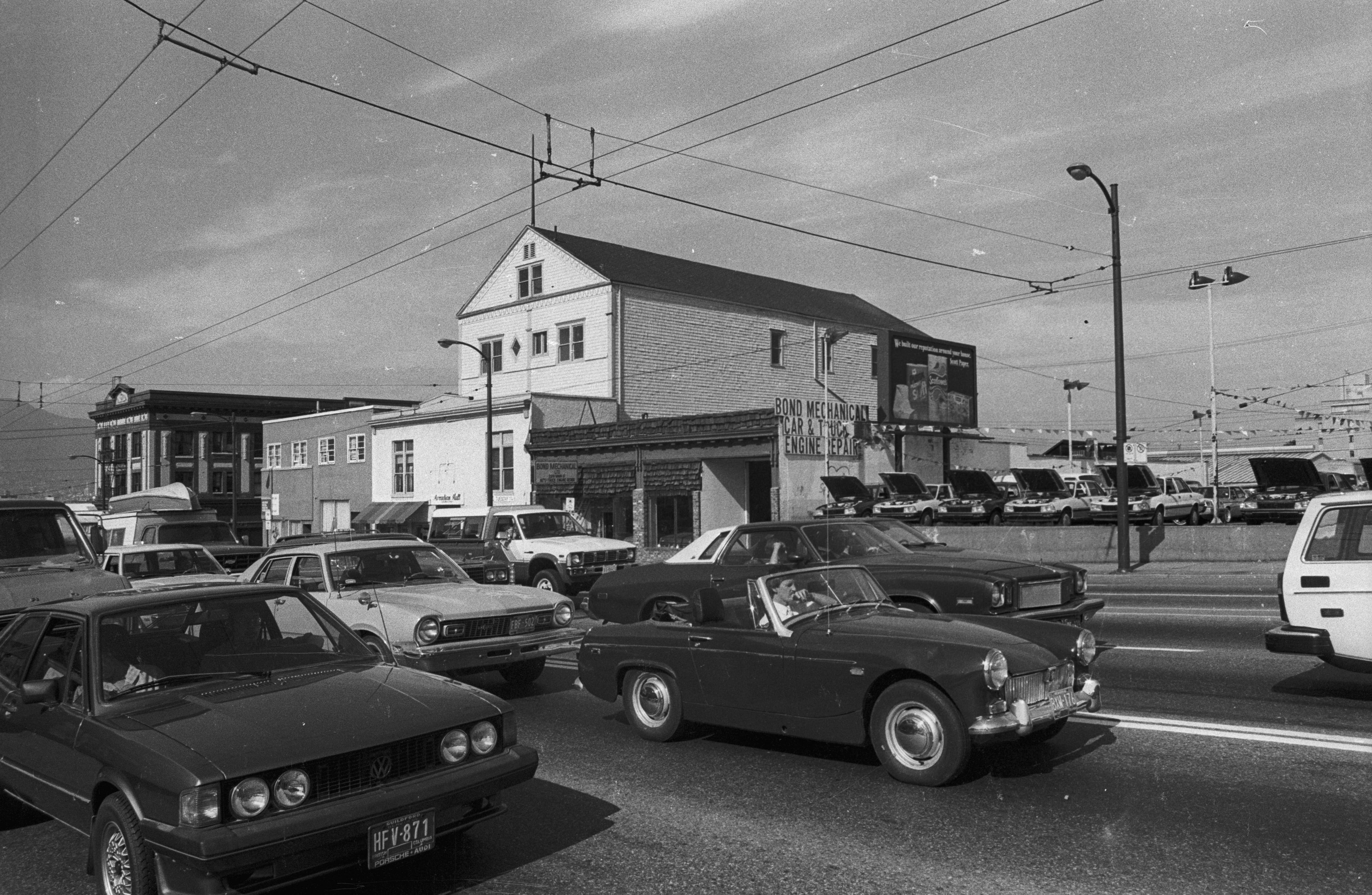
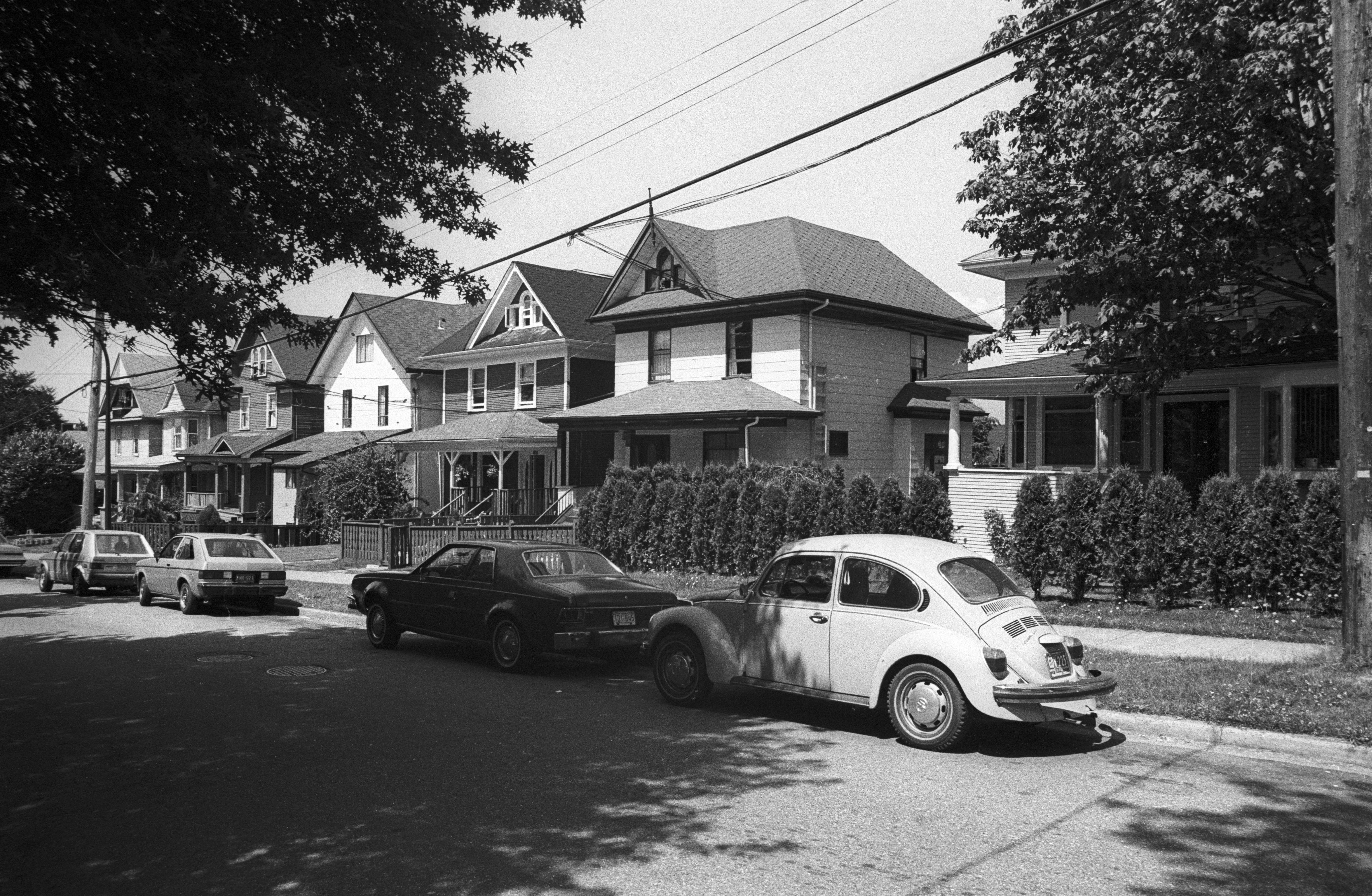
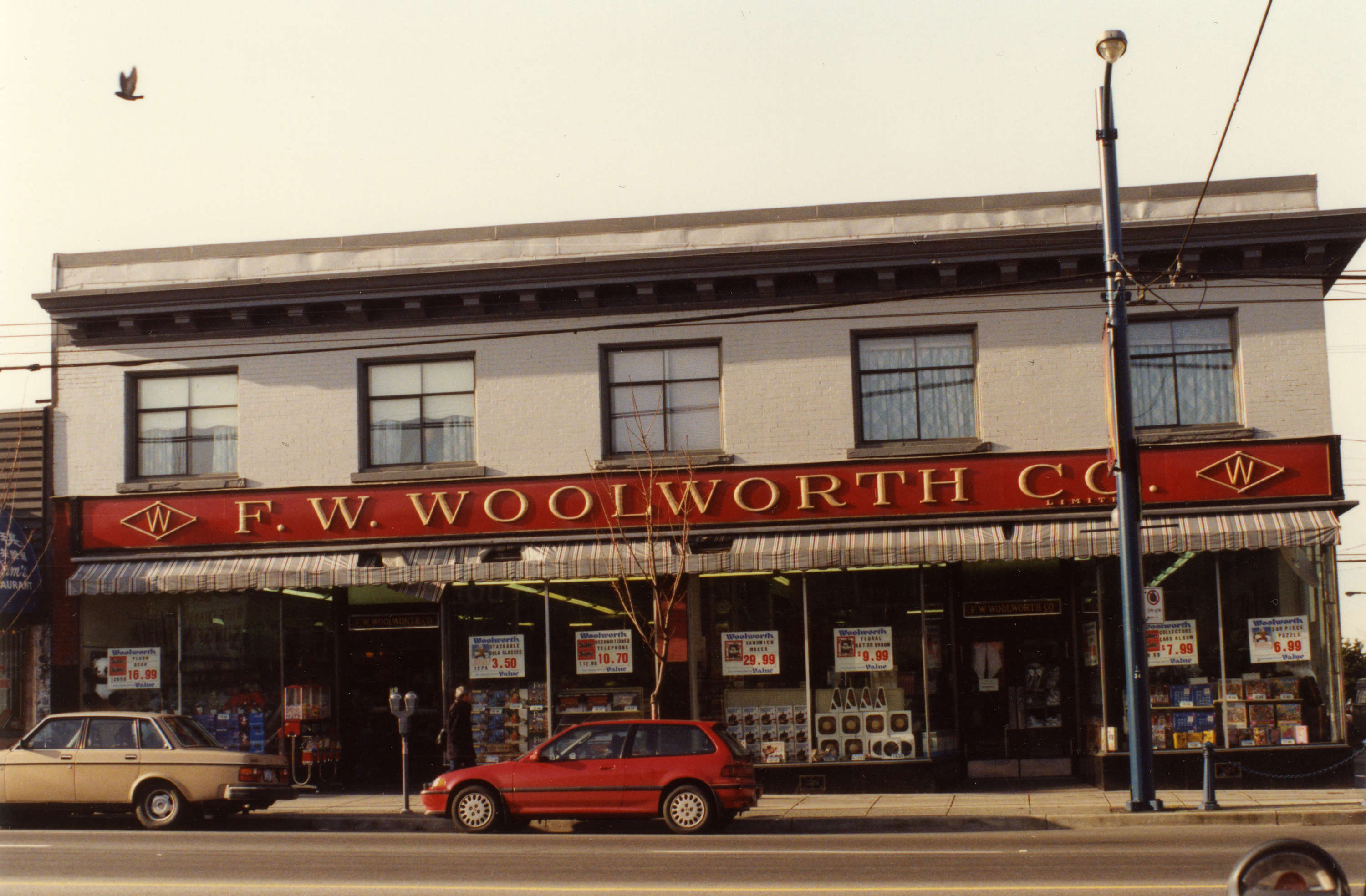
Some of those landscapes appear in the city’s archival photographs of Mount Pleasant, starting from the 1890s.

Here’s a selection of images that show the evolution of the neighbourhood.

1200px version of MountPleasant-1890-MtPleasant.jpg
189-?: In Mount Pleasant, looking north at downtown Vancouver from the south side of False Creek (which then stretched east to Clark Drive at high tide). Main Street, then called Westminster Avenue, had a trestle bridge spanning the creek. City of Vancouver Archives AM54-S4-: SGN 26.
851px version of MountPleasant-1890-Brewers.jpg
1890: Employees of Doering and Marstrand Brewery, part of the neighbourhood’s original ‘Brewery Creek,’ which consisted of four breweries. Today, the number has more than doubled. City of Vancouver Archives AM54-S4-: Dist P18.
1200px version of MountPleasant-1893-MountPleasantSchool.jpg
1893: Mount Pleasant School at the site of what is now Kingsgate Mall (built in 1974) at Broadway and Kingsway. City of Vancouver Archives AM54-S4-: SGN 46.
1200px version of MountPleasant-1898-Meat.jpg
1898: E. Trimble & Sons. Note the bikes and beards. Perhaps Mount Pleasant hasn’t changed that much today. City of Vancouver Archives AM54-S4-: Bu P546.
851px version of MountPleasant-Conductor.jpg
1898: Conductors in front of an open side streetcar. City of Vancouver Archives AM1376-: CVA 277-6.
851px version of MountPleasant-1899-Milk.jpg
1899: Samuel Garvin rides into Mount Pleasant with his horse-drawn milk wagon. ‘No. 1,’ his sign promises. City of Vancouver Archives AM54-S4-: Str P415.
1200px version of MountPleasant-1907-Main.jpg
1907: The shops of Mount Pleasant, looking southeast from Main Street at 10th Avenue, with a view of an anti-alcohol Temperance hall on the right, a thorn in the side of Brewery Creek nearby. City of Vancouver Archives AM54-S4-: Dist P142.
1200px version of MountPleasant-1908-Shops.jpg
1908: Main Street between 7th and 8th Avenues. City of Vancouver Archives AM54-S4-: Dist P140.
1200px version of MountPleasant-Map.jpg
1912: A map of the neighbourhood by the Charles E. Goad Company, which was established in Montreal in 1875 to create fire insurance plans and would become the most comprehensive company to map Canadian communities. City of Vancouver Archives AM1594-: MAP 342b-: MAP 342b.18.
851px version of MountPleasant-1920-ClassPic2.jpg
192-?: students of Mount Pleasant Elementary. The students identified as Fred Thom (first in back row), Fred Lee (seventh in back row) and Toby Wong (second in front row) appear to be Chinese. This was taken sometime in the 1920s, when Chinese immigration to Canada was cut off in 1923 by the federal exclusion act. City of Vancouver Archives AM1376-: CVA 1376-450.
851px version of MountPleasant-1937-Woolworth.jpg
1937: Woolworth’s at 2409 Main, which opened in 1929 as a five-, 10- and 15-cent store. City of Vancouver Archives AM1535-: CVA 99-5010.
582px version of MountPleasant-1940-StreetCar.jpg
1940: Streetcars on Main Street, 50 years and going strong. City of Vancouver Archives AM1616-: CVA 136-513.
582px version of MountPleasant-1940-LeeBuilding.jpg
1940: The Lee Building at the northwest corner of Main and Broadway. City of Vancouver Archives AM1616-: CVA 136-539.
582px version of MountPleasant-1940-BeaverDam.jpg
1940: Children near the old Mount Pleasant beaver dam, which, before settlers arrived, had created a swamp. City of Vancouver Archives AM1616-: CVA 136-533.
1200px version of MountPleasant-1960-Industrial.jpg
Between 1960 and 1980: Industrial Mount Pleasant, which today is slowly fading away. In the left image, a building has since been added to the gap between Lansair Limited and the house to its right and is currently home to the 33 Acres Brewing Company. City of Vancouver Archives COV-S511---: CVA 780-242, OV-S511---: CVA 780-241 and COV-S511---: CVA 780-243.
1200px version of MountPleasant-1975-Shops.jpg
Between 1960 and 1980: Shops of Mount Pleasant. (Left) Craner Sign and Silk Screen Studios at 151 East 8th Avenue, now home to Eight ½ Restaurant. (Middle) Crystal Finish Photo Service at 137 West Broadway. (Right) Bert’s Restaurant at 2904 Main Street (the Dairy Queen behind it is still around). City of Vancouver Archives COV-S511---: CVA 780-239, COV-S511---: CVA 780-230 and COV-S511---: CVA 780-231.
1200px version of MountPleasant-1969-FalseCreek.jpg
1969: Industrial False Creek, with sawmills and autobody shops. City of Vancouver Archives COV-S511---: CVA 780-219.
851px version of MountPleasant-1972-Demolish.jpg
1972: The original Mount Pleasant school is demolished. Kingsgate Mall would be completed two years later. Vancouver School Board Archives & Heritage.
851px version of MountPleasant-1975-QuebecManor.jpg
1975: Quebec Manor at 101 East 7th, one of many apartment buildings in the area. Today, it offers co-op housing. City of Vancouver Archives COV-S511---: CVA 780-258.
1200px version of MountPleasant-1975-Broadway.jpg
1975: (Left) The Bank of Montreal, at the northeast corner of Main and Broadway, is now home to a different kind of financial institution: Cash Money, which offers payday loans. (Right) Yellow Submarine Records at 319 East Broadway. City of Vancouver Archives COV-S511---: CVA 780-235 and COV-S511---: CVA 780-236.
1200px version of MountPleasant-1976-Shops.jpg
1976: (Left) 2349 Main before Goh Ballet moves in in 1978. (Right) Royal City Antiques, now two businesses: Ride On Bike Shop and Cartems Donuts. Draperies & Remnants at the back is now The Whip Restaurant & Gallery. City of Vancouver Archives COV-S511---: CVA 780-233 and COV-S511---: CVA 780-234.
851px version of MountPleasant-1978-ShoesProduce.jpg
1978: 2417 Main. City of Vancouver Archives COV-S535-F4-: CVA 786-61.18.
851px version of MountPleasant-1978-HeritageHeart.jpg
1978: Looking northwest from Broadway and Kingsway at the neighbourhood’s triangular block. City of Vancouver Archives COV-S535-F4-: CVA 786-60.29.
851px version of MountPleasant-1985-HeritageHall.jpg
1985?: The non-profit Main Source Management Society raised enough money in the 1980s to restore the Heritage Hall as a public arts and community venue, which had sat vacant and in disrepair for six years. It was formerly a post office and an RCMP building. City of Vancouver Archives COV-S639-1-F02-: CVA 790-0053.
851px version of MountPleasant-1985-BondMechanical.jpg
1985: Main Street. The private automobile reigns. City of Vancouver Archives COV-S639-1-F01-: CVA 790-0032.
851px version of MountPleasant-1985-Streetburb.jpg
1985: Automobiles in the streetcar suburb. City of Vancouver Archives COV-S639-1-F01-: CVA 790-0022.
851px version of MountPleasant-1992-Woolworth.jpg
1992: Woolworth’s would close in 1993 after 64 years in business on Main Street. It is occupied today by clothing retailer 8th & Main. City of Vancouver Archives COV-S585-: CVA 332-26.
851px version of MountPleasant-2019-Today.jpg
2019: The transformation of Mount Pleasant continues with condos and murals, techies and foodies. Photograph by Christopher Cheung.

You can read Heritage Vancouver’s Top10 Watch List for 2019 here .  [Tyee]

Read more: Photo Essays

  • Share:

Facts matter. Get The Tyee's in-depth journalism delivered to your inbox for free

Tyee Commenting Guidelines

Comments that violate guidelines risk being deleted, and violations may result in a temporary or permanent user ban. Maintain the spirit of good conversation to stay in the discussion.
*Please note The Tyee is not a forum for spreading misinformation about COVID-19, denying its existence or minimizing its risk to public health.

Do:

  • Be thoughtful about how your words may affect the communities you are addressing. Language matters
  • Challenge arguments, not commenters
  • Flag trolls and guideline violations
  • Treat all with respect and curiosity, learn from differences of opinion
  • Verify facts, debunk rumours, point out logical fallacies
  • Add context and background
  • Note typos and reporting blind spots
  • Stay on topic

Do not:

  • Use sexist, classist, racist, homophobic or transphobic language
  • Ridicule, misgender, bully, threaten, name call, troll or wish harm on others
  • Personally attack authors or contributors
  • Spread misinformation or perpetuate conspiracies
  • Libel, defame or publish falsehoods
  • Attempt to guess other commenters’ real-life identities
  • Post links without providing context

LATEST STORIES

The Barometer

Do You Think Naheed Nenshi Will Win the Alberta NDP Leadership Race?

Take this week's poll