Every year, Lower Mainland residents prepare for the Big One. The region is located near the Cascadia subduction zone, and it’s only a matter of time before a megathrust earthquake hits. During the annual Oct. 20 ShakeOut event in southwest B.C., school kids practice diving under desks. People ready their workplaces with emergency kits and evacuation plans.
But there’s another type of disaster that we’re reminded about less often: a major flood.
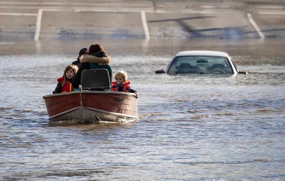
When it hits, the Lower Mainland could become gridlocked by road, rail and air. Parts of the SkyTrain and Canada Line will be flooded. Food will start to run out after four days. Phone and internet will be down. Cars and dead animals will float in dangerous floodwaters, contaminated with chemicals, fertilizers, gasoline and raw sewage. All of this will generate over a million tonnes of debris.
This is how the Fraser Basin Council, the non-profit co-ordinating the region’s flood defenses, expects such an event will play out. And if sea level rise meets its forecast of one extra metre by 2100, over 311,000 people will be displaced and seeking shelter — 20 times the population displaced during the flooding in B.C. last November.
But this is just one flood. And the way we view floods should be very different from how we view earthquakes.
Humans tend to think about disasters in binary terms. The impending Big One is a clear example: it’s the single whopper that will cause massive damage.
But flooding isn’t binary like that, says Tamsin Lyle, an engineer and flood expert at Ebbwater Consulting. There’s a chance that we could get hit by a flood every year.
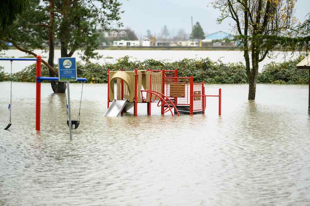
From puddles to torrents
“With floods, we have this whole range of potential events,” says Lyle.
At one end of the spectrum is that tiny puddle that shows up in your neighbourhood when it rains. As you move along the spectrum, the events get more intense, like the freshet floods that hit the region in 1894 and 1948 and are primed to come again. But the events in between can still cause damage that costs million of dollars.
“If you think about the chance of flood occurring every single year,” says Lyle, “then it very quickly becomes the biggest risk in Canada and many places around the world.”
Floods are also becoming harder to predict with climate change. A flood that experts say only happens once every 500 years may be an inaccurate measure as climate change increases their frequency and intensity.
All governments want to keep their citizens safe and dry. But as we’ve shown in our series, there’s disagreement over how to best do that for the Lower Mainland.
In the mid-1970s, the province did take up the responsibility through the Floodplain Development Control Program. But this came to an end in 2003. The province established requirements around dikes, but left local communities to develop policies and protections of their own.
That’s why local communities have turned to the Fraser Basin Council, a non-profit, to help develop a flood strategy for the Lower Mainland. But plans have been stalled due to the large number of stakeholders involved.
So what’s it going to take?
Devoted to dikes
One challenge when it comes to flood planning is the timeline.
Humans need to think far into the future, says Kees Lokman, director of the Coastal Adaptation Lab and a University of British Columbia associate professor in landscape architecture.
“Currently we're dealing with a lot of decision-makers who feel a lot of pressure to make decisions, ribbon cutting and those types of things that will be positive for their re-election cycle,” said Lokman. “So there's a conflict between how do we keep communities safe in the short and near term, versus what is best for our communities when we're thinking 50 to 100 years, or generations down the line. That latter conversation we're not having right now.”
However, Lokman notes, politicians don’t tend to consider what the full PARA framework has to offer. This framework that we introduced in part one of our series has four types of solutions when it comes to flood resiliency: protect, accommodate, retreat and avoid.
In the Lower Mainland, communities tend to gravitate towards the “protect” approach: build bigger dikes and upgrade pump stations to keep water out.
Almost no one is considering taking infrastructure down and rebuilding it on higher, dryer land or letting certain parts of their communities flood. With real estate prices where they are, it’s also unthinkable that cities and developers would agree to not build on a prime piece of land near a river or dike.
Relying too heavily on the “protect” approach harms surrounding ecosystems and locks communities into the strategy, making it harder to consider anything else, Lokman says.
Building dikes to protect from sea level rise creates a phenomenon known as “coastal squeeze,” where rising water levels drown out intertidal ecosystems like eelgrass beds or salt marshes that are unable to migrate inland. This is bad for salmon and migrating birds who depend on these ecosystems, but also bad for communities. When waves hit a salt marsh, it disperses the force of the wave. But if a wave slaps into a dike at full force, the wave splashes higher and damages the dike faster.
“Once you commit to building these dikes it’s the only thing you can do. There’s a very low adaptive capacity in the future.”
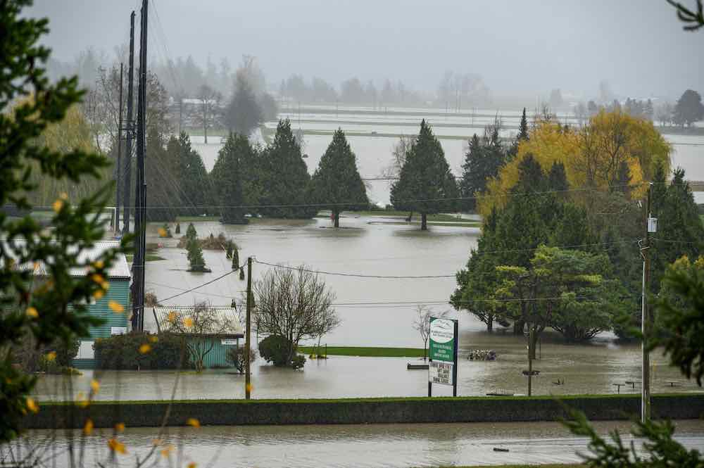
Resilience over recovery
Disaster relief funding exacerbates the problem because it funds rebuilding a home or infrastructure in the same place, instead of picking up and moving out of a flood-prone area.
“We don't have specific funding for strategic relocation and we don't currently have incentive programs that would have municipalities look into living dikes or sediment enhancements,” Lokman said. “We're not encouraging innovative solutions.”
Very little of the “accommodate” approach is used in the Lower Mainland. The two examples Lokman could think of are: the Sumas First Nation, which used to build homes on stilts before Sumas Lake was drained by European settlers in the 1920s and turned into Sumas Prairie for agricultural purposes; and Surrey’s flood boxes, which are strips of agricultural land that can be flooded when the Nicomekl and Serpentine rivers swell.
People tend to get extremely prickly when you talk about the “retreat” approach, but they’re thinking too short-term, Lokman says. It’s less about kicking people out of their homes and more about deciding where to rebuild once a building or piece of infrastructure hits the end of its life cycle.
For homeowners, this could mean living out your years in your house, but then selling the property to the city instead of to a new family who would face a tremendous flood risk. For municipalities, it could mean rebuilding important infrastructure out of a floodplain instead of in the same location.
That’s expensive but worth it in the long run, Lokman says. “The amount of money they will be spending, and each of us as taxpayers will be spending on recovery funding after flooding, will be many times higher.”
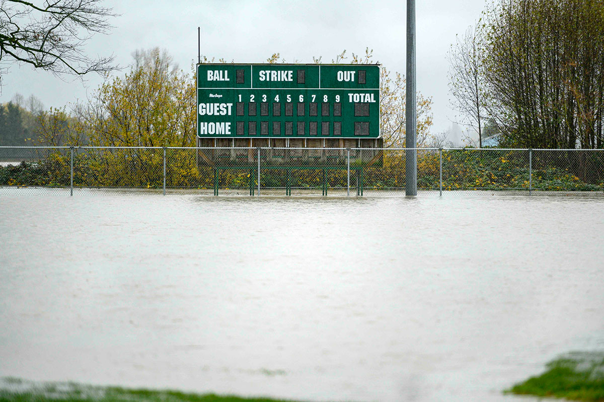
Why we need to understand colonialism’s impacts
On Vancouver Island, the Pacheedaht First Nation are moving their community in Port Renfrew out of the tsunami-risk area.
First Nations face unique challenges when it comes to the “retreat” approach because colonization stole their land and forced them onto reserves with strict boundaries, preventing them from moving around the Lower Mainland with the seasons, Lokman says.
That’s why land-back policies and a comprehensive understanding of the impacts of colonialism should be part of flood adaptation discussions. With B.C. law recognizing the United Nations Declaration on the Rights of Indigenous Peoples in 2019, the Fraser Basin Council is planning to include Indigenous rights, interests and worldviews into the Lower Mainland flood strategy that’s in the works.
While it wouldn’t be in anyone’s best interest for the government to take a heavy-handed approach and force people to relocate out of the floodplain to save money in the long term, a similar forced relocation did happen when clearing land for the Site C dam, Lokman notes. So it’s not like a large-scale, highly organized retreat hasn’t happened in B.C. recently.
‘Knowledge can change values’
Finally, there’s the last letter of the PARA framework: “avoid.” It might seem like a monumental task to prevent developers from swooping in and building a condo on every flat piece of land, but it can be as easy as educating people about flood risks, Lokman says.
Cities are gaining “tremendously” because development pours money into a community, Lokman says. But that’s a short-term gain — if we invest in widespread education about the risks of flooding and the eventual cost to taxpayers, communities might be less interested in developing space in high flood-risk areas.
“How we adapt has everything to do with values and time, and knowledge can change values,” he says. “How we engage is another piece of it. We need new processes to get people engaged at different levels of decision-making and to foster collective learning about these issues.”
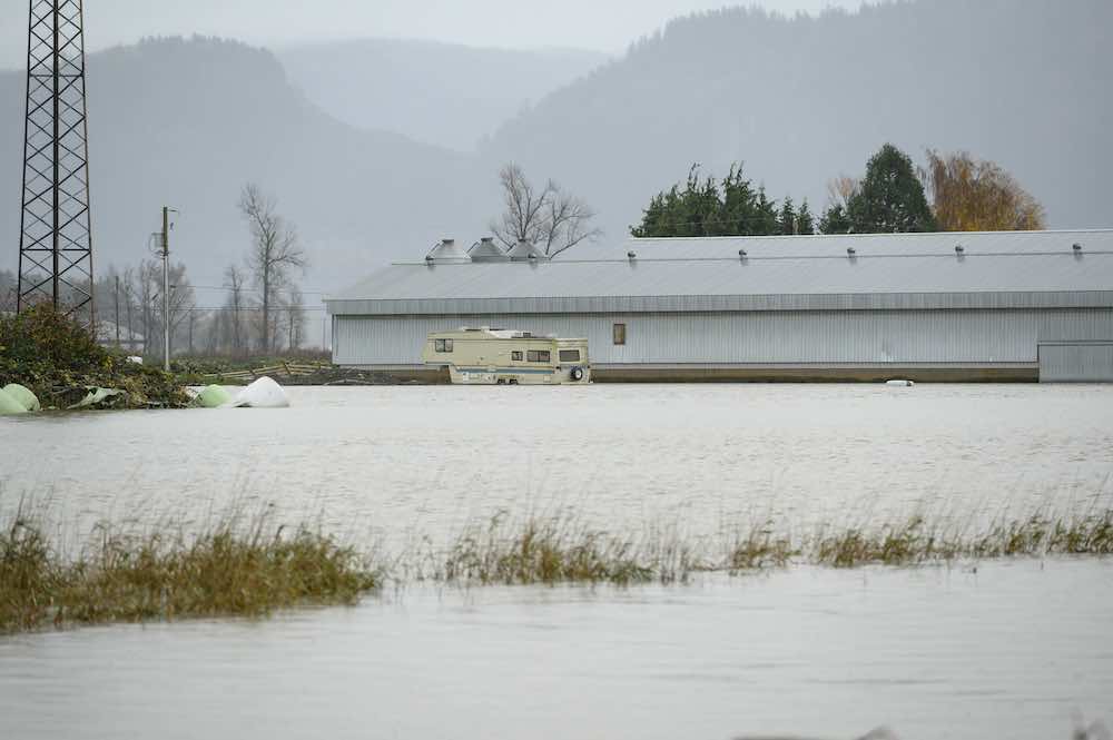
Disastrous inequality
There are houses in coastal communities — from Delta to Vancouver Island to the Sunshine Coast — that offer a sneak peek at the growing inequalities to come.
“There are individuals who can afford it that are throwing a lot of rock in front of their property to stop them from being damaged by erosion,” said Lyle of Ebbwater Consulting. “That makes things worse for their neighbours because now they’ve got this hard edge next door.”
In Delta’s Boundary Bay, beachfront mega-mansions fortify properties with large, imported piles of riprap, or uneven stones, to protect their homes from the brunt of waves at high tide. Within the same neighbourhood small, single-storey rancher-style houses rely on municipal protections to keep their properties dry.
This class divide also plays out on a community level, with rich communities building up their flood defenses while others are left behind — a result of the individualistic approach the province has left communities with.
The auditor general noted this back in 2016, with small communities and First Nations shut out of federal funding for disaster protections. One reason the report suggested for this was the lack of staff and experience needed to access grants.
“It’s a catch-22,” said Lyle. “The people who are the worst off are getting the least help from a government level.”
Insurance vs. inundation
Flooding — and fear of future flooding — is also transforming the landscape of insurance.
For individual property owners like those caught in the Sumas Prairie flood, insurance companies have been paying them for the November damage, but are refusing to offer them future coverage.
As a result, the federal government is planning to step in to offer flood insurance to those who are shut out from the private market.
Insurance companies are taking some action of their own. Fifteen of Canada’s largest property and casualty insurers have formed a coalition called Nature Force, organized by the non-profit Ducks Unlimited Canada, and is investing in nature-based flood mitigation infrastructure to protect urban centres.
The $4 million, three-year “living laboratory” will build natural infrastructure, like wetlands, near cities in B.C., Quebec and Ontario to collect, store and slowly disperse water, says William Jones, senior development director with Ducks Unlimited.
In B.C. that’ll likely mean investing in nature-based flood mitigation infrastructure that’s already in the planning stages, like Delta, Surrey and the Semiahmoo First Nations’ “living dike” project and restoring tidal marshes.
Jones says the projects will show what needs to be done and how much funding will need to protect a community from a certain amount of water. The data will be open-sourced with the hope that municipalities, First Nations and senior levels of government feel more comfortable investing in nature-based solutions.
Wetlands sequester carbon, lend to healthier communities, preserve biodiversity and can help mitigate the risk of urban flooding by 40 per cent, says Tina Osen, president of the Canadian region of HUB International Ltd., one of the insurance companies involved in Nature Force.
“Climate change is a very real challenge that the insurance industry is facing firsthand, and we’re all concerned about the environment and impacts,” she told The Tyee.
And while this might just be insurance companies trying to protect their assets, it’ll likely be beneficial for communities too, Lokman says.
Funding nature-based pilot projects is expensive and runs the risk of a big storm rolling through and wiping it out before they can prove their usefulness. With insurance money involved, Lokman says municipalities can explore the potential of these solutions without running that financial risk.
‘Like unclogging a bathtub’s drain’
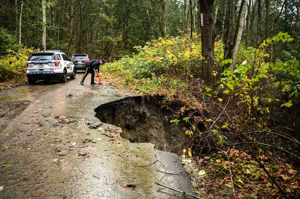
Meanwhile in Abbotsford, Henry Braun, the mayor who experienced the most recent flood disaster in the region, and his council are weighing the options for their city.
There are currently four options on the table to protect the Sumas Prairie. They range from $209 million to $2.8 billion. Dikes and a new pump station are mentioned, but the two pricier choices include something rare for the region: floodways.
This is land that is set aside for the river to flood and might require the city to buy out properties, forbid new building permits or only allow new structures if they’re built on higher elevation. One of Abbotsford’s local news outlets, the Fraser Valley Current, sums up floodplains like this: “Like unclogging a bathtub’s drain, it allows the water to smoothly flow downhill, relieving pressure on upstream areas experiencing flooding.”
Braun, who has a farm himself, knows that there will be residents displeased at the thought of allowing floodwater to spread where they live or farm.
“We had good conversation and engagement with the farmers on Sumas Prairie, and I was pleased with what I heard,” said Braun. “But you know, we’re not going to get 100 per cent buy-in ever, so that’s not our goal. Our goal is what’s in the best long-term interest of our city.”
As we are hit by worsening floods, these are the kinds of tough decisions that elected officials will have to make.
A regional rethink
Tyrone McNeil, the chief of the Stó꞉lō Tribal Council and a member of the Seabird Island Band, right by the Fraser River near Agassiz, says a regional rethink of how we face floods is long overdue.
He has something to say to those who still think dikes should be at the forefront of flood defenses in the face of climate change.
“Resilience is so much more than hard concrete for dike protection,” he says. “You can’t lock the Fraser. You need the ability to give the river to breathe.”
During the November floods, people from Seabird Island took a boat of supplies down the Fraser to the nearby Sq’ewalaxm reserve, Ruby Creek. The residents there were running low on supplies — essentials like food, toilet paper, hand soap and period products — because the roads were blocked, with no word when they’d be replenished.
“There’s a tremendous amount of urgency right here and now,” he said. “We need to start investing in resilience.”
McNeil warns that money spent on building real estate in floodplains and on status quo solutions that will become outdated with climate change is only going to cost communities more in the long run.
Instead, we need to learn how to live with water. “We’ve got to give it some space to do what it wants.” ![]()
Read more: Indigenous, Environment, Urban Planning + Architecture









Tyee Commenting Guidelines
Comments that violate guidelines risk being deleted, and violations may result in a temporary or permanent user ban. Maintain the spirit of good conversation to stay in the discussion.
*Please note The Tyee is not a forum for spreading misinformation about COVID-19, denying its existence or minimizing its risk to public health.
Do:
Do not: