


My husband Kees was born in a tiny apartment in Amsterdam. When he was 25, he immigrated to Canada and spent the rest of his life searching for the wilds. Some years ago he studied a map of B.C. and noticed an area north and west of Lillooet called Spruce Lake Wilderness. No roads go through it, but he bought several maps that at least showed how to get to its edges. (And no, this was not an era, nor a terrain, compliant with GPS systems, cheery automated voices, satellite-guided, telling where to turn next.)
We left Vancouver in the late morning and drove the 250 kilometres to Tyax Resort, a lakeside lodge north of Lillooet, where we camped overnight. Once we left the highway, the road became rougher, but nothing our Ford Ranger couldn’t handle. When we arrived, my husband started asking people about access to Spruce Lake Wilderness. He had forgotten his maps at home. He did find a fly-fishing map on the wall of the lodge recreation room to study intently. I did what I considered to be more practical, unrolling the map I had bought at the gas station in Pemberton for the Whistler-Squamish area with a tiny bit of Spruce Lake on it. All of the roads on the map other than highways looked exactly the same; two narrow black lines described as “other.”
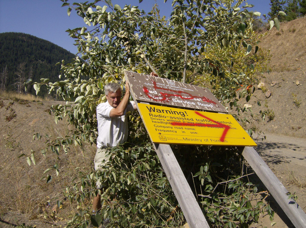
My husband wanted to drive a few kilometres up the Tyaughton Lake Road to find the Mud Creek / Paradise Creek Forest Service Road that would lead him to Spruce Lake. We couldn’t find the right turnoff. We stopped at the corner that matched the map, walked around, looked in the ditch and found the sign. At that point we should have heaved a sigh of relief and turned around in the middle of the road to return to Gold Bridge.
Except we’d spent too much time studying my map. A road across the top of the map looked like we could make an enjoyable excursion through Mud and Swartz Lakes, past Poison Mountain, to the Yalakom Road and finally to Lillooet.
Kees set the odometer to zero and put the Ford into gear. The narrow black lines on the map quickly turned into a bumpy, narrow, rutted dirt road. At Swartz Lake we met a middle-aged man on an all-terrain vehicle and asked him if our truck was good enough for the road. “Oh, your truck can get through,” he said, “But I don’t know if you will.”
We met two more people at Churn Creek where we forded through two feet of water. In between sips of beer, they opined that it was possible to get through to... Where? I didn’t even know the name of the place that would intersect with the road that went past Gold Bridge that would get us to Lillooet.
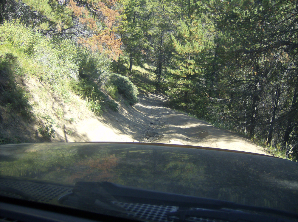
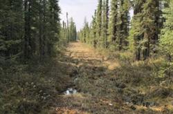
At first I videoed our downhill descents, but I was soon in a state of terror. The road was dark and narrow with tall trees on both sides and an occasional glimpse of nothingness. Every corner offered death. What if we met someone on this 18 per cent downgrade? What if the truck wheels fell into the crater between the ruts? Could we back all the way up this hill? Did anyone in the whole world know where we were?
Of this much I was certain: We could have tumbled off pretty well any cliff and not been found for days or weeks.
The whole adventure seemed to bring together our disparate worldviews. He craved mountains and adventure; his earliest childhood memory was looking out a high window onto a rainy, crowded Dutch street. When his family went on outings, they’d take public transit or bicycles. I grew up on an Alberta farm where flat fields were practical and valuable and the Sunday drive was a tour of the crops.
We’d found each other and we had found British Columbia’s ragged edge and we’d been on logging roads many times before. But this time was different, and just maybe the last.
At one point my husband gave up. It coincided with the exact moment that I had come to peace with my soul and was ready to meet death. I patted him on the knee and said, “You can do it.” And he did.
We travelled across a high ridge for several kilometres. When we finally reached the “top” we pulled off the “road” and admired the view. My husband’s arms were visibly shaking. Mine were simply numb. In the far distance we could see a beautiful pointed peak all by itself.
“People in Holland would pay thousands for this view,” Kees said.
As we stood there, a pickup truck laboured by, going the way we had just come. The men inside waved. We waved back.
Sixty-four kilometres and three hours after turning down the Mud Creek road, we arrived at Lillooet. If we had not read the map, we could have taken Highway 40 - Carpenter Lake Road, 100 kilometres and one hour. Or, we could have simply turned around. But that would have been anathema to my husband.
When we finally caught our breaths in front of the best (and only) Greek restaurant in Lillooet, I thought to myself that surely my husband had finally achieved his goal of reaching true wilderness. He turned to me and said, “What about driving the back road to Harrison Lake next weekend?”
And we did.
[Author’s Note: Kees de Zwart (1944-2013) loved the great outdoors and tried to spend as much time as he possibly could outside.]
Do you have an Extremely B.C. true story to share? It could be amazing, terrifying, sublime, hilarious, life changing. We publish written essays like the one above, or may be willing to interview you and convert the conversation to an ‘as told to’ written or audio piece. In that case send an email telling us the basics of your tale. If you prefer to share a video or audio piece, please do. We can’t guarantee we will publish every one, but we do pledge to review all we receive and get back to you. Send it to info (at) thetyee.ca with the subject line ‘Extremely B.C.’ And yep, we pay! ![]()
Read more: Travel


Tyee Commenting Guidelines
Comments that violate guidelines risk being deleted, and violations may result in a temporary or permanent user ban. Maintain the spirit of good conversation to stay in the discussion.
*Please note The Tyee is not a forum for spreading misinformation about COVID-19, denying its existence or minimizing its risk to public health.
Do:
Do not: