


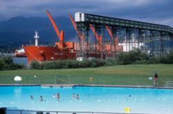
Seagulls scream as they whirl in the blustery spring air above the Iona Beach jetty. The wind makes dog walkers hunch deeper into their coats, and rustles the early-blooming bright yellow Scotch broom and scrubby grass that sprouts out of the sandy, seaweed-flecked ground.
It’s an area known for its sunsets, with the sun staining glassy waters as it sinks into the Salish Sea, and a popular birding location as millions of shorebirds pass through on their annual migrations.
It’s also an area of intense development, hosting some of the Lower Mainland’s most expensive infrastructure — and an area coming under increasing environmental scrutiny as salmon populations continue to tank.
Which makes for a fascinating tension between the environment humans have designed and developed and the ways we’re trying to unbuild that environment in the name of protecting the natural world.
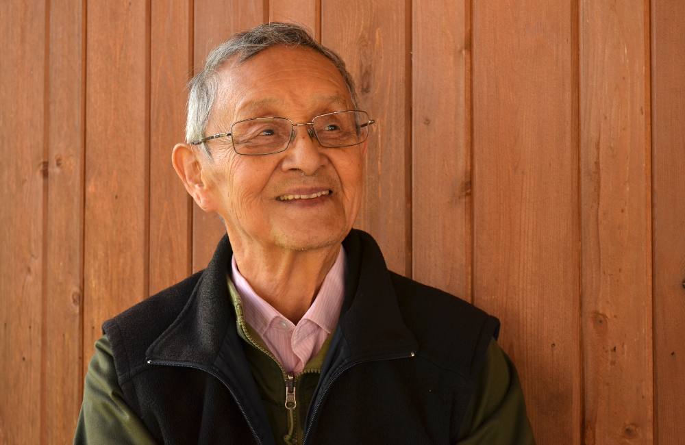
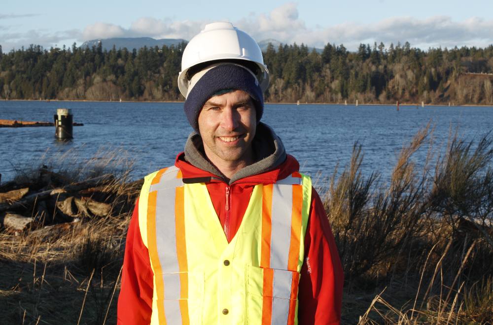
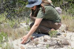
It’s a tension familiar to David Scott, Raincoast Conservation Foundation’s research and restoration co-ordinator for the lower Fraser River program.
Scott is a fish guy; his master’s degree and work with Raincoast focuses on the importance of the lower Fraser River as salmon habitat and restoring the area to benefit salmon.
When we met last spring at Iona Beach, he wore a tuque pulled low under his construction hat and an exuberant smile. There was a spring in his step despite his heavy gumboots.
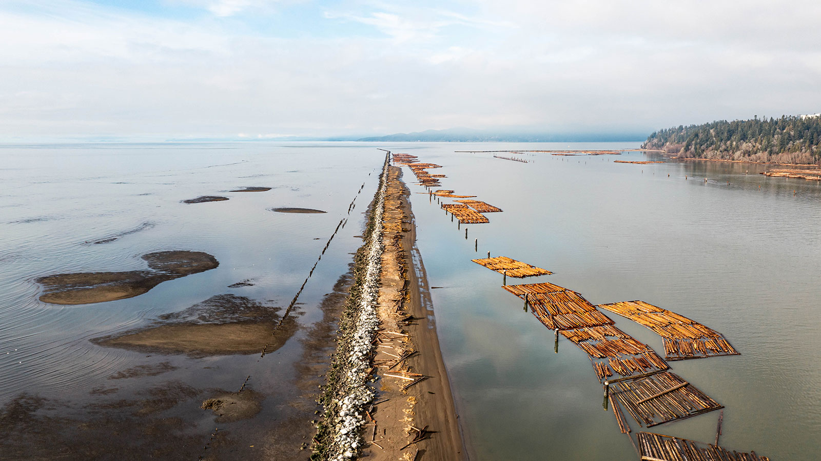
Scott had arrived with a crew and their two dump trucks, bulldozer and excavator, all delivered by barge that morning because there are no roads that lead out to the jetty.

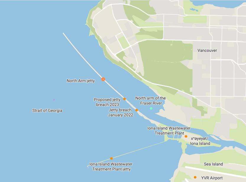
Scott was here to unbuild. Raincoast is working on punching holes in several Fraser River jetties to reintroduce fresh water, nutrients, sediment and juvenile salmon to the tidal flats that stretch out from the shore. The jetties were originally built to control the flow of the Fraser to allow large commercial ships to navigate its murky, shallow waters.
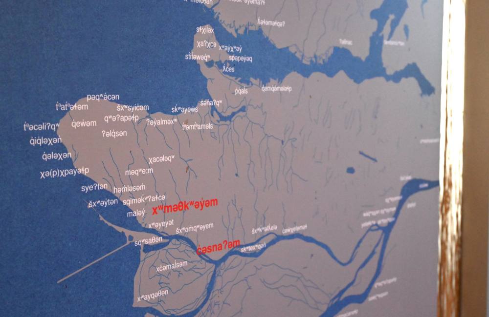
We were standing on Iona Island, known as xʷəyeyət in hən̓q̓əmin̓əm̓, the traditional language of the Musqueam First Nation, who trace their history in the area back thousands of years.
xʷəyeyət sits at the mouth of the Fraser River. To its north is one of the Musqueam reserves and South Vancouver. To the south is Sea Island, where you can catch a flight at Vancouver International Airport, and Lulu Island, better known as Richmond.
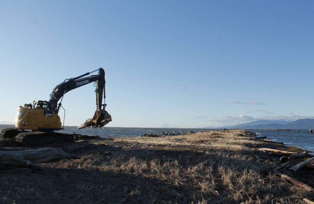
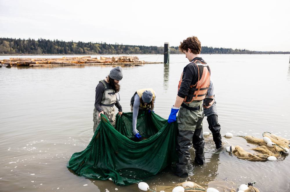
The jetty holes shouldn’t impact commercial shipping but will allow juvenile salmon and river nutrients to spill back onto the tidal flats at medium and high tide, Scott said. This also reintroduces salmon to shallow, brackish waters where they can hide from predators, eat, grow and adjust to their salty new environment.
In its first year of existence, the jetty breach saw sockeye, chinook, chum and pink salmon swimming through from April to July 2022, Scott said. He’s happy to report that the breaches have not yet impacted navigation.
Problem solved, right?
Well, maybe not. The area is still heavily industrialized, and most of it was built up decades ago before things like environmental damage were considered by developers. This impacts salmon, herring, shorebirds, killer whales and, most importantly, the Indigenous people who have called this area home for thousands of years.
To try and understand the impacts development has had, we need to look back at how the area has been modified and developed by humans. How can we know how to unbuild our built environment if we don’t understand its history?
A marshy, brackish landscape
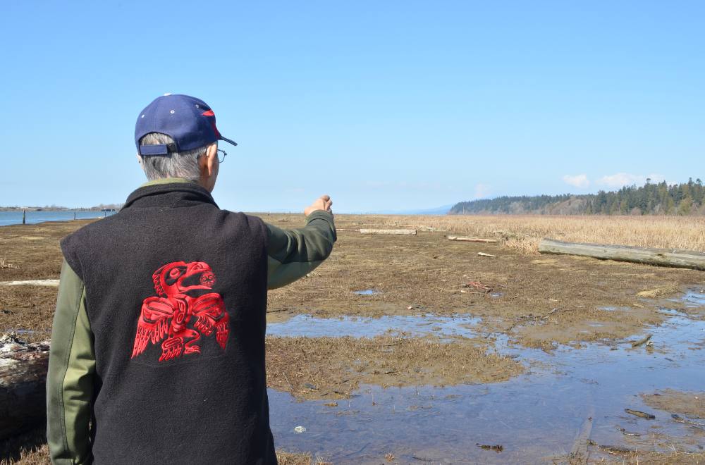
To start this journey I met with Larry Grant, a Musqueam Elder in his late 80s. Grant’s Musqueam name is sʔəyəɬəq and his Chinese name is 洪禮興. Grant is a knowledge holder and hən̓q̓əmin̓əm̓ language teacher. His mother was the last Musqueam to speak hən̓q̓əmin̓əm̓ as her native tongue. His eyes, despite not seeing so well anymore, are bright, and he sports a vest with bright red Coast Salish embroidery.
When you ask him about the human history of Iona Beach, his eyes crinkle and he waggles his eyebrows.
If we’re talking about human history, Grant explained, we’re going back to before planes, trains and automobiles peppered the landscape, before xʷəyeyət was even formed.
The Musqueam have been in the area for a very, very long time. According to Jason Woolman, Musqueam’s archives and research manager, səw̓q̓ʷeqsən, a village located at the foot of today’s Alex Fraser Bridge, has been carbon dated to be 8,000 years old.
Woolman, Grant and I meet in the Musqueam Culture Centre, where we stand amid baskets finely woven from cedar, fishing nets woven from stinging nettle and tools made from antlers and bones used thousands of years ago.
These pieces of history are often found within village sites, where Indigenous people dumped leftover shellfish in middens over hundreds or thousands of years and built up deposits several metres deep. The shells help balance the pH of the soil and preserve pieces of Musqueam history, Woolman said. Further up the river the soil is more acidic, and belongings are less preserved.
Elder Grant points to a map of the Lower Mainland that identifies village sites and place names in hən̓q̓əmin̓əm̓. The village of səw̓q̓ʷeqsən sits between modern-day North Delta and New Westminster. The village would have been built back when that location marked the mouth of the river, Grant said.
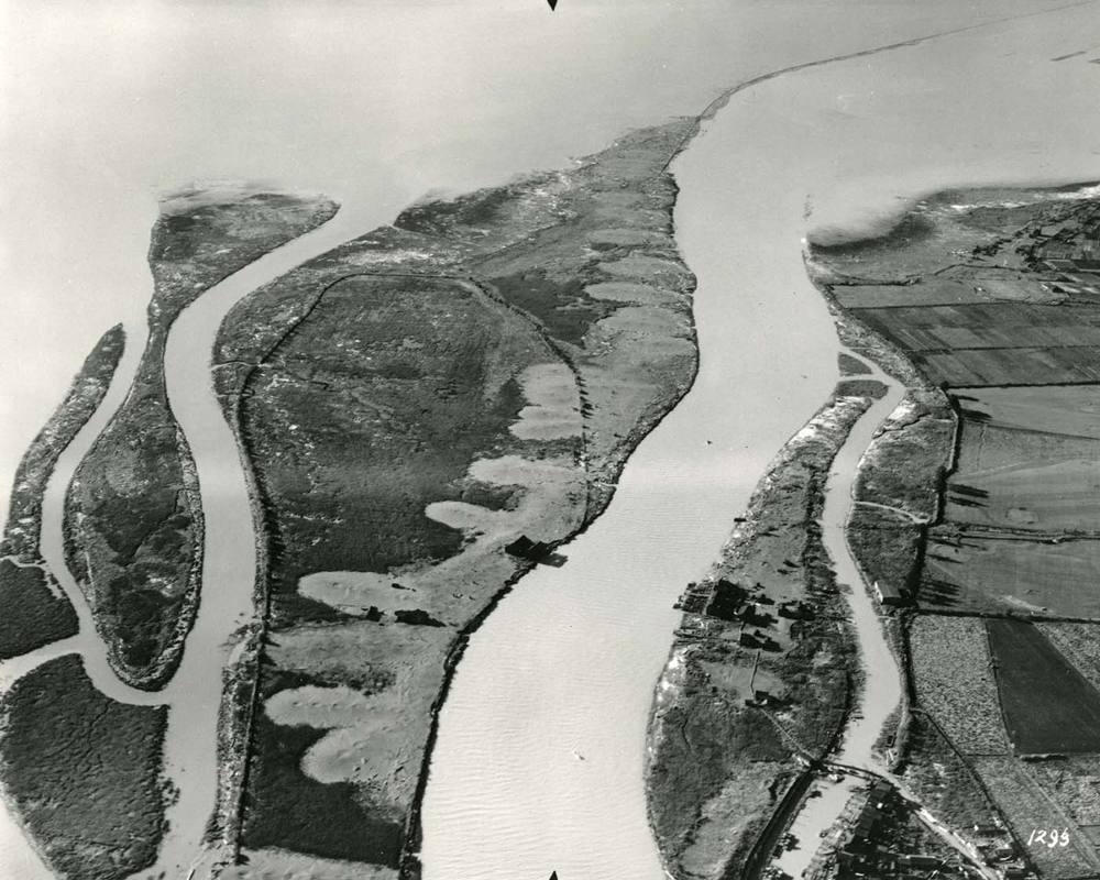
Over thousands of years the Fraser River deposited sediment and built out the Lower Mainland. The Musqueam followed the river, building new villages as their territory expanded and occasionally visiting the island of present-day Tsawwassen and Point Roberts.
Slowly over time, other islands formed, first as sand bars and then as marshy land that was dry most of the year but could flood during a storm. Sloughs criss-crossed the landscape and people would use the tides to help them paddle canoes or pole barges, travelling from modern-day Annacis Island to Bellingham in a day, Grant said.
Food was plentiful. Grant talks about the deer, seals, elk, sea lions and bears that frequented the area. They were hunted and their bones were turned into tools. Blueberries, cranberries, crab apples and bog bilberries sprouted throughout the landscape
Ducks fattened themselves on seafood to the point their meat tasted like shellfish; clams, mussels, oysters, cockles and crabs could be harvested at low tide. During herring, eulachon and salmon season thousands of Indigenous people would be invited to travel to the mouth of the river and to join in the harvest.
This was organized through relationships; mainly marriages, Grant said.
“Kinship is the foundation for everything,” he added. “Many things flow through family lines so you have to know your genealogy. You need to be able to recite it to justify your position and how you’re connected.”
Families and groups built and maintained large sturgeon traps along the north arm of the Fraser that could capture the several metre-long fish.
Settlers arrive
To learn about the colonial history of the area, I head to the City of Richmond Archives, where I meet records analyst Dan Farrell. Farrell is tidy and orderly, listening keenly as I explain how I’m researching the history of Iona Island.
I sit in a climate-controlled reading room and am given a pencil to take notes (no ink allowed in the archives). Farrell brings me books, brochures and stacks of records organized in manilla folders.
On top of the pile is the book A Bridge to the World: The Life and Times of Sea Island, written by Mary Keen in 1942.
While Sea Island is today mainly known as the home of the Vancouver International Airport, 200 years ago it was dominated by grass and shrub lands with salt-resistant spruce growing on the southern part of the island, according to Keen.
European settlers arrived on the East Coast of North America long before they reached the West Coast. In 1763 the British King George III issued the Royal Proclamation, a document that claimed ownership of North America but acknowledged how land belonged to Indigenous people unless it was ceded by treaty to the Crown. Settlers were not allowed to buy land themselves.
Most of the lands within British Columbia were never ceded, which is why today’s land acknowledgements often reference “unceded territory” or stolen land.
Smallpox pandemics, brought by European settlers, swept through the region in the 1780s and again in 1862. Tens of thousands of Indigenous people were killed and communities were decimated.
Around the same time, European settlers started arriving and claiming land. Expeditions through the 1790s and 1820s brought people searching for the mouth of the Fraser River, Elder Grant said — they knew they were close because the water was stained a muddy colour, but they couldn’t find a single deep channel. The river flowed out slowly through shallow estuary marshes and tidal flats, he said.
The first European settler to stake a claim on Sea Island was Hugh McRoberts, an Irishman born in 1815 who bought 1,640 acres, Keen writes in A Bridge to the World. The island was named McRoberts Island until it was renamed Sea Island by the English.
Settlers noticed the rich soil in the area and built dikes so they could farm it without losing crops to flooding, which was common in the spring and fall. The landscape had begun to change.
A landscape transformed
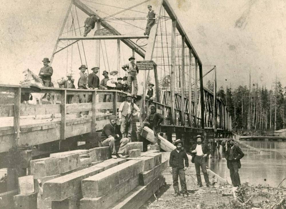
By 1860, the first sawmill had opened in New Westminster. Mill and tugboat owners started muttering about how nice it would be to be able to use the north arm of the Fraser at low tide, as well as high.
People used to talk about how you could walk across the river on the backs of salmon and never get your feet wet during the salmon run, Grant said. That speaks to the booming salmon population — but also about how shallow the river was.
By the mid-1800s Musqueam people were being evicted from their lands and moved to reserves that were one per cent the size of their traditional territory. At the time the Indian Act was amended to help settlers “demarcating land and pushing preemptions barring First Nations from pre-empting land,” according to Woolman, Musqueam’s archives and research manager. “There was no way to get lands back.”
At the same time, Keen notes in her book, settlers were erasing Indigenous history by digging up village sites and using old shells as road filler, chicken scratch and fertilizer. This had serious consequences — when settlers removed remains from village and burial sites Musqueam peoples lost their ability to prove certain areas were permanent or seasonal village sites.
Village and burial sites are important ways to mark out Indigenous history in an area, but there are caveats, Woolman said.
First, a midden is a dump site for a village, not the boundary of a village. Second, a village or burial site suggests there was a sprawling community spreading out across the surrounding landscape, not just a single house. Third, only a tiny fraction of any civilization is ever preserved for thousands of years, and only a tiny fraction of that fraction is ever recovered. Village and burial sites are an “infinitesimal” piece of Musqueam history, Woolman said.
Finally, people didn’t just exist within a village: they would have travelled, harvested and lived their lives spread out across their entire traditional territory. A blueberry patch might not have archeological remains but that doesn’t mean it wasn’t cultivated and harvested from for hundreds of years, he said.
Settlers arriving in B.C. were not all white Europeans. The first Chinese migrants arrived in 1788 and lived and worked in the West Coast’s first year-round, non-Indigenous settlement. Japanese immigrants started arriving in the late 1800s. Despite long histories, these settlers faced strong anti-Asian racism from white settlers.
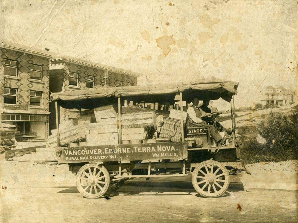
By 1906 the community of Eburne had popped up on what is today known as Vancouver’s Marpole neighbourhood and parts of Richmond. A brochure for the neighbourhood boasted about the community’s flour mill and iron plant. Pictures from the time show a scattering of neat, squat houses tucked in between partially clear cut pine forests. Today the same area hosts the Canada Line and glittering towers along Southwest Marine Drive.
Houses in the community sold for around $3,500 — with some ritzy $8,000 mansions for those who could afford them, according to the brochure.
The brochure talks up the neighbourhood’s potential — once the north arm of the Fraser is dredged, it promises, businesses will flock to the area and industry will line the river.
A report from 1908, written by engineers surveying that area of the river, describes it as “slow-moving and gentle,” fading to half a metre deep at low tide. The north arm could be a “valuable waterway” if deepened, it says. This would also save ships the journey of travelling 16 kilometres south to the river’s south arm, which flowed into heavy seas and featured strong currents.
The report recommends dredging the river and building a 400-metre-long jetty — a project estimated to cost $606,700 — roughly $16 million in today’s dollars.
The project was approved in 1913 by the newly minted Canadian government when it passed the North Fraser Harbour Commissions Act, which gave settlers the right to control the 17-kilometre-stretch of water from New Westminster to the Salish Sea. The Fraser was dredged and the first version of the north arm jetty was built.
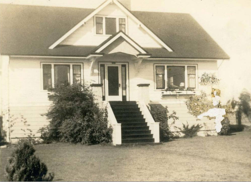
By 1918 the last of the sloughs on Sea Island had been drained and a wealthy farming community had sprung up.
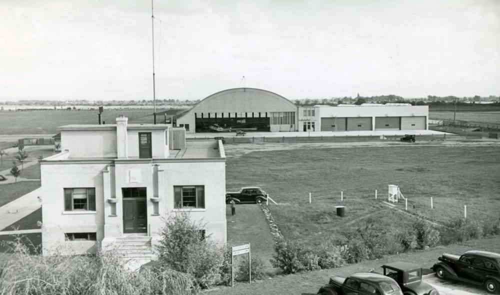
At this point we move on to the next book in the stack of research material at the City of Richmond Archives to learn about the history of Vancouver’s airport, which was known as the Vancouver Civic Airport and Seaplane Harbour when it opened in 1931, further industrializing Sea Island. It had a staff of five when it first opened: one manager, three employees and a horse to keep the grass nice and trim, according to the Historical Atlas of Vancouver and the Lower Fraser Valley by historian Derek Hayes, published in 2005.
By the mid-1930s a larger runway was built to accommodate fights to Montreal and Seattle. The Second World War expanded it further.
A legacy of racism
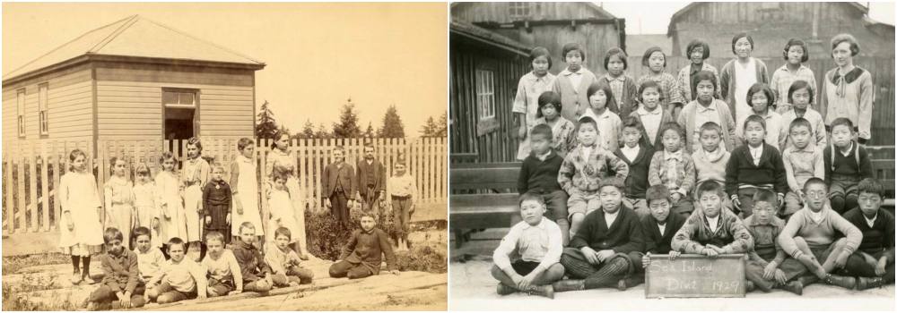
It was around this time Elder Grant’s father emigrated from China and started working on a farm on the Musqueam reserve, where he met and married Grant’s mother.
Grant, born in 1936, remembers how there were 15 Chinese-owned farms on the reserve when he was a kid. Farmers sold their crops at produce stands in Chinatown and would collect the cuttings after to add to their compost heap, which was three-and-a half-metres-wide and three metres tall, Grant said. They’d add horse manure from the racetrack and it made an excellent fertilizer.
When the Shaughnessy Golf & Country Club was built, most farmers were forced out and either moved to Chinatown or Burnaby, Grant said.
During the Second World War, which lasted from 1939-45, 23,000 Japanese Canadians of all ages were forced from their homes after the federal government declared they were not allowed to live along the coast in March 1942. Three-quarters of them were Canadian-born or naturalized citizens.
Before the war Japanese people made up two-thirds of Steveston, a fishing village at the mouth of the Fraser River.
Despite the RCMP and military saying Japanese people were not a threat during the war, 12,000 people were forced to live in internment camps separated from their families, 700 civilian men were sent to prisoner of war camps in Ontario and 4,000 people were sent to work on sugar beet farms in Alberta and Manitoba. During this time the government seized Japanese homes, cars, businesses and belonging including 12,000 fishing boats and used profits from the stolen goods to finance the internment.
After the war Japanese Canadians were told they could resettle outside of B.C. or be deported to Japan, a country foreign to most of the people facing deportation. It took four years after the end of the war for the government to allow Japanese Canadians to vote, live, work and travel freely.
The federal government apologized to Japanese Canadians in 1988 and offered $21,000 to each person directly affected by internment.
Post-war development
After the war came plans to expand the North Arm Jetty. A City of Richmond Archives newspaper clipping from January 1946 said 50 to 200 veterans would be employed as the North Arm Jetty was expanded by an extra three kilometres and built up to be about five metres above the high tide line.
The project would use 110,000 tons of stone and cost $218,000 — but once completed, two ships could navigate the river at the same time, even at low tide.
When the flood of 1948 hit the Lower Mainland — the second-largest ever recorded in its written history— it devastated huge stretches of the Fraser Valley, but Sea Island avoided almost all flooding because it was entirely surrounded by dikes, Hayes writes in the Historical Atlas of Vancouver and the Lower Fraser Valley.
Grant, who was 12 years old at the time, said he remembers having to take off his shoes and walk through the floodwaters every day to get to school. Water seeped all the way to Vancouver’s 51st Avenue, he said.
The airport built its first jet-sized runway, which stretched out 2.6 kilometres, in the early 1950s. This expansion “completely bulldozed, levelled and covered” an area that had been a noted archeological site, which held old village sites and skeletal remains — signifying the area had once been a permanent Musqueam settlement, Keen writes.
This is a development pattern that happens again and again, Grant said. House posts, which are remains of large houses Musqueam lived in, have been found stretching along the north side of the north arm of the Fraser River, from Shaughnessy Golf & Country Club to McCleery Golf Course; on Sea Island under the McArthurGlen Designer Outlet mall; and on Lulu Island under the River Rock Casino. And in Vancouver’s Marpole neighbourhood, there is “huge amounts of midden just under the roadway.”
“It wasn’t just one house, it’s a whole complete village sitting there utilizing these shores,” Grant says.
The next major infrastructure project to be built on xʷəyeyət was all about poop. In the 1880s wooden sewers dumped directly onto local beaches, which made people sick with typhoid fever, cholera and other waterborne diseases.
In 1957 Vancouver proposed to build a sewage treatment plant on xʷəyeyət which, at the time, was home to half a dozen sheep and several squatter shacks.
Richmond refused, but the plant was built anyway. To hear how that happened I called Harold Steves, who served as a Richmond city councillor for 51 years and an MLA for three years, and who has opposed the plant for his entire career.
He said the province overruled Richmond and Musqueam objection to the project.
The sewage treatment plant introduced raw sewage and high levels of lead and mercury to Sturgeon Banks, the mudflats and estuary at the mouth of the Fraser River, Steves says. Cars would drip gasoline and oil on the ground in Vancouver and it would flow through storm drains and onto the bank. Heavily polluting industries would also dump all of their waste down the drain.
The pollution killed off all the clams in the area and continues to impact fish to this day, Steves says.
The impact this had on Musqueam was minimal because they hadn’t been harvesting bivalves from the area since before his childhood, Grant said. Pollution flowed down the Fraser as industry set up shop, which turned locally grown shellfish into “poison.”
The pipe that brings wastewater to the facility is called the Highbury Interceptor Air Management Facility and runs right through Musqueam land, taking up around 35 building lots, Grant said. The band council of the time opposed the construction but weren’t listened to, he said.
To prevent sewage from seeping up the Fraser at high tide a causeway was built in 1959 between xʷəyeyət and Sea Island, officially connecting the two land masses together. This was built over where Musqueam sturgeon traps once stood.
Then, to prevent sewage from littering the beach, the four-kilometre-long Iona jetty, which pipes sewage out into the Salish Sea, was built in 1987. The Iona plant uses primary treatment, which means it “removes materials that float or readily settle out by gravity, and up to 50 per cent of dissolved organic materials,” according to Metro Vancouver.
A dance of humans across history
I’m standing with Musqueam Elder Grant in late March on the banks of the north arm of the Fraser next to the Musqueam Culture Centre, watching tugboats chug past the reserve. We’ve just wrapped up an interview covering 6,000 years of Musqueam history and have lapsed into thoughtful silence.
Grant breaks it, pointing out the bulrushes that choke the edges of the briny river and explaining how the area used to be a lush landscape of edible grasses, succulent duck and nutritious shellfish habitat. Then the north arm of the Fraser jetty was built, changing the flow of water and the landscape.
Thousands of years of human history flow across the landscape as the bullrushes rustle in the breeze. A mallard eyes us before letting out a raspy guffaw as it floats past on the river’s current.
Humans build and unbuild, migrate to the mouth of the river and retreat. A dance, visible only through the shifting landscapes of history. From the Musqueam reserve we look across the river at xʷəyeyət, which rose up from the beneath the river, became an island and is now known as the beach next to a sewage plant.
Humans aren’t finished with this landscape yet. Through burning fossil fuels we have created climate change which is causing sea level rise. Could xʷəyeyət one day sink back beneath the waves?
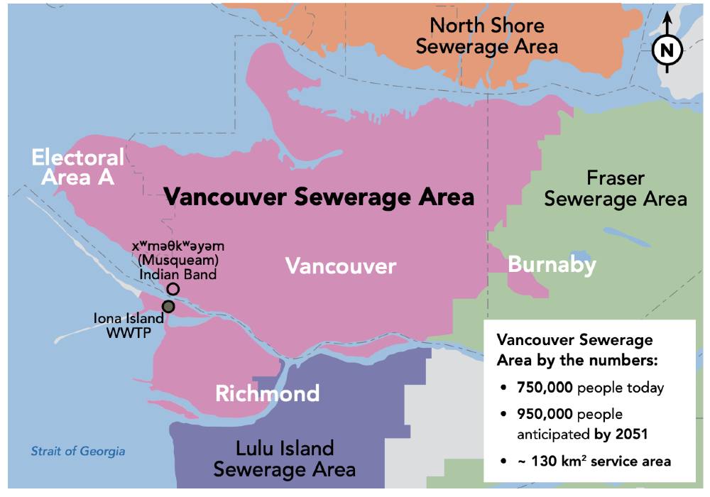
Not if Metro Vancouver can help it. The federation of 21 municipalities, one electoral area and one Treaty First Nation is working on upgrading the sewage plant to be resilient to sea level rise, earthquakes and population increase. Metro Vancouver intends for the plant to use tertiary treatment by 2038, meaning any water it pumps into the Salish Sea will technically be clean enough to drink.
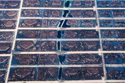
Organizations like Raincoast Conservation Foundation are working on projects to reintroduce the flow of nutrients, sediment and juvenile salmon to the tidal flats, which are built and maintained by a continuous flow of sediment washing down the Fraser River. When infrastructure like river jetties cut off this flow, the ecosystem slowly deteriorates, Scott said. Hopefully punching holes in jetties can help reverse some of those impacts.
Rebuilding salmon habitat will also require reconnecting waterways and protecting intertidal and riparian areas from drowning under sea level rise — these habitats are unable to migrate to shallower waters because humans built things like seawalls and dikes, he said.
“We’re going to have to really think about what we can do to provide habitats that can provide resilience for these fish into the future,” Scott said.
Metro Vancouver’s plans for upgrading the Iona plant include rebuilding marshy shores and reopening the McDonald Slough, the waterway between xʷəyeyət and Sea Island, which would once again turn Iona into an island and prevent juvenile salmon from swimming into a dead-end waterway.
And while the Musqueam First Nation will also be grappling with sea level rise and an increased risk of flooding, Elder Grant says he’s more worried an earthquake could damage the Highbury Interceptor, which could have “massive ecological damage.”
“In a massive earthquake is it going to stand up, not crack and spew raw sewage all over the floodplain?” he asks. “It feels like the provincial and federal governments are not interested in helping Musqueam keep safe.”
Grant shivers slightly — the wind is biting despite the cloudless spring day, and we turn away from the river, heading back indoors. In the distance a giant plane larger than some BC Ferries roars as it gently touches down at the airport.
There’s a lot of different proposals for how communities throughout the Fraser Valley and along the coast can adapt to climate change and sea level rise. Solutions range from building bigger dikes to unbuilding communities and letting the Fraser River reclaim historic floodplain habitat.
What communities will be fortified? Which ones will be unbuilt or abandoned as climate change-related impacts worsen in tens to hundreds of years?
The mouth of the Fraser River is a world of development and displacement and its story is far from over. ![]()
Read more: Indigenous, Environment, Urban Planning

Tyee Commenting Guidelines
Comments that violate guidelines risk being deleted, and violations may result in a temporary or permanent user ban. Maintain the spirit of good conversation to stay in the discussion and be patient with moderators. Comments are reviewed regularly but not in real time.
Do:
Do not: