


The film studios where Luke King works are tucked behind a Walmart. This industrial part of the Renfrew neighbourhood by the Vancouver-Burnaby border is at a noisy nexus of highways. You can come here to rent scaffolding or have a countertop made.
It’s a grey landscape, but there’s a bit of green. Still Creek, flanked by Japanese knotweed and bushes of Himalayan blackberry, flows by the studios before passing car dealerships, a Costco and cookie-cutter office parks on its way to Burnaby Lake.
Between hours of decorating sets, King spends his lunch breaks by the water. He’s been working at the studios for seven years, and in that time the area’s been getting wilder.
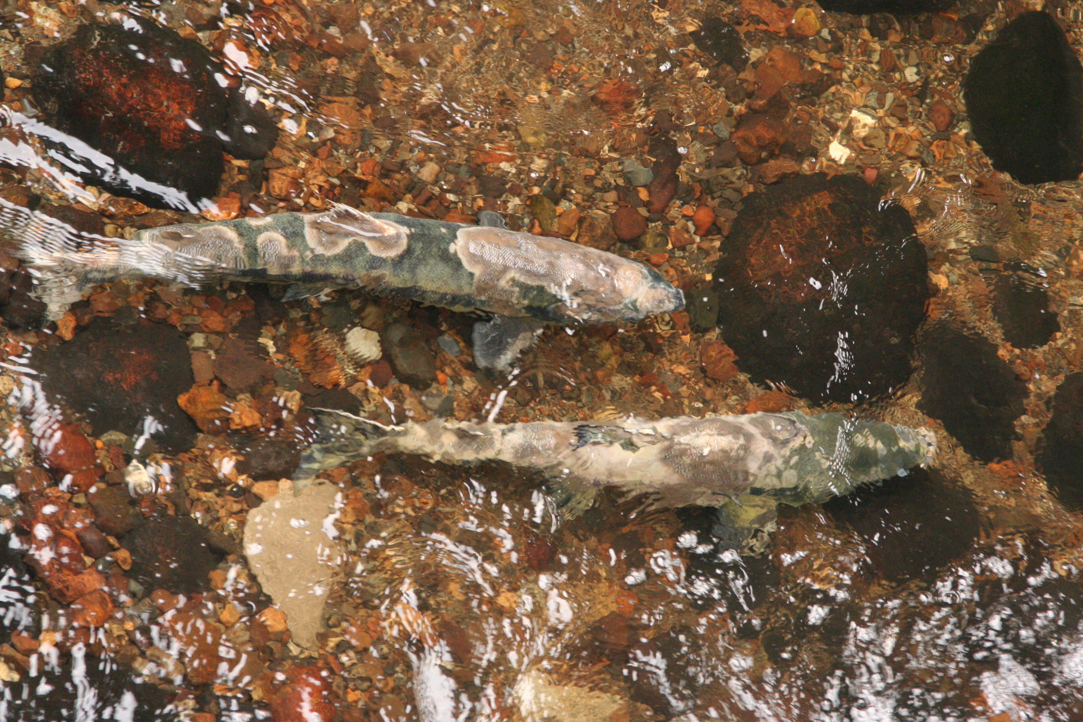
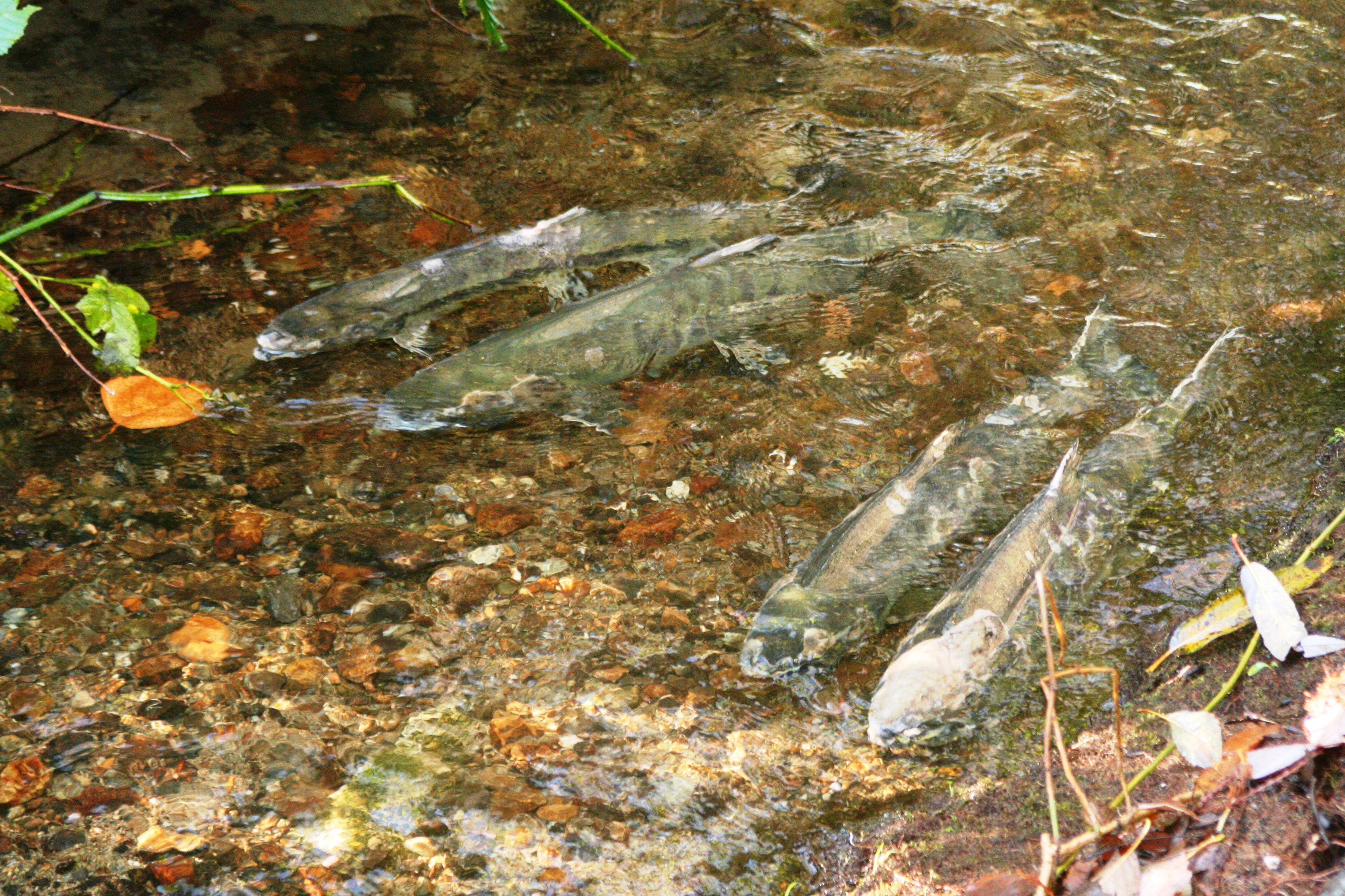
“We’d come over here and see these huge fish!” he said. Chum salmon showed up the same year King did, the first time in almost eight decades. “There’d also be days with eagles, herons, salmon, coyotes and raccoons.”
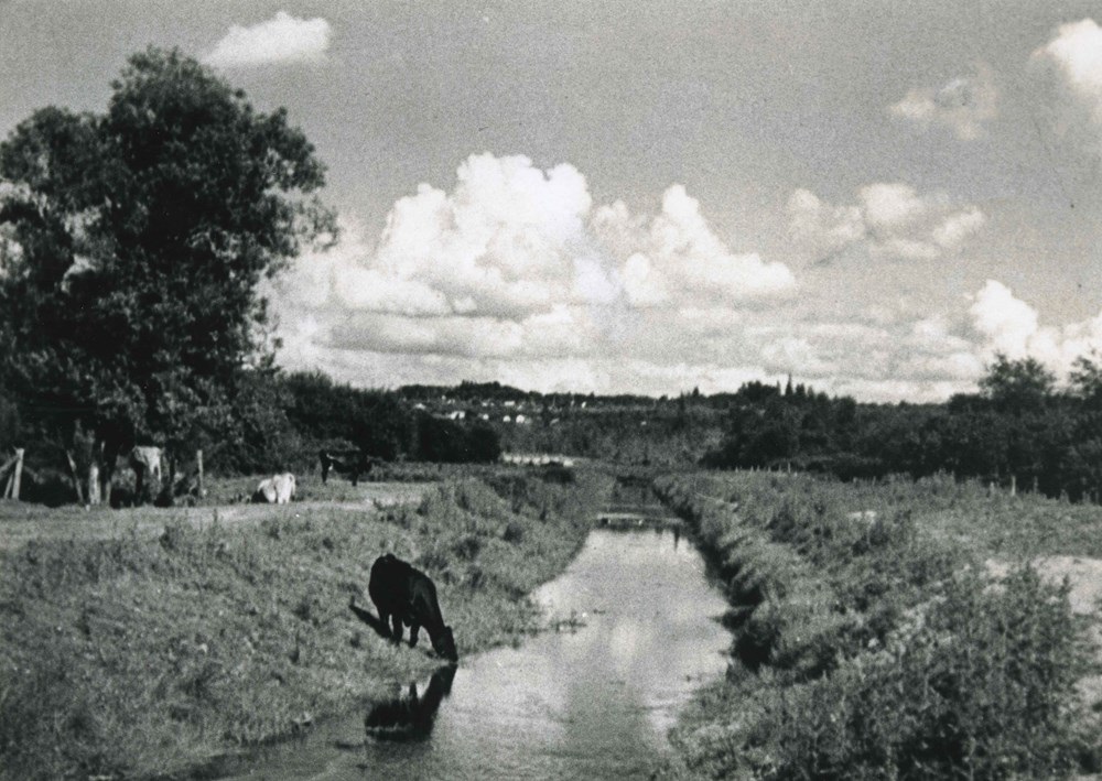
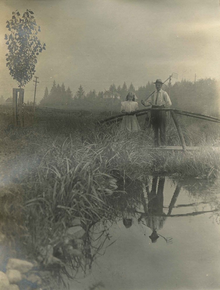
The wildlife is a remnant of the Still Creek watershed that existed before settlers came. The creek was an Indigenous thoroughfare, the area a seasonal gathering site. There were still elk, deer, bears and wolves 100 years ago when newcomers began setting up farms and businesses. They enjoyed the creek too: swimming, picnicking, hunting pheasant and fishing for salmon.
But then the settlers wanted to build a city on this landscape.
“Creeks and streams were seen as obstacles to development,” said Mark Angelo, an internationally respected river conservationist who lives in Burnaby. “Back then, the standard approach was to bury them and pave them over.”
That’s exactly what happened in Burnaby when urbanization picked up in the 1920s and boomed after the Second World War.
Those creeks that remained above ground were used by industry as places to dump waste.
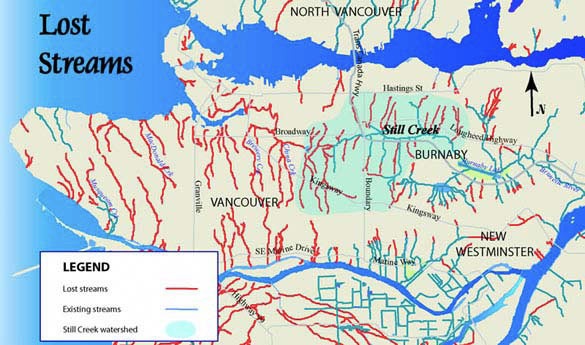
This is a common story of urban growth. The wilderness of cedar and hemlock west of Burnaby was logged to become Vancouver. Most of Vancouver’s waterways were also buried in concrete and under asphalt.
But in the 1960s and ’70s — the era of “urban renewal” when the City of Vancouver and the federal government championed freeways and slum clearance via what it called “comprehensive redevelopment” — Burnaby’s leaders started thinking about their environmental footprint.
“There was a desire to achieve a better balance between the development of land and the protection of waterways and ecosystems,” said Mark Sloat, an environmental planner at the City of Burnaby. “It didn’t have to be an either-or proposition.”
So instead of burying waterways, the city changed course and decided to keep them open.
Waters of life
Burnaby’s topography has been compared to a bowl. The city is surrounded by an elevated outer ring, with a dip in the middle. It’s an apt shape, considering how the land fed both Indigenous and settler communities.
This landscape might be easy to miss. Your eyes are likely drawn upwards towards sparkling towers rising from the city’s town centres. One skyscraper in the works is poised to become the province’s tallest at 64 storeys.
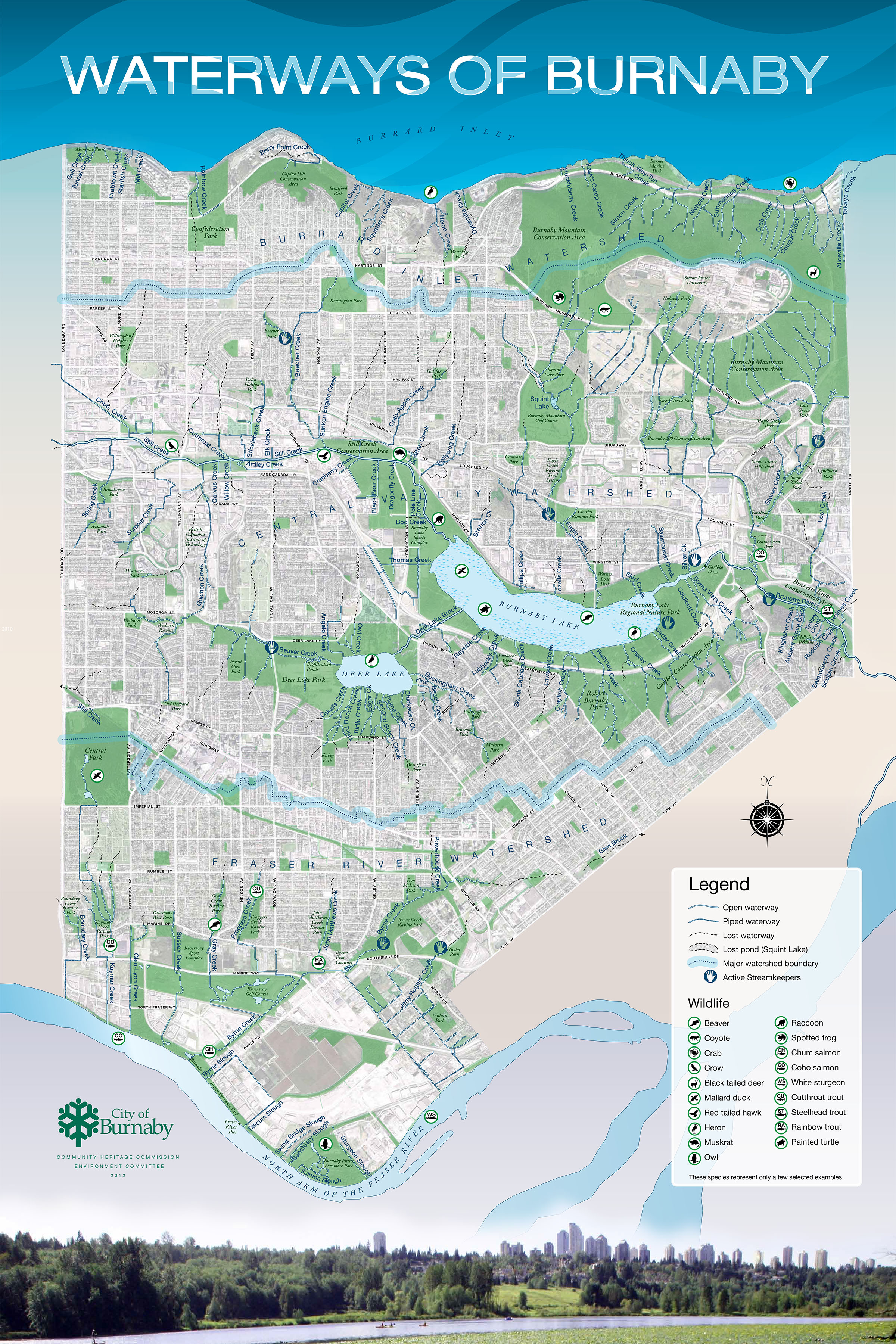
But look down and around and you’ll see Burnaby’s ancient arteries: a river, two lakes and more than 90 creeks. Together, they stretch over 200 kilometres. Vancouver’s 52 historic creeks are about 120 kilometres.
The Coast Salish lived near the lakes at the centre of the Burnaby bowl for thousands of years, harvesting cranberries and hunting big game like elk. But that traditional life began its decline in the 1860s when settlers began moving in.
Burnaby’s first settler, William Holmes, lived near the Brunette River, which his daughter said was so crowded with salmon that “it would have been possible, had [the salmon] remained stationary, to walk across the stream without getting one’s feet wet.” After Holmes arrived, Indigenous fishers asked him each year for permission to camp beside the stream, where they would dry and cure their supply of salmon.
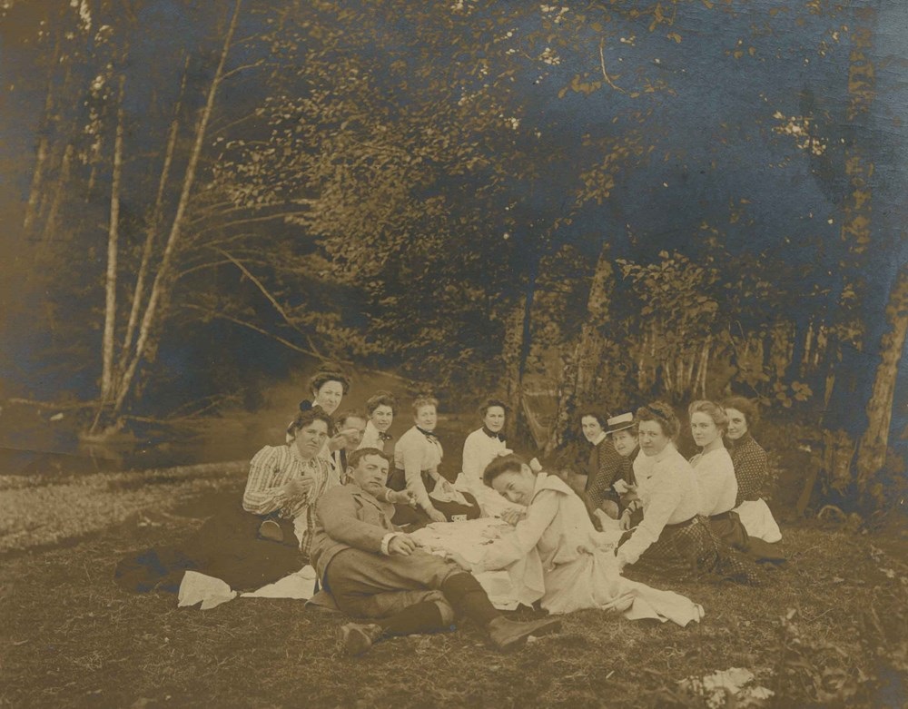
Fish were also plentiful in Rainbow Creek, a spawning ground for rainbow trout. In the early 1900s, Chinese mill workers who lived in small cedar shake houses on the water would fish for trout from their verandas.
The settlers’ reliance on the land helped them survive when the Great Depression hit and the municipality of Burnaby went bankrupt. Residents already possessed the connections to trade and the skills to fish, hunt and garden. Families raised chickens, cows, goats and bees.
Despite this connection to Burnaby’s natural heritage for both Indigenous people and settlers, the desire for an urban environment came out on top. And many waterways, being “obstacles” of progress, were diverted, paved or culverted, hidden beneath roads and homes.
Guichon Creek was stripped of its vegetation and had a near total loss of its form and function. Still Creek became a dumping ground and gained a reputation of being “one of the most-polluted waterways in the Lower Mainland,” said Angelo. The Brunette River began suffering as early as the late-1920s; in 1955, salmon stopped spawning after chemicals were leached from a plywood plant, refuse was flushed by a slaughterhouse and hot liquid was piped into the water.
Gone were the days when parents told their children to go down to the creek and catch a fish for dinner.
Back on course
Burnaby’s commitment to healthier waterways began in the 1960s when environmentalism took off. That commitment was reflected in new policies that helped set the stage for restoration, said the planning department’s Sloat.
In 1962, the city council decided that no person “shall foul, obstruct or impede” a waterway.
In 1973, council passed a bylaw, unprecedented in the region, stating that waterways should be left in an “open condition.”
“Burnaby took a proactive approach, which at the time wasn’t a common thing to do,” said Angelo.
Angelo, who grew up in California by the Los Angeles River, had an early love of moving water. (Though today, that river is almost lifeless and entirely encased in a massive concrete culvert).
“As a boy I spent hours walking up and down creeks, turning rocks upside down looking for critters,” he said. “I felt creeks and streams were literally these ribbons of life.”
That love led him to Burnaby, where he spent 37 years teaching at the British Columbia Institute of Technology and is now chair emeritus of its Rivers Institute. In that time, he’s worked on and witnessed the turnaround of the city’s waterways.
“Society started to view streams differently,” said Angelo. The mindset of waterways as obstacles began to fade.
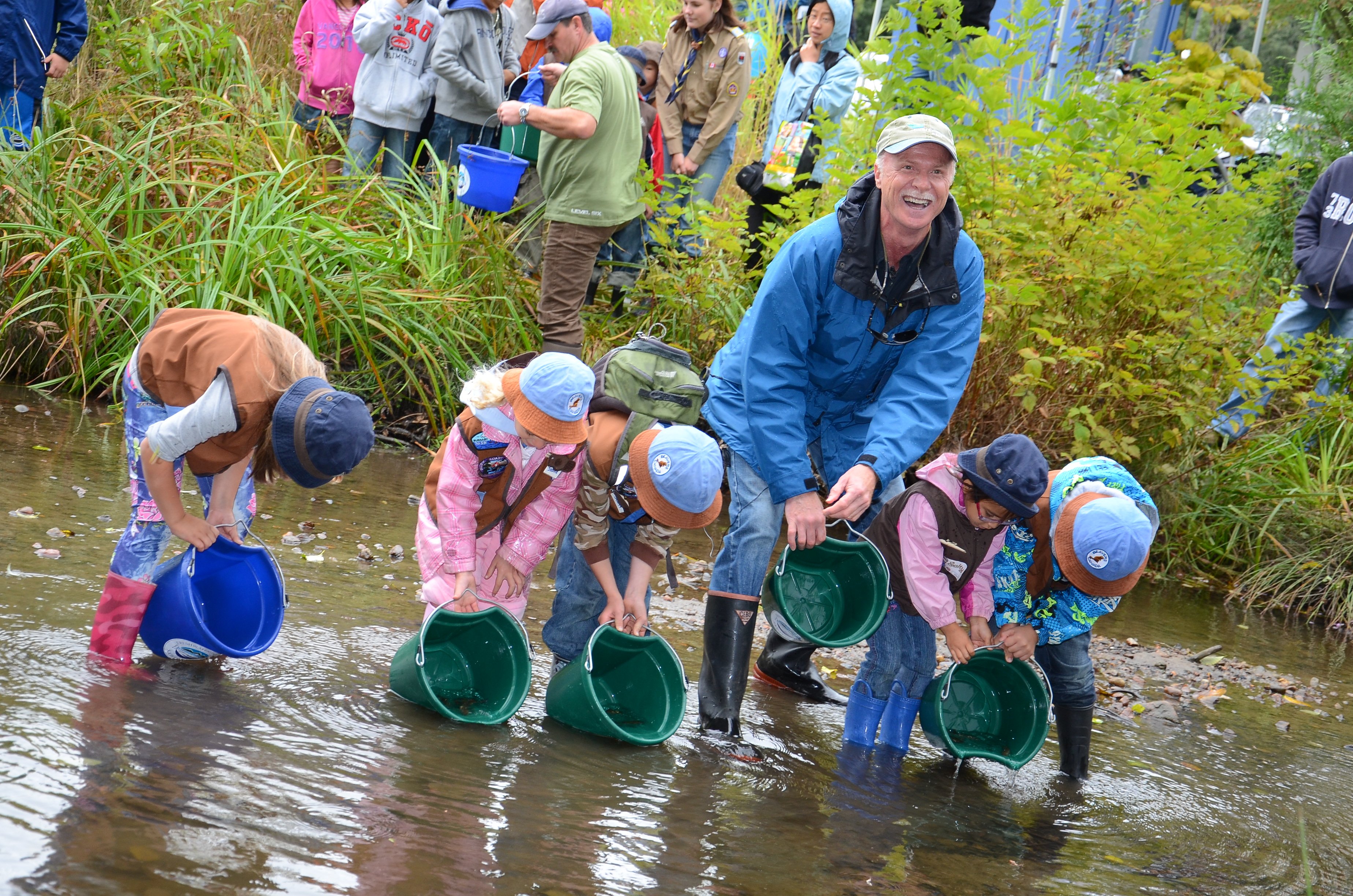
Turning waterways around requires a mix of experts, such as urban planners, engineers and biologists. It also requires a mix of parties — governments, the private sector as well as community groups and volunteers like streamkeepers. They’re the “boots on the ground” when it comes to cleaning waterways, enhancing habitats or taking care of fish, said Angelo.
To “daylight” a waterway, a creek or stream that’s been piped underground is reinstated into an open channel aboveground. This allows the waterway to breathe – literally. More oxygen mixes with the water of a daylighted creek or stream.
Work is done to help rebuild the ecosystem and get the waterway close to its natural function, such as adding riffles and pools, and replacing invasive plants with native ones. The vegetation helps soak up water from rainfall and filter pollutants. The bulk of the City of Burnaby’s work is enhancing streamsides.
As for development applications, the city uses each one as an opportunity to protect waterways, along with environmentally-sensitive areas. It’s similar to requirements that most cities have for new developments, like upgrades to sewers or the streetscape.
“If a development happens to be near a stream, then the developer is required to protect and enhance it,” said Sloat.
Piece by piece, development by development, Burnaby’s been setting the urban environment back from waterways, restoring channels, planting new vegetation and tweaking existing culverts that block fish migration. These strategies are in place regardless of whether a waterway is near high or low density.
One example of daylighting is Byrne Creek. A section of the creek ran in an underground pipe beneath six houses in south Burnaby. In 2010, the creek suffered greatly when a chemical, suspected to be industrial cleaner, killed over a thousand fish.
In 2011, when a developer wanted to turn the houses into townhouses, Burnaby negotiated the daylighting of the creek as a condition of approval. It cost the developer about $1 million, but in return the city granted extra density allowing construction of an apartment building.
As a result, 150 metres of Byrne Creek — which had been buried for over 50 years — were daylighted, and chum and coho salmon have returned to spawn.
Salmon have also returned to Buckingham Creek, Deer Lake Brook, Eagle Creek, Stoney Creek and Guichon Creek, which had been reduced to little more than a ditch.
Angelo estimates that about 70 per cent of Burnaby’s waterways today are open and free-flowing. In comparison, the vast majority of Vancouver’s remain covered, though there has been significant work on “rewilding” the city in recent years.
But Angelo says the work of caring for urban waterways is never done.
“You have to be continually vigilant. There are always ongoing pressures for creeks and streams in an urban environment.” Creeping urbanization and habitat loss. Industry and pollution. Residents being careless about what gets carried by runoff.
Angelo has helped combat those pressures in a different way: education. From Burnaby, he helped found Rivers Day in B.C. in 1980 and World Rivers Day in 2005, which received the blessing of various United Nations agencies.
“I like to believe now that most people and local governments view creeks and streams as having great natural, cultural and recreational value, and that they contribute greatly to the quality of life,” he said.
This view has helped sweep away the older approach of covering streams and creeks.
“There are now streamkeeper groups on virtually every stream in the region,” he said. “That’s a far cry from the way things were back in the early 1970s.”
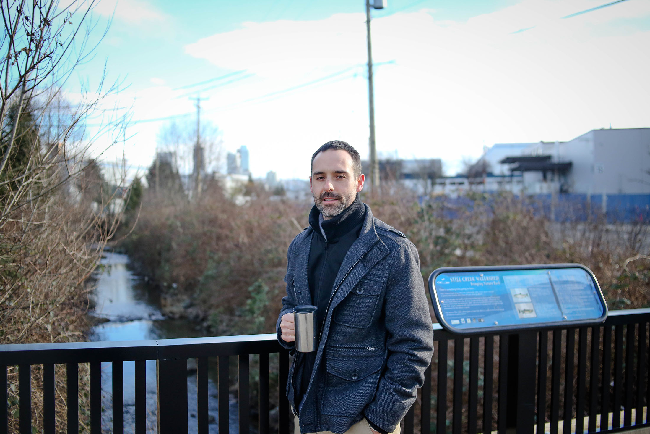
Back at the Vancouver-Burnaby border, by the film studios behind the Walmart, Luke King got caught up in the current and is now a Still Creek streamkeeper. He’s been helping clear invasive species like the Himalayan blackberry bushes.
“With tens of thousands of people moving here, it’s great for people to have a connection with nature while living in an urban environment,” he said. “It’s a great thing for all life.”
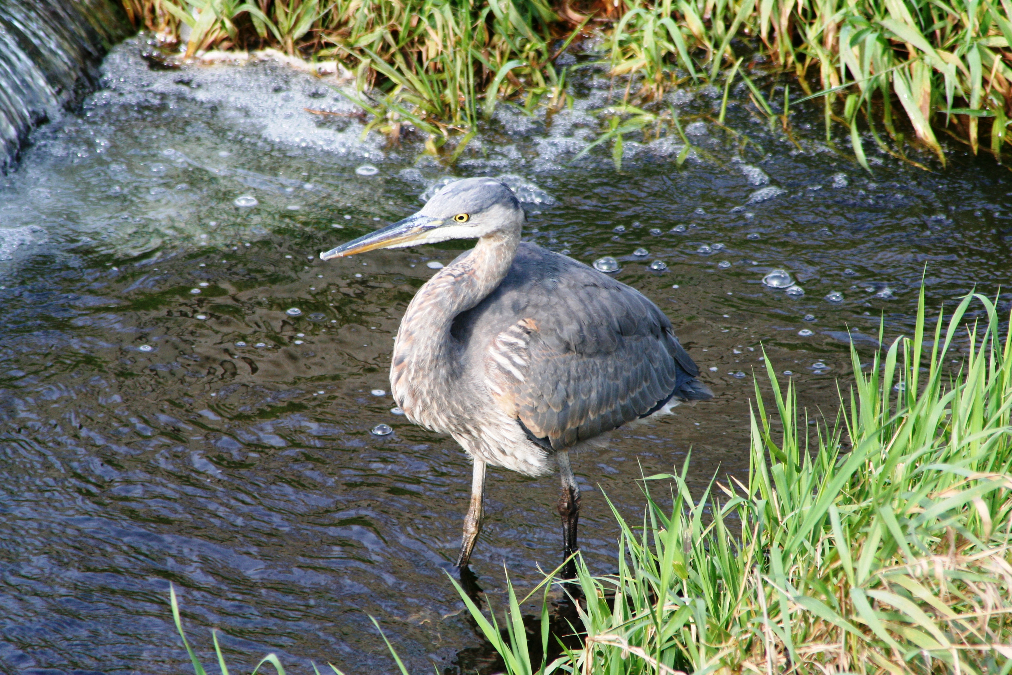
With SkyTrain tracks and a Canadian Tire steps away — not to mention Still Creek’s polluted history — it’s hard to believe that salmon have returned to spawn in such close proximity to urban life. It seems a miracle that this is again a home and hangout for herons and hawks, beavers and otters.
Only 40 years ago, Mark Angelo was told that Still Creek was a lost cause. But Angelo had faith.
“I’m a real believer,” he said. “Never give up on any waterway.” ![]()
Read more: Environment, Urban Planning + Architecture


Tyee Commenting Guidelines
Comments that violate guidelines risk being deleted, and violations may result in a temporary or permanent user ban. Maintain the spirit of good conversation to stay in the discussion.
*Please note The Tyee is not a forum for spreading misinformation about COVID-19, denying its existence or minimizing its risk to public health.
Do:
Do not: