


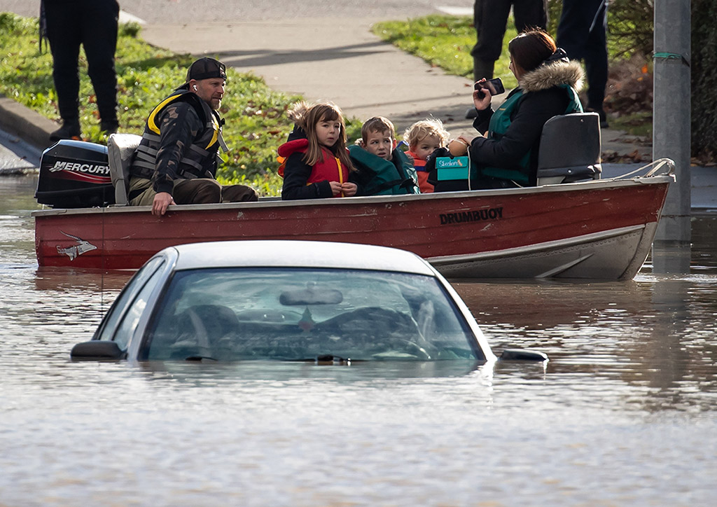
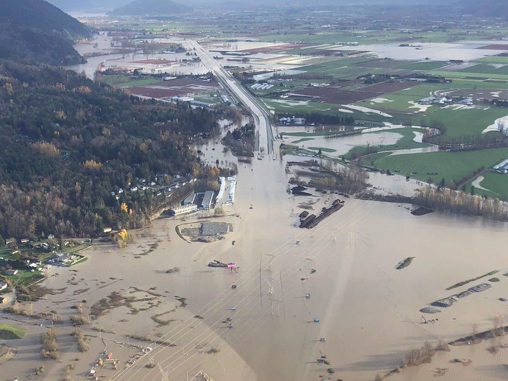
The only two things that came as a surprise when many parts of British Columbia flooded this week was the head-spinning scale of the disaster and the sight of a farmer on a Sea-Doo roping a cow that was neck deep in water, and dragging it to safety.
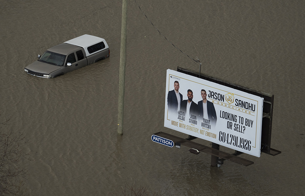
Everything else that happened we’ve seen before: bridges collapsing, roads crumbling, houses and cars submerged in water, boats coming to the rescue, and power and drinking water being shut off to victims who were stranded in their communities and forced to find a way to stay warm in plummeting temperatures. Recall how Fort Simpson in the Northwest Territories flooded so mercilessly last spring, and how so much of western Europe was underwater this past summer. The only thing missing this week were the scorpions that are taking refuge in Egyptian homes following flooding last week.
Premier John Horgan called for a state of emergency, as he was obliged to do. Like other politicians before him who have tried to make sense of so-called natural disasters like this one, he described this catastrophe as a once-in-500-year event, giving the impression that this was a freaky show of nature that was not likely to occur again for several hundred more years.
He is wrong. Five-hundred-year events, like the 100-year event that the monumental Calgary flood of 2013 supposedly was, are based on what has happened in the past. It doesn’t mean that there won’t be another catastrophic flood for another 500 years. It just means that the odds are 0.20 per cent that it will happen in a given year.
The past, however, is no longer, and never really was a reliable proxy for the future, because the ingredients necessary to create a catastrophic flood are much different now than they have been before and because the historical record of flooding is as sketchy as the wildfire picture.
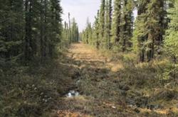
Consider what has happened to moisture-absorbing landscapes such as forests that have been destroyed by the mountain pine beetle and bogs and fens, swamps and marshes that mitigate floods, because many of them contain metres-deep peat that can absorb up to 26 per cent of its moisture.
Abbotsford was built on Sumas Lake, which shrunk during droughts and expanded when it rained, producing a peaty wetland over time that acted like a sponge when the next flood came along. Like the Papaschase Cree who lived along the shores of McKernan Lake in Edmonton, the Semá:th people built villages around Sumas to fish and to harvest peatland plants such as blueberries and swamp potato, or wapato, and pharmaceuticals such as Labrador tea. Unlike us, they could easily move their homes when the wetlands were occasionally overwhelmed with water.
Like McKernan, Sumas was drained to make way for farms, towns and subdivisions. Because the bottom of Sumas was at sea level, dikes, drainage channels and pump stations were built to keep the gravity-loving water from coming back.
It was common practice, as I point out in my book Swamplands. In the U.S., 42 million hectares of peatlands, an area the size of California, have been drained, often with help of governments that literally gave away swamplands on the condition that they be drained.
The impetus to drain the swamp, and harvest peat for locomotive fuel, bog iron, catalytic agents for fire bombs and for gardens and agricultural purposes was just as strong here in Canada. Burns Bog in B.C. was originally 4,000 to 4,900 hectares before development. Only 3,500 hectares remain. Wainfleet Bog in southern Ontario used to be the size of Metropolitan Toronto. Now it could barely fill the suburbs of Etobicoke. This is peat that not only mitigated flooding; it also filtered nutrients that are seeping into the Great Lakes and creating algal blooms.
The big problem now is that infrastructure needed to keep water out was predicated on the assumption that climate does not change, and that atmospheric rivers such as the one that dropped so much rain on the West Coast did not need to be factored into engineering solutions because even now, we know so little about them.
Rivers in the sky meet a slowed jet stream
The DNA of climate change is all over atmospheric rivers like this one that can carry twice the volume of water as there is in the Amazon River. As oceans like the Pacific warm, they release more water vapour into the atmosphere, filling up these atmospheric rivers with even more moisture.
As the oceans continue to warm, we’re likely to see more of the procession of storms that dropped more than 200 millimetres of rain on cities such as Agassiz and Chilliwack last week.
We’re also going to see storms stall because of changes in the jet stream.
The jet stream isn’t what it used to be. This fast-flowing river of air snakes around the Northern Hemisphere at altitudes of up to six kilometres, creating high and low-pressure areas and dragging weather along with it. It is powered by the difference in temperature between cold Arctic air and the warmer air to the south. As the Arctic warms, and the temperature difference diminishes, the stream’s westerly winds weaken, vying with La Niña and El Niño as a force of nature that shapes weather patterns from Alaska down to California.
Just such a shift was associated with the “ridiculously resilient ridge” that hunkered down over most of California in the fall of 2017, persistently redirecting wet weather northward to Alaska, which at one point got a record of just over 100 centimetres of very wet snow and rain in 12 hours.
Weaker westerly winds in turn amplified the stream’s north-south swings, sending cold air much farther south than it usually does, and holding it there. Baseball fans noticed when the Texas Rangers opened their 2018 season on near-record or record cold days. Californians noticed when wildfires burned over the Christmas holidays because there were no late autumn and early winter rains to quench the thirst of the forests and grasslands.
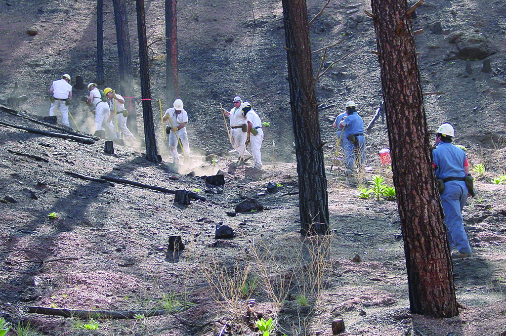
It may seem strange making a connection between wildfires and flooding. But floods often follow wildfire because there is little vegetation left on the ground to absorb the moisture. Fires, as well as clearcuts, can also change the chemistry of soil in ways which makes it impermeable. “Hydrophobic” is the word geologists use to describe it.
Fire and flood: the connection
It’s not like we haven’t been warned.
If you’re a firefighter, you likely know the story of the US Forest Service employee who ignited the Hayman Fire in 2002 while allegedly burning letters from her estranged husband in the Colorado Rockies.
Six lives were lost. Six hundred structures, including 133 residences, were destroyed. Some 5,340 people were forced to evacuate; 14,000 were told to be ready to leave on a moment’s notice.
The fire had a devastating impact on the state’s economy. Pike National Forest, home to Canada lynx, the flammulated owl and dozens of other species of concern, was shut down for most of the busiest part of the tourist season. Ranchers lost feed, equipment and fencing. Small businesses suffered.
What was unexpected was the impact the fire had on water — the water in which fish and other aquatic forms of life live, and the water people drink.
Without trees, vegetation and a stable soil structure to absorb the unusually heavy rains that eventually followed in the denuded Rocky Mountain landscape, tons of ash, debris, heavy metals and nutrients were flushed through the watershed towards the city of Denver.
Washed out highways were the least of the problems. So was the precipitous decline of the blue-ribbon South Platte River trout fishery, which was the best of any river in the United States within a one hour’s drive from a major city.
The affected watershed serves 75 per cent of the state’s residents. Hundreds of tons of sediment filled lakes and reservoirs. Intakes got clogged. Water quality suffered, not just for a few days, but for several years.
To find a solution, more than 60 scientists from various disciplines were brought in. Crews dredged out tens of thousands of tons of sediment. More than 175,000 trees were planted. Still, the water quality problems persist and the trout fishery is coming back only slowly.
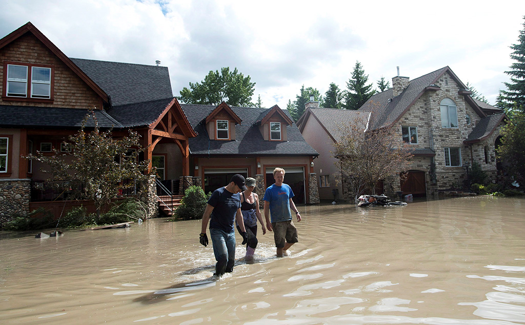
Calgary’s 2013 ordeal, and salvation
The risk of floods like this rises when the movement of weather stalls or slows and then drops rain on snow as it did in the Alberta side of the Rocky Mountains in the spring of 2013. It was the costliest flood in Canadian history, with more than $400 million in damages in Calgary and $5 billion across southern Alberta.
Rain on snow events are significant because they can accelerate the melting of snow to the point where flooding follows.
The 2013 flood was made worse by the fact that the city of Calgary had drained about 70 per cent of its wetlands to make way for homes and businesses. It would have been even more disastrous had forests and beaver dams not held back so much water in the Sibbald Fen and adjoining alpine regions of Kananaskis country.
University of Saskatchewan scientist Cherie Westbrook highlighted this in the research that she has conducted there.
Had the beaver ponds been removed, the fen drained and the surrounding forests subjected to clearcuts, hundreds of millions of litres of additional water would have flowed out of the mountains that spring, says colleague John Pomeroy.
Pomeroy is director of the Global Water Futures program — the largest university-led freshwater research project in the world.
He and his colleagues published a paper a few years ago that demonstrates that extreme flooding in the Bow River is not well-estimated by historical record. Pomeroy's colleagues Kevin Shook and Paul Whitfield also published a paper that shows that fall-winter high stream flows are increasing throughout western North America. Calgary, which suffered from another catastrophic flood in 2020, will be especially hard hit.
“Our models suggest a four-fold increase in extreme rainfalls of Calgary later this century,” says Pomeroy.
Once again, it’s not like we haven’t been warned, as Pomeroy noted when he sent me a PowerPoint that he put together while working for Environment Canada 25 years ago. He predicted back then that larger winter floods in Eastern Canada and the western mountains were coming. No one listened.
“It makes me feel terrible to revisit it because we knew this was coming and we did not take sufficient measures to prevent it,” he told me.
All of this speaks to future decisions that will have to be made about mountain top coal mining in the Alberta Rockies, salvage logging in the Columbia wetlands, further clear cutting of old-growth forests, and draining and degrading fens and bogs as the oilsands continue to do.
“The hydrology of the mountain region is changing due to climate change,” Pomeroy says in my book. “Rain rather than melting snow is now the main source of moisture at lower elevations. It is coming down more erratically with longer and more severe wet and dry spells.”
‘The extreme hydrology of the 21st century’
Pomeroy suggests that the water management techniques developed over the 20th century will no longer be useful in this vastly changed water future. Every fen, tree and moss banked stream will count even more so than they have in the past. Infrastructure such as roads, bridges, dams and dikes will be challenged.
“Climate change means that the world is going to face more severe droughts and floods and more wildfire,” he says. “Heavy rains and rain-on-snowmelt events can mobilize open-pit mine waste as it did at Mount Polley in British Columbia where retaining dams were overwhelmed. They were not designed for or maintained to withstand the extreme hydrology of the 21st century.”
Investing in tens of billions of dollars of infrastructure will only go so far mitigating the floods that are coming. Cities like New Orleans should know that, now that it is obvious that a recently completed $14-billion upgrade to its levees are not keeping up with sea levels that are rising faster than what was forecasted and storms that are bringing more rain.
Like wildfire, flooding is entering a new paradigm. In this era, business as usual will not be successful. ![]()
Read more: Science + Tech, Environment, Urban Planning + Architecture


Tyee Commenting Guidelines
Comments that violate guidelines risk being deleted, and violations may result in a temporary or permanent user ban. Maintain the spirit of good conversation to stay in the discussion.
*Please note The Tyee is not a forum for spreading misinformation about COVID-19, denying its existence or minimizing its risk to public health.
Do:
Do not: