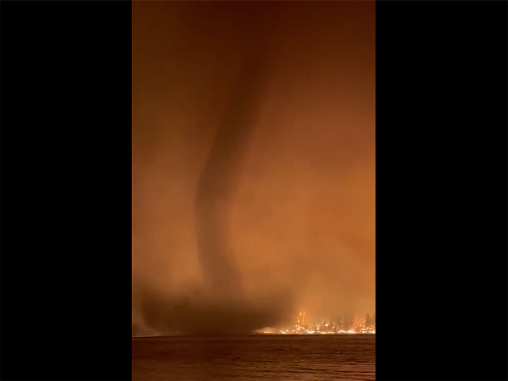
On Tuesday, the BC Wildfire Service posted a video that many found astonishing and frightening: it showed a swirling, tornado-like windstorm kicking up water over a B.C. lake, against the backdrop of an intense wildfire that has been raging in the area.
“Fire whirls are vertically oriented, intensely rotating columns of gas and flame,” the service wrote in a series of social media posts.
“As shown in the video, the combination of high fire intensity, strong winds and air mass instability resulted in the formation of a fire whirl (otherwise known as a fire tornado) over Gun Lake.”
Ed Struzik is a fellow at the Institute for Energy and Environmental Policy at Queen’s University who published Dark Days at Noon: The Future of Fire in 2022.
Struzik said fire tornados are a rare phenomenon that can happen when intense wildfires create their own weather.
A more common occurrence is a pyrocumulonimbus storm fuelled by heat, smoke and water vapour sucked up by the fire. It’s like “a thunderstorm created by a fire on a blue-sky day,” Struzik said. The wildfire-created storms can generate their own weather, including lightning and high winds — but not rain.
“You just have so much intense heat, ambient heat on the ground produced by the fire — it sucks up all the moisture from the ground and even from vegetation, and it can create this dirty thunderstorm,” Struzik told The Tyee.
“It can take it to another level and create a tornado in itself.”
In a series of Twitter posts, the BC Wildfire Service explained that the fire tornado captured in the video was part of an intense period of wildfire activity above Gun Lake, northwest of Lillooet. A cold front that pushed temperatures down very suddenly played a role, as did strong southwest winds and extremely dry air.
Last week, a cold front passed through the province following several days of hot, dry weather. pic.twitter.com/fHbPsizjbr
— BC Wildfire Service (@BCGovFireInfo) August 22, 2023
“Another important factor in the formation of whirls is adequate vorticity, a measure of the atmosphere’s tendency to spin or rotate,” BC Wildfire staff explained. “Complex terrain, downslope winds and the passing cold front provided the necessary conditions for the formation of this fire whirl over Gun Lake.”
Struzik said wildfire-created “dirty thunderstorms” are storms created and fuelled by intense wildfires and they can lead to the fire spreading. Lightning from the storms can spark new fires and winds generated by the intense heat can cause embers and ash to travel long distances. The storms suck moisture out of the air, from plants and waterways, instantly turning it to water vapour.
“That vapour basically just evaporates by the time it gets up into the atmosphere,” Struzik said. “A pyroCB, unlike a thunderstorm, almost never produces any rain.”
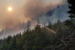
Another photo posted by Matt MacDonald, the lead fire weather forecaster with BC Wildfire Service, is a good illustration of how high a plume of wildfire smoke can rise into the atmosphere, “sometimes more than 50 kilometres,” Struzik said in a followup email. “Not so long ago, scientists thought this to be impossible.”
Another incredible photo taken from a friend who is an Air Canada pilot and was flying over one of our countless #BCwildfire pic.twitter.com/dMYvRaLVBR
— Matt MacDonald (@meteo_matt) August 20, 2023
People who saw huge clouds rising into the air from fires near Kelowna and Penticton have frequently compared what they saw to a volcano’s plume, and the comparison isn’t far off, Struzik said.
“The reality is, is that they have as much energy as a volcano.”
According to a 2022 study, researchers who studied wildfire plumes found that smoke is rising higher and travelling farther as the changing climate leads to longer wildfire seasons. That could lead to worsening air quality.
Dirty thunderstorms aren’t a new phenomenon, Struzik said: massive wildfires at the beginning of the 20th century also created pyrocumulonimbus storms, captured in historic photographs of the Great Porcupine fire in northern Ontario in 1911.
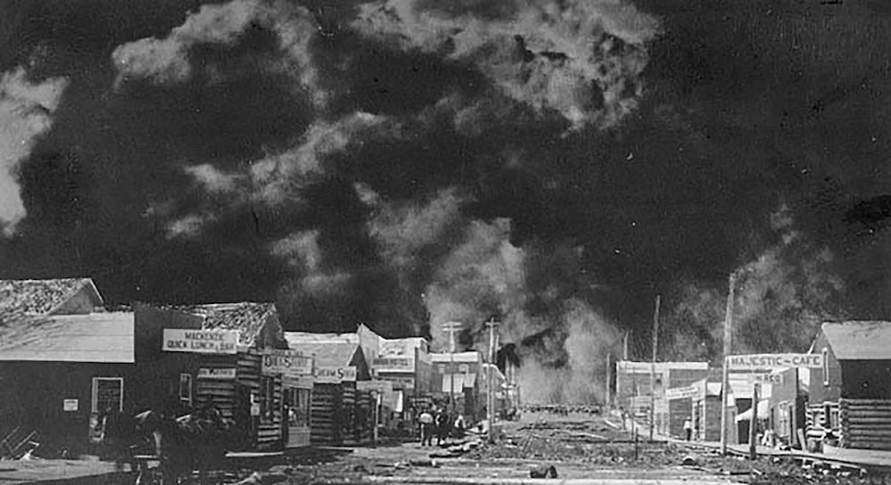
But as temperatures warm because of human-caused climate change, wildfires are becoming more frequent, more intense and harder to fight.
Canadian fire researchers are now working on models to try to predict when pyrocumulonimbus storms will occur, “because it's a real danger to firefighters on the ground,” Struzik said. He said more research is needed to be able to develop advance warnings for firefighters and residents who are at risk.
“Essentially it suspends all firefighting activity and allows the fire to go even farther than it would normally go,” Struzik said.
“Any time that they get the sense a pyroCB might erupt, they pull everybody back because it can actually spread the flames and overwhelm the fire crews on the ground. It can actually knock a helicopter or a water bomber out of the air.” ![]()
Read more: Science + Tech, Environment






Tyee Commenting Guidelines
Comments that violate guidelines risk being deleted, and violations may result in a temporary or permanent user ban. Maintain the spirit of good conversation to stay in the discussion and be patient with moderators. Comments are reviewed regularly but not in real time.
Do:
Do not: