Nightmare on the Fraser

Wet winter, hot spring a bad mix for the Valley.

By Richard Warnica, 14 Feb 2007, TheTyee.ca

Big Story

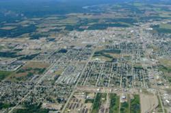
A wet, snowy winter combines with an early hot spring to flood the Fraser River. Dikes from Chilliwack west are overwhelmed. Tens of thousands are evacuated. Billions of dollars are lost. It was the nightmare scenario Chris Wood envisioned in a Tyee investigative series last summer. But new warnings from B.C.'s Environment Ministry have some saying the nightmare could be just months away.

Snow packs in some parts of the province are 160 per cent of normal, according to a story in yesterday's Globe and Mail. That, combined with what is expected to be one of the hottest springs on record, has the province's river forecast centre saying the flood risk on the Fraser is at its highest in a decade.

Yesterday, we checked in with Wood to get his thoughts on the new developments. He wasn't optimistic.

"With the right combination of rain and snow and timing...throw in a high spring tide at the wrong moment (which I left out of my scenario) and sure it could be bad," Wood said in an e-mail. "Could it be as bad [as the situation in my story]? Truly."

Wood said three factors, all related to climate change, are converging to create a high-risk situation. "One is that we're getting more wild swings of weather, so we could go from a whole lot of snow to a very warm spell very quickly," Wood said. "Another is that we're more frequently getting heavy rain (rather than additional snow) in late winter or spring. That both helps the snow melt faster and adds its own load of water to the runoff.

"Finally, spring is coming earlier by several weeks compared to the middle of the last century. So it can all happen sooner that you'd think."

Despite the increased risk, no work has yet been done to dredge the gravel and silt pushing up the river floor. (A rising river floor means a rising river, which means old dikes can grow obsolete fast.) Last week, Environment Minister Barry Penner said "there has been some discussion at fairly high levels," about getting dredging, but "things did hit a snag."

For Wood, the time for delays is over. "This is exactly why we need to be preparing for consequences now rather that putting it off in the false security of thinking that the effects of climate change are somewhere out there at the end of the century," Wood said. "It takes time to raise dikes, or to dredge at a time of year that won't harm fish. You don't want to be trying to do it as the flood crest is hitting Yale."  [Tyee]

43  Comments:

Login or register to post comments

  • Grumpy

    5 years ago

    Of course the Fraser will flood

    We have neglected the Fraser river much too long and monies spent on political frills instead of improving dikes, will tell the tale. Richmond is most vulnerable as much of the dikes along river road, along the North Arm are in a Sorry state. Remember, it only takes one breach on a flood tide and all hell will break loose!

  • Grumpy

    5 years ago

    Noah anyone?

    Lack of comments is worrisome, have we all caught the Alfred E. Neumann disease? WHAT ME WORRY?

  • DenisB

    5 years ago

    Why comment on something we

    Why comment on something we all know is true? This has been predicted for some time.

    Only problem is who's going to pay for rebuilding Richmond? No flood insurance there, don't you know? Personally I think we should adopt the policy of those in the Missisippi Delta - we only help you rebuild if it's on high ground. Why pay for things twice?

    I read once in Westworld that a single breach in Richmond at 1948 levels would flood all of Richmond in less than half an hour to a level of 6 feet. I'm sure that Gordo will make sure that the provincial response will be quicker.

  • Grumpy

    5 years ago

    High ground in Ditchmond?

    I was born on the highest ground in Richmond, 6 inches above the high tide water level!

    Well, if Richmond floods, I guess it will really like be rats leaving a sinking ship!

    A friend of mine, who does some dike repair did say those North dikes between #6 and #9 roads are indeed weak and still mostly peat dredged up 100 years ago! All that has changed is that ruble has been dumped on them, but peat scours very quickly!

  • jwstewart

    5 years ago

    I suspect that the Canadian

    I suspect that the Canadian Forces don't have anywhere close to the number of helicopters that were used in New Orleans. So, please order one of these....

    http://www.canadiantire.com/browse/product_detail.jsp?FOLDER%3C%3Efolder_id=1408474396672334&bmUID=1171488837906&PRODUCT%3C%3Eprd_id=845524443250427&assortment=primary&fromSearch=true

  • murdock

    5 years ago

    Real Estate bust?

    Could it be that so many of those whom live in the upper Fraser are not interested in what happens in the delta, because those in the Delta are the only ones with anything at risk?

    New West waterfront is used to lower levels being flooded.

    Chilliwack could flood out totally with only a few thousand being displaced, arguably many of them are not 'major contributors' to the powers that be.

    Delta and Richmond are filled with many 10's of thousands 'at risk', last time I checked they had voted LIEberal Federally and it is with the Feds that the fish issue must be overcome...meaning that nothing will be done until the political bowels are 'unplugged'; maybe a good Fraser River Enema in Richmond could solve this?

  • clubofrome

    5 years ago

    Calculations...

    How about factors not related to climate change. Chance of major seismic activity during the flood..... Naw, that would be too cruel...
    Are there any planning departments/municipalities/Gov't that consider anything other than $$$? Perpetual growth does not equal progress. When will we stop the insanity and try and figure out if we can maintain the infrastructures we have now? All are becoming more fragile and the risk to interuption of services increases. Our reliance on the big wheel and it's millions of specialized parts is under great strain. Like the ecology once a key stone is removed others will follow. That equation was figured out years ago. It's why fish stocks don't recover, at least in any form that we could call commercial. Clear cut, drag net and move on. No plan for the future. But yet all economic factors point to growth? Ed, what's the name of that style of economics called again?

  • G West

    5 years ago

    nice unit jwstewart

    I bet the local councils could get some nice quantity discounts too.

  • doggone

    5 years ago

    hello from Tulum

    Just spent a couple of nights on a peninsula to the south here that never rises more than 3 meters above tide. Very little snow pack though so until the real warming gets in gear they should be fine

  • maestro

    5 years ago

    clubofrome

    Why don't ya date that NASA astronaut currently in the news and see if ya can get a guest pass on the next shuttle flight ?

  • bowenmark

    5 years ago

    mo money

    I got an idea! Instead of taking care of this problem that has been known about now for years, let's spend our money on some games for a few athletes that will make wealthy land owners living in the mountains even richer!

    While we're at it we can make the roads bigger and able to handle more traffic to the mountains where only they can afford to live. While we're waiting for those roads to be finished, let's make a venue for one of those games in the flood plain.

  • maestro

    5 years ago

    Short memories:

    How soon we forget:

    We had this same flood fear just a few years ago....Local Gov't jurisdictions were on alert for the potential of spring flooding and reacted accordingly.

    Much of their Pro - activeness was based on analyzing the integrity of the dykes....but apparently not the more comprehensive solution of raising them.

    It appears that the Upper Fraser, around Mission, is the area oft quoted as having the higher flood risk.

    Also, FYI , jurisdictions with both Urban and Rural ALR land have segregations as to Floodplain management. I am not sure how well known this is.

    Suffice it to say, those in the more RURAL / ALR areas of the given jurisdiction on the same basic flood plain are more SOL...their properties , by literal definition will be UN developed, hence likely lower in elevation, and will end up as the literal "sump pit" bearing the brunt of the flooding. Aka their Rural /ALR properties will flood before the more Urban ones in the same jurisdiction.

    Some Local Gov'ts have insisted that their Urban areas undergoing development or redevelopment MUST have their land elevation raised , often by fill material like river sand ...likely to minimize any potential flood damage and liability.

    However, what may happen, is that a breach of the dykes may result in a scenario where the river flow may be such that it undermines the higher elevation "fill material" under these Urban areas...hence erode and undermine the buildings footings...and the entire integrity of the building compromised.

    This would be opposed to such structures in the lower - elevation Rural/ALR areas that are less exposed to such a possibility, and these more Rural buildings may suffer "water damage only" and these may be more easily restored.

  • clubofrome

    5 years ago

    Ring - a - Ling

    maestro: Hello?
    clubo: There's a comment for you back on the education thread. Click, Brrrrrrrr.

  • maestro

    5 years ago

    To: Cluboclownsn'bozos

    Hey club-sky....

    Why not post it here...?

    Sorry...too busy....maybe later.

    PS Why the " Brrr" ....
    Mommy not dress you warm?

    Oh yeah , anticipating Global Warming.
    Set your watch!

    Good thinking , oh club'bed -2- legged -seal -pup.

    Ciao.

  • clubofrome

    5 years ago

    Good one....

    Click, Brrrrrrrr..... the sound of the phone after hung up. Damn you're dumb. Just thought that being considerate to others we could keep the feud on one thread. Another reason you don't "get it."
    But, at least you're trainable, as I see that you have started your "Hooked on Punctuation" course as taught by Stump. Now repeat after me... "I will not chew gum in class. I will not chew...."

  • bessejell

    5 years ago

    why did i move here?

    Oh right... to go to college. I moved to Richmond in September, and... need I say that I have noticed that even without the dikes being breached, a little bit of rain puts Richmond in a puddle. I think what people don't realize is that the entire Vancouver area is within 50 years not even going to be livable. I mean, not to be a pessimist or anything, but the fact that we have chosen to ignore the hundreds of signs of global warming is proof that regardless, unless we somehow stop Greenland from melting and slow the CO2 production the water levels will continue to rise.
    Even if the levels maintain, the slightest bump of an earthquake of the Juan de Fuca plate will cause Richmond to turn to mush. They built an entire city on a river delta. The consequences of that are inevitable, no matter how high the dikes are built up.
    Just another reason why, the second that I get my degree, I am getting the hell outta dodge. If not, I'll put a canoe on the roof and hope it doesnt get blown away by the winds.

  • Yeoman

    5 years ago

    Dredging

    If you think dredging will allieviate the problem I've got some swampland for you. Look at the numbers - it would take millions of cubic meters to even make a measurable change!

  • maestro

    5 years ago

    clubofclownsn'bozos

    Keep honkin,

    .....I am simply re-loading.

    Quit peeing on your own powder...
    Generous moi...I'll lend you match to dry it out.

    ..OH actually.... I just happen to have an oxy - acetalyene torch you can borrow.

    PS: Let Stump borrow it when you are
    F-I-N-I-S-H-E-D.

  • G West

    5 years ago

    Errata

    That's Oxyacetylene, maestro; or, if you prefer Oxy-acetylene.

  • zalm

    5 years ago

    Grumpy, I'm surprised you

    Grumpy, I'm surprised you haven't weighed in on the utility of investing in Skytrain to submarine suburbia... Skytrain was Richmond's reward for telling the GVRD to go to hell when they tried to cap development in Richmond at 170,000 people by 2021. The reason? Floodplain with dykes that were only 1-in-50 or 1-in-100-capable, I forget which. Upgrading of which required several billions in investment - federal investment, which we know is as easy to get out West as getting Emerson to change seats.

    I like Richmond. Even the parts in East Richmond that are 9 metres above sea level, if memory serves. I wouldn't want to see it underwater. But I fear the worst.

    And what's going on with that stupid Skytrain anyway? They haven't even started the bridge across the Fraser, and they've closed down major intersections all up and down Cambie when they said they wouldn't. You can't get across the city from east to west anymore except at 3:00 am - all the roads are virtually closed.

    I don't think it's going to be finished by 2010 - not by a long shot.

  • zalm

    5 years ago

    Yeoman

    Dredging isn't about removing all the material from the river, it's about making a smooth, clear submarine channel in the riverbed that allows the river to scour itself clean especially during spring freshet. Sometimes just a few shovels full is enough, if the hydraulic engineer knows what he's doing.

    Otherwise, if we'd have to remove all the silt and overburden ourselves, we'd never get it done.

    Unfortunately, yes, the feds haven't kept up with dredging or clearing debris

  • maestro

    5 years ago

    Zalm:

    Zalm :

    Good points:

    The RAV line seems to be humming along in some areas, specifically at YVR and around the RiverRock casino. The rest seems like a snail's pace. My theory is that the RAV , the RiverRock casino and the YVR alignment were NO coincidence, the whole non - coincidence suggests that airline passengers on layovers will be encourage to gamble at RiverRock. They can probably get from YVR to the casino in about 5 minute or less once RAV is built....gamble $$$ , lose...and then be back to catch their flight.

    Richmond , via its legislated share of casino revenue, is already acquiring up around $10 - 11 Million per year as its current share. Once RAV is completed, the Richmond share of casino revenue , will, in all probabilty increase significantly.

    Perhaps that explains why Richmond wanted RAV...all those " YVR fishies " swimming upstream via RAV to the Ca$$$ino. FYI Richmond is dedicating a minimum of $50 Million dollars of Casino revenue over the next 10 years to pay for the approx. $200 Million Olympic Oval.

    We need a " Woodward and Bernstein " type of in -depth investigative reporting to really dig into this amazing series of coincidences on how the Casino, the Olympic Oval and RAV all lined up. Richmond Council did a major 180 degree turn on expanded gambling , once following the wishes of their citizens and saying NO.. and then overnight Council approving expanded gambling. The lead "Pro Expanded Gambling" Councillor on this happily got their ass -branded and kicked out of office last election.

    Of course , given all the crime lately around the RiverRock casino, the usual cry for more police... not perhaps making the corroboration that casinos " may " attract the unsavory elements.

    Dredging is a rather bizarre political football. The costs are not huge in the scheme of things, and my much of the material dredged, ie sand, has a market.

    Unless it is the Fisheries Dept. at the Federal and Provincial level getting involved, (ie dredging having an impact on fisheries)..it makes no sense. It's like the debris trap up in Agassiz...it seems the smaller the cost in the overall scheme of things...the more Gov'ts like to nickle and dime and delay action. However, Gov't seems to have no hesitation in cutting cheques for billions of dollars.

    One wonders what goes on and what the true agenda/s really are.

    Woodward and Bernstein, time to move to " Beautiful (Ugghhh/Shudder ) BC "...much to do.

  • maestro

    5 years ago

    G West: re: Oxy-acetylene

    No problem...

    ...its simply me gathering evidence to substantiate a theory that You, "Stump" , " Spelling and Grammar Police " and "Clubofclownsn'bozos" and maybe even Ron are one and the same...

    (sorry Ron, I had to say that)

  • clubofrome

    5 years ago

    SPS

    Further proof that those wih SPS, must continue efforts to disguise their "shortcomings." Thus the ramblings continue.......ad nauseam. Lets finish this today. Go back to the School thread, unless you're yellow....

  • zalm

    5 years ago

    Good one, Maestro...

    Quote:
    They [Pax] can probably get from YVR to the casino in about 5 minute or less once RAV is built....gamble $$$ , lose...and then be back to catch their flight.

    Who'd a thunk it? Certainly not Malcolm Brodie... mmmmpphhhh........ GUFFAAWWWWWW!!

  • maestro

    5 years ago

    Zalm:

    Its a no brainer,....which is why few have even made the connection or openly admitted it. The evidence is appallingly obvious if you see where the casino is...it's right at where the RAV line forms a "T" junction. Look over the Oak Street bridge ..both sides...see all the advanced RAV work .

    It almost looks like the Airport- to Casino -RAV section will be finished soon...the rest looks way behind..gee what a coincidence....get them YVR layovers to the Casino by Xmas 2007 ...maybe Hallowe-en 2007 ... ?

    Once RAV rolls up #3 RD...they are going to line both sides of #3RD with High Rises...again another major convenience for people to jump aboard and gamble...like a fiscal abbatoir/slaughterhouse . I am not even talking about how Vancouver etc. will feed the RiverRock...

    Probably have shootings and highjackings, muggings ,rapes , murders ,drug deals etc. etc. as high rollers meet the gang members, but hey, that's the price we all must suffer for being called World Class Cities...

  • maestro

    5 years ago

    clubofclownsn'bozo's

    Hey, there is a cannibal- vegetable out there wanting to have you over for dinner .

    Do us a favour and accept the invite.

  • Yeoman

    5 years ago

    Zalm + Maestro

    Not to put to fine a point on it but you don't appear to know jack about hydrology and sediment dynamics. As for there being a market for the "sand" (its actually gravel) supply and demand rules. The volume required for flood control would overwhelm the market.

  • maestro

    5 years ago

    Yeoman

    The closer to the mouth of the Fraser the dredged material is sand...the farther up the valley it tends to be larger aggregate/gravel.

    Fisheries gets involved with the claim that the gravel beds are prime habitat for salmon and salmon eggs. We have seen this issue many times in the news.

    Apparently the dredged sand is sold by Gov't to the private sector, and stockpiled. Anyone buying river sand doesn't get it for free.

    There is always a demand for fill material, regardless of the cost. Also, at times major excavation projects will truck it at very reduced cost.

    Regardless , flooding the " sand " market is secondary with respect to the flooding that may occur if the river is not dredged.

  • Yeoman

    5 years ago

    The flood concern is in the

    The flood concern is in the gravel reach, where, yes, it is arguabley the most extensive spawning area in the world. The lower river (sand reach) is dredged for navigation purposes by private firms that bid for the contract. They get to keep the sand to sell. The market for this material is not insatiable as it is only suitable for fill, not concrete or other high value uses. In most cases the sand is only competative for fill if it can be pumped by pipeline to a riverfront property.

    If you want the real story on dredging, don't believe the political spin. Go to the source and read the report by Church.

  • maestro

    5 years ago

    Yeoman:

    I think its pretty much a given that the South Arm of the Fraser River (ie from Steveston right on up past Surrey etc.. will be a major commercial waterway for the foreseeable future..., given the way things are shaking down.

    That will inherently imply a need for dredging. However the North Arm of the Fraser is interesting,(ie Sea Island , and East past Vancouver and Burnaby )given that many industrial sites are being decommissioned and converted to residential.

    Can't remember the last time I saw a dredging operation in that North Arm area. Hence, are we seeing a differential in (i) dredging on one "more commercial "South arm " side of the Fraser side vs. little or no dredging on the other?

    RE: Your comment on the CHURCH REPORT...any relevant "links" that you can provide would be appreciated.

    Perhaps also your views on the implications of the report would be good to put into the discussion.

    ALSO: Did you happen to read the report by one party (name escapes me) a few years ago discussing how the way the Fraser Rivers historical natural flow has been altered has now created a situation and possible scenario whereby a large amount of material is being deposited at the mouth of the Fraser and quasi- teetering on the edge of an oceanic shelf,..... and that if and when it collapses it could create a tsunami, given tsunami physics , water displacement etc.

    Finally , I am wondering if there is still a lingering " political odor" of the dredging contracts scandal years ago ..ie the collusion amongst the companies aka " price/bid fix -was -in " several years ago which warranted an investigation.

  • G West

    5 years ago

  • Yeoman

    5 years ago

    Yes, that's the URL location

    Yes, that's the URL location I was referring to. My take on the research to date is that the primary benefit of conventional dredging (ie not a mega project) is control of local erosion and limited local peak flood elevations. Removal rates large enough to really increase capacity would be very expensive and have a devestating impact on salmon and sturgeon

    As for delta face instability I am familiar with it although I'm not sure about what, if any, effect the dredging and training jetties may be having on it. My intuitive response would be "not much"

    The price fixing issue is a new one to me.

  • maestro

    5 years ago

    G West and Yeoman

    Thanks for the link G West:

    Yeoman...the price fixing happened in the 1970's if I recall correctly...there weren't many companies doing the dredging work , and I recall collusion was involved. Also I recall dredging was much more frequent a few decades ago, hence more temptation given the contracts involved.

    One other website I reviewed, which I can provide later, had a interesting graph which seemed to indicate a cross section of the speed of river flow. It seemed to indicate that the central and upper portion of the rivers have the greatest speed of flow...the periphery has lower water speed...ie the same cross -section of a river can have various different speeds of water flow.

    If one stand near a river, this seesm to be the case..ie the slowest moving water is at the rivers' edges.

    I presume that dredging would increase flow, somewhat of a " Venturi effect" , which I will guesstimate creates a greater scouring effect...hence this would disperse the sediment better and would lessen the degree of build -up that would result in the delta face instability you suggested.

    It appears to be an either OR situation, ie save the fish OR dredge..very little wriggle room, no pun intended.However, seems a bit ironic...saving the fish's environment, yet controls on the actual fish harvest is another story.

  • zalm

    5 years ago

    Maestro...

    ...you may not no any more than I do. It appears according to Church that bank-hardening is the key, and after that, dredging but not necessarily to increase flow.

    Ugh. And I thot my theses were bad...

  • Yeoman

    5 years ago

    Sediment Dynamics

    Yes, based on the size of the sediment (think grit of sandpaper) the velocity profile does change - measured as "Manning's roughness". However, when you dredge, you don't change the dominant substrate size. in addition, the gravel reach is a deposition zone so you can't "flush the sediment". Trust me on this one -I do this for a living.

  • Skookum1

    5 years ago

    Fraser estuary at 20m...30m....40m...

    Just for context, since everyone seems so interested in what's down by what's now the Fraser's mouth (that Richmond place), here's some figures on where the Fraser will meet saltwater, more or less, at different amounts of sea level rise. Figures are spot-elevations from BC Basemap.

    12m - CPR tracks through downtown Mission
    (NB Nicomen Island east of Mission is 8-10m)

    15m - Chilliwack and most of Rosedale (which is hillier than Chilliwack); and Harrison Lake becomes an inlet...as does the Harrison River as well as the little gorge used by Hwy 14.

    20m - Agassiz

    30m - Laidlaw

    45m - Hope

    55m - Yale

    And if things get really crazy, 155m will bring the sea to what will no longer be the confluence of the Thompson and the Fraser, but the mouths of the Thompson and Fraser. 200m and Lillooet is a saltwater port...

    Not that it's going to get that bad in the lifetime of anyone around here; but worth a double-check about Chilliwack-Agassiz and Harrison Lake; similarly bye-bye Pitt Meadows, and Pitt Lake becomes an inlet, but that's pretty obvious. Cloverdale? What Cloverdale? Ditto Langley City and Fort Langley and Albion and, of course, Matsqui Prairie.

    35m, by the way, would be enough to turn (what's left of) Langley and Surrey and Abbotsford-Sumas Mountain into an island, as that's the height of the rise between Bellingham Bay and the Nooksack River vs the Sumas River/Sumas Lake; location of the col is at Everson or thereabouts - old sand riffles from an ancient mouth of the Fraser, which went that way.

    Of course, whatever's going on around here in the way of economic/urban chaos as a result will be a blip by comparison to the alarm/emergency re Florida, California, the Atlantic Seaboard, and in Europe. By comparison, our own foolishness here (Richmond, further urban expansion of the Fraser Valley because of Gateway etc) is piffle, a mere blip.

    All the foundations are calling for people to try and reverse global warming. I say what they have to be doing is gearing up industry and engineering types for the task of emergency mediation. How, exactly, do you turn back the sea? King Canute tried, at least symbolically. But this time around, it's gotta be done; or, conversely, plans made to relocate a couple of billion people over the course of the next few decades.

    Recycling? Carbon credits? Gimme a break. What we need now are fallback positions. It's too late to arrange the doilies....

  • Skookum1

    5 years ago

    correction

    I know, I know, use the preview function, but anyway:

    Quote:
    15m - Chilliwack and most of Rosedale (which is hillier than Chilliwack); and Harrison Lake becomes an inlet...as does the Harrison River as well as the little gorge used by Hwy 14.

    20m - Agassiz

    That got scrambled by a sloppy cut-and-paste. Should have been:

    Quote:
    15m - Chilliwack and most of Rosedale (which is hillier than Chilliwack)

    20m - Agassiz; and Harrison Lake becomes an inlet...as does the Harrison River as well as the little gorge used by Hwy 14.

  • maestro

    5 years ago

    zalm: bank hardening?

    BTW watch the spellink

    Sorry, but we tend to do a lot of travelling and have a pretty reasonable laymans handle on the various rivers. Way back when we used to actually swim in the lower Fraser and have family outings there .

    The lower Fraser River was, and often still is, perceived as polluted, given its less than clear and pristine look ie murky look. However, much of that nowadays is simply suspended sediment.

    In the 1960's literal "Mr. Floaties" were flushed directly into the Fraser by many Local Gov'ts , but a major initiative was made to create sewage treatment plants, given development was ramping up and the coliform counts were rising. (I am actually doing a mini- research project which peripherally involves that issue right now.) Regardless, The Fraser is still cloudy and murky, but MUCH cleaner on the pollution front..

    Anyone that walks along the banks of the lower Fraser and sees a rock at low tide will have to realize that rock was likely not there naturally. Also anyone that has seen or bought dredged sand will find it composed of mostly fine sand and some plant material...ie tree bark etc. and very very few if any rocks.

    Bank hardening?...if I interpet that correctly, that would do two things..ie(i) prevent the bank from being eroded and contributing to the overall sediment in the river...and (ii)also having a lower friction co-efficient for the river flow... thus faster water -flow velocity with LESS sediment.

    If this is the case, then I agree it would likley reduce the need for dredging, " in theory ".

    This would appear to require a major initiative that all the flood plain areas would need both stronger "more solid"/hardened dyking and higher dyking.

    PS Maybe they should have RAV'd or Skytrain the dykes given the sh!tload of cement (ironically made of aggregate material )they are using and killed two birds with one stone. Maybe next time.

  • maestro

    5 years ago

    Skookum 1:

    Nice to see ya again:

    If you are taking any " special requests " .....If you don't mind my asking , what do you have on " WALACHIN " ...that quasi - Utopian settlement that once existed near Cache Creek, but was wiped -out supposedly due to the collateral effects of WW1 ?

    Thanks !

  • zalm

    5 years ago

    Bank hardening

    Ummmm.... I'm not going to say any more. Suffice to say that I read through one of the theses posted by GWest and by the time I got to the conclusions I was pretty clear that things weren't very clear, except that dredging wasn't the answer in a lot of cases - that bank-hardening was. Sediment of different sizes (classifications) seems to fall out at different rates in different spots on the river...or not.

    If you want to go over it and find it for yourself, great, but be prepared to spend the evening - it's a dense subject. I'm not going back in... ;>)

  • maestro

    5 years ago

    zalm...

    Agreed its very technical, I 've looked over two different sites...and also I'll defer to Yeoman if he has professional credentials in the field. Much info to peruse, and also each of us can focus on different details.

    Regardless the issue boils down to a concern each spring of (i) if the snowpacks are larger than normal and (ii) fears of a hot spring, both of which combined may result in a volume of water entering the rivers that is beyond the man -made dykes capacity to resist and hold back the water and prevent flooding .

    Solution is to either build taller dykes .....or somehow make the river capable of handling a greater volume of water than it does currently, .... or perhaps a combination of the aforementioned.

    I recall a major concern re: spring flooding just a few years back...floodplain areas were into serious review of the integrity of their dykes, and related infrastructure.

    They tend to operate on the basis of such predictions of 200 year time frames...the worst case scenario. Should they be even more proactive NOW and in the future and perhaps say, raise the dykes by say one metre (latest ProActive estimates)?

    Unfortunately, many jursidictions are now into making use of the waterfront areas for residential. In doing so, they have integrated the dykes into the overall aesthetics, and to raise them now would have the NIMBY's likely out in full force.

    The Fraser River Debris trap near Agassiz is nickle and dimed every year...the Fraser is simply a political football, like many other things. Throw Fisheries in it..we effectively have two senior levels of Gov't running a river, yet also one by which many Local Gov'ts are affected as the same river runs either through them or besides them. Who ultimately is responsible?

    Dykes need to be an all- or -none scenario..given the way water works, thus raise them all , at least in high risk areas. Some info regarding the last major flood was that the flooded agricultural lands lost agri-productivity for a year or two after the flood.

    I don't think they, the powers that be have a plan , and in fact I am not sure they give a dam....they will simply hope they, the powers that be, "guessed right", and most of them likely live on higher ground.

  • zalm

    5 years ago

    Maestro

    Agreed, agreed and agreed.

    So what's with the Skytrain bridge to Richmond, then? Trying to figure out how they can install a debris trap in it? Trying to figure out how high to build it so that it will still be above water during the flood? Waiting for a new casino application so they can park the bridge right beside it for broke patrons to throw themselves off?

    It's been educational, but I'm still no wiser...

    • No best comments selected by an editor for this story yet. To see all comments, click the All Comments tab, above.
    • The discussion for this story is closed. No more comments can be added.