The Big Melt
This is Klinaklini, the largest glacier in Western North America beyond the Alaskan border. As this giant melts, so go B.C.’s more than 16,000 other mountain glaciers — and the pace is fast accelerating. In mere decades, Klinaklini will be gone.
By century’s end B.C. will lose 70 per cent of its glacial ice. The effects will imperil life on the coast for everything from salmon to grizzly bears, plankton to people.
Today begins a three-part series telling the story of the Big Melt, and what comes after.
BC’s disappearing rivers of ice
The climate crisis is shrinking glaciers around the globe at a rate that startles even scientists who study the process. In British Columbia, the transformative effects extend from mountaintops, down valleys and into coastal waters. The more experts learn about what’s happening, the more they realize the complex, challenging implications of the Big Melt.
Brian Menounos, a glaciologist based at the University of Northern British Columbia and a Hakai Institute affiliate, is sounding the alarm. It’s his job to document the glacial decline, and provide the best information possible to prepare for a future when the critical benefits we reap from healthy mountain ice are no longer available.
Menounos is working with UNBC, Hakai Institute and B.C. government hydrologist Bill Floyd on a project to study how the cryosphere — a term referring to frozen water in its many forms, including snow, river ice, and glaciers — is changing.
Using space-borne optical imagery, Menounos and his collaborators in 2018 for the first time detected a massive loss of glacial mass across much of Western North America during the last 20 years, including a four-fold increase in rate of glacial melt in just the last decade.
How big is Western North America’s melt? Yearly, the ice lost is more than all the water we use in Canada.
2000-2018
2018-2100
Nowhere is the situation more dire than along the south and central Coast Mountains, a string of peaks that run from Vancouver to southeast Alaska.
Menounos says the demise of our glaciers is being driven by two things: warmer temperature trends across the region, and less winter snowfall. He and his colleagues are particularly interested in how the timing and volume of fresh water from the cryosphere is changing as our climate changes.
Start your day with The Tyee
Never miss a story. Get The Tyee's independent, reader-funded reporting sent straight to your inbox, for free.

These great seasonal pulses of fresh water are critical to life as we know it: coastal ecosystems along the length of the British Columbia coast have evolved in tandem with the cool rush of seasonal meltwater provided by thousands of snow-capped glaciers in the summer.
While the melting of glaciers in places like Alaska — home to more glacial ice than all of Western North America combined — are thought to significantly contribute to sea level rise, the biggest concerns about losing our glaciers is we will lose a critical source of cold, fresh water to rivers and coastal ecosystems.
“Around here, this is more of a fresh water storage story,” says Menounos. “And it’s a story that we ignore at our peril.”
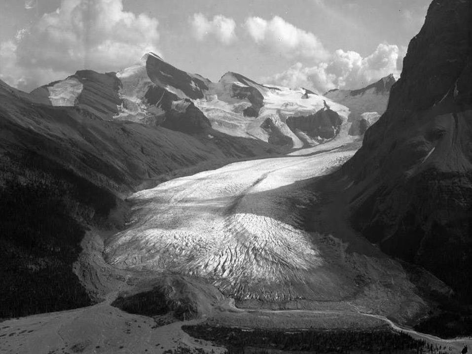 1911
1911
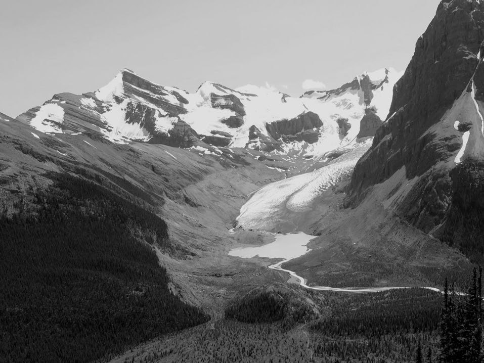 2010
2010
To understand what the future holds, it’s necessary to go back to 2015, the year a severe winter and summer drought was wreaking havoc on the central coast of British Columbia, and in particular, the Klinaklini Glacier about 270 km north west of Vancouver.
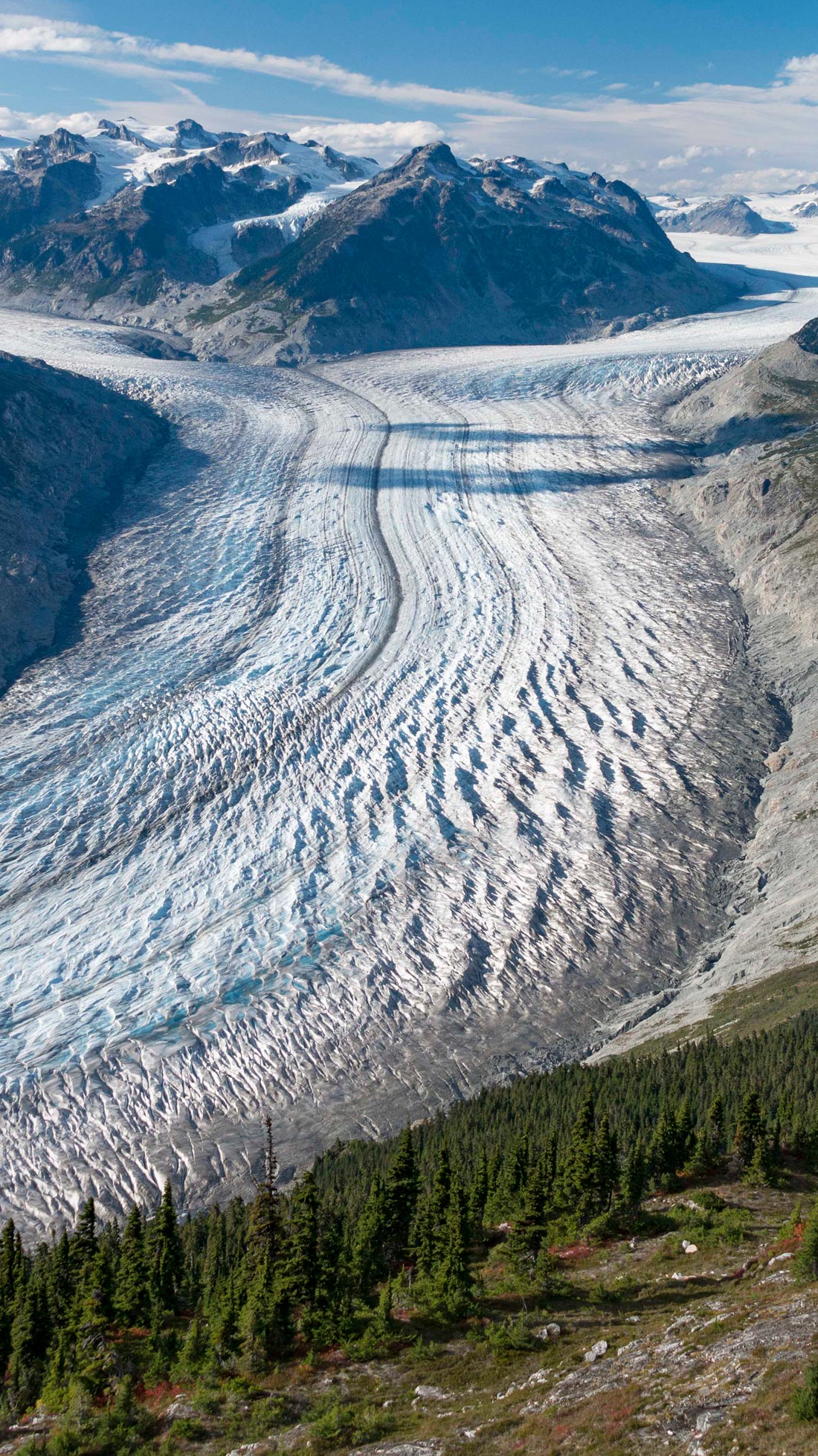
Beyond glaciers that straddle the Alaskan border and lying farther north, Klinaklini, [pronounced CLEAN-a-CLEAN] is Western North America’s biggest mountain glacier, covering a total of about 470 square km. The glacier drains into Knight Inlet and Rivers Inlet, its backside stretching eastward near the Chilcotin Plateau. It is part of the much larger icefield which covers over 1000 square km, the largest such icefield in Western North America. From high above the icefield, which is like the body of a giant octopus, many glacial arms extend into mountain valleys.
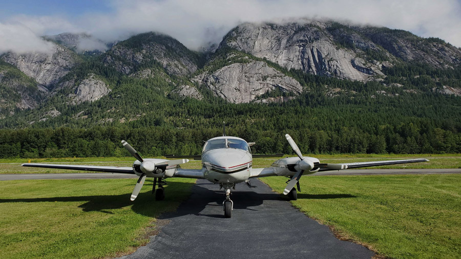
Both Menounos and his collaborator Bill Floyd describe with awe their first experiences of seeing Klinaklini Glacier from the air. It is so vast, says Floyd, that being near the glacier distorts perspectives of time and space: a passenger in a plane flying over it gets the sensation of not moving at all. Menounos says it is so colossal, standing at its edge makes a human feel tiny and inconsequential.
Coastal mountain glaciers are different from the glaciers found, for example, in the Rockies, because they are generally lower elevation and receive much more precipitation.
Floyd likens the Klinaklini to a river of ice. Although it appears static, it is constantly flowing, or “creeping” in the parlance of glaciologists. That’s because the huge amounts of snow that accumulate and turn into ice are heavy, and under that weight, the glacier is constantly collapsing down upon itself, causing ice to flow down the body like a giant conveyor belt. This ice flow terminates at the “toe” or “snout” of the glacier — which is the terminus dumping ground for this living body of ice.
The Big Slush: Warming glaciers around Klinaklini develop underground rivers that destabilize the ice as they grow | Footage from the Hakai Institute
A healthy mountain glacier is nourished by ample snow in the winter, which will melt over the summer; by late summer the surface ice begins to melt, refreshing the low water levels in rivers, and providing a critical cooling effect that salmon in particular need to complete their spawning migrations.
But the Klinaklini is no longer healthy. The winter that began in 2014 brought what Menounos calls a “snow drought” – meaning there was very little snow on the top of the “accumulation zone” of the glacier by the end of winter. The summer that followed was dry and much warmer than average.
“That really set the stage for dramatic mass change” in terms of ice loss, “not just for the Klinaklini, but for glaciers across the entire Coast Mountains.”
During the summer of 2015, rivers of meltwater poured down the glacier, gouging channels into the ice. The rivers at certain points would disappear into thermal well holes bored into the ice (known as “moulin”), where gravity would force the water through a labyrinth of internal plumbing channels forged by the melt. Some of the melting water would percolate to the ground beneath the glacier, where it joined a great sub-glacial river eating away at the body of the glacier from below. The flow of this sub-glacial river also created a slipping effect (similar to how the weight of your body easily shifts around the bottom of a filled bathtub).
The sight of the Klinaklini hemorrhaging water in the late summer of 2015, says Menounos, was a vision of things to come.
“2015 was like a window into what it’s going to look like 30 years from now,” he says. “Or maybe in 20.”
Bill Floyd says the Klinaklini is an unusually big glacier, which means it will last much longer than many smaller glaciers across Western North America, many of which are already disappearing.
“There’s thousands of glaciers that are supplying water to relatively small watersheds [along the B.C. coast], and those are the ones that are going to change the soonest.”
The Big Shrink: Glacier depth change
The rate at which glaciers are thinning is speeding up. This lets you compare the past two decades.
Floyd has been flying over the Coast Mountains for years, and describes the sight, now commonplace, of remote, nameless mountain basins of bare rock with cerulean-blue lakes at the base, bereft of ice that once clung to the edges year-round. He says on Vancouver Island where he lives, there are also multiple examples of small glaciers, like the Comox glacier, which are “ready to wink out” in the near future.
“Many of these smaller glaciers,” he says, “won’t last 20 years.”
Modern tools for monitoring old ice
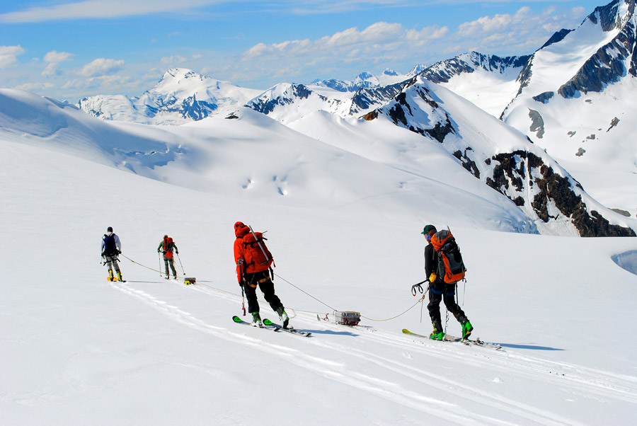
Menounos has studied the Klinaklini for a decade, a relatively short period which nevertheless makes it one of Western North America’s best studied glaciers. Out of over 16,000 B.C. glaciers, just one — the Place Glacier near Pemberton — has records of surface mass balance (basically the difference between snow accumulation and melt), going back to 1965, as well as measurements from a stream flow gauge at the toe of the glacier.
Research is scarce because historically, monitoring glaciers was time-intensive, expensive and dangerous. Researchers had to be dropped off on the top of the “accumulation zone” of the glacier twice a year, travelling with skis or hiking with crampons depending on the season. Beyond the harshness of the elements, the glacier surface is pocked by crevasses that can be as deep as 40 metres; falling into such a crack is the equivalent of dropping from the roof of a 14-storey apartment.
Researchers, once there, must measure total snowfall at the height of winter, and maximum melt in later summer. From these two measurements comes a calculation of the surface mass balance, which is the basic health indicator of a glacier.
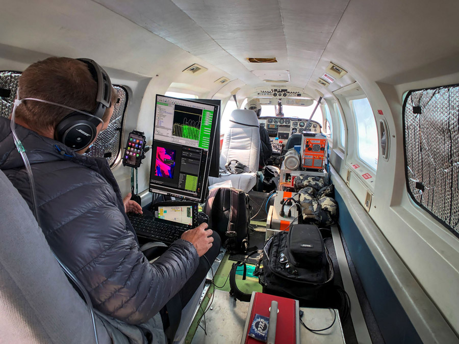
Menounos and a new generation of glaciologists are now able to use space-borne satellites to make these same measurements, which have revolutionized glacier research and has made Menounos’ most recent warnings possible.
Menounos has used technology called Light Detection and Ranging to measure the health of local glaciers. A satellite shoots millions of tiny numbered light particles down upon a glacier, and elevation measurements can be gleaned based on the time it takes the particles to bounce back. Using LIDAR, It was possible for Menounos to map the entire surface elevation of the 470 square km Klinaklini Glacier in several hours.
Historical aerial photos can now be paired with the new mapping images to reveal how glaciers have changed over time. A few years ago, Christina Tennant, one of Menounos’ students, was able to calculate that the Klinaklini Glacier lost 10 per cent of its total mass between 1949 and 2009 by digitizing and comparing old aerial photos with recent satellite images.
Over the period 1949-2009 Tennant calculated that the glacier lost 20.24 cubic km of water. Using airborne LIDAR and satellite imagery, Menounos updated the rate of water loss from the glacier over the last 10 years (2008-2019), and calculated that the “wastage” of Klinaklini Glacier has nearly doubled.
Then / Now
Measuring the health of Klinaklini
In the past, researchers were dropped onto a glacier like the Klinaklini twice a year — during the height of winter snow, and at the warmest point of summer, to measure the difference in glacier depth by hand. Photos were taken from above aboard small aircraft.


Now, space-based imagery is used to detect the loss of glacial mass on the Klinaklini Glacier and across much of Western North America. A satellite shoots millions of tiny numbered light particles down upon the glacier, and elevation measurements are calculated based on the time it takes the particles to bounce back. Using LIDAR, the entire surface elevation of the 470 square km Klinaklini Glacier can be measured in a few days.
By digitizing and comparing old aerial photos with recent satellite images, scientists discovered that the Klinaklini Glacier lost 10 percent of its total mass between 1949 and 2009.


A giant losing its toe
What makes the Klinaklini Glacier so fascinating and useful to study, other than its colossal size, says Menounos, is the opportunity to witness the real-time decay unfolding at the toe (sometimes called the “snout”) of the glacier.
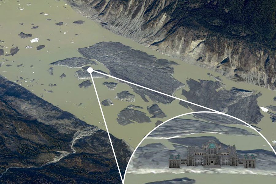
The toe of the Klinaklini, the lowest point where it drains into Knight Inlet — is now breaking apart into a growing proglacial lake. This lake in turn continues to eat away at the toe, in a similar way seen with large glaciers in Greenland and Antarctica. As it breaks up, the glacier is shedding icebergs — some of the larger icebergs visible in satellite imagery on Google Earth are 400 m wide and up to 740 m long, about the combined size of 15 of the largest-sized container ships. One dislodged, floating slab of ice is large enough, in fact, to have room left over if B.C.’s Parliament Buildings were to be placed on its surface.
“The toe is literally falling apart,” says Menounos. “If you could stand on the toe of the Klinaklini Glacier for an entire year, you’d see on average, between 12 to 15 m of surface lowering per year.”
The more a glacier melts and destabilizes, the worse its future prognosis for survival becomes. As ice disappears, more surrounding dark rock is exposed, attracting heat from the sun that causes more melting. And the more elevation the glacier loses, the lower the surface elevation becomes — exposing the remaining ice to ever lower snowfall and warmer temperatures.
Eventually the elevation of a melting glacier will drop below the snowline, at which point it cannot accumulate any more snow, at which point it is doomed.
Klinaklini is so huge it will exist in some form for another half century, long after many of our smaller glaciers have disappeared. Eventually, however, Menounos expects the demise of even the Klinaklini Glacier to play out like this: as the climate continues to warm, the snow accumulation zone will shrink, and the octopus-like, coalescing arms of the glacier will separate from the main body, turning into small individual glaciers, which will continue to shrink away.
“If you project that forward to a point where there’s no ice left, you will have a completely deglaciated landscape. It can still receive and collect winter snow, but that snow will melt earlier, and you will no longer have that repository or that reservoir that can [supply] headwater rivers with cool water once the seasonal snow has been depleted.”
The loss of coastal mountain glaciers like the Klinaklini will put us into uncharted territory, and no one knows for sure how the ecosystem will respond and adapt. Not only will the coast’s late summer emergency cooling system be disrupted, but the nutrients that flow from the glacier melt and nourish the ocean, most importantly iron, will come to an end.
A special thanks to Brian Menounos and everyone at the Hakai Institute. This series is written by Christopher Pollon. Design and development by Andrew Munroe. Artwork and additional development by David Marino.