Marking 20 years
of bold journalism,
reader supported.
Analysis
Energy
Environment

What’s at Stake with the Trans Mountain Pipeline Expansion?

The megaproject is already a money-loser for producers. Here’s what else it could threaten.

Garth Lenz and CCPA 11 Nov 2020TheTyee.ca

Garth Lenz is an award-winning photographer who has spent decades documenting the ecological and climatic impacts of the fossil fuel industry. This article originally appeared in the CCPA’s Policy Note blog.

New research from veteran earth scientist David Hughes concludes that the Trans Mountain pipeline expansion project makes no financial sense. In fact, Alberta heavy oil producers can expect to lose money on every barrel of oil they produce and move through TMX.

Contrary to claims that bringing heavy oil to tidewater for export to Asia will fetch a higher price than in U.S. markets, Hughes’ report for the Corporate Mapping Project shows that when TMX is completed, Alberta heavy oil producers could lose $4 to $6 on every barrel of oil they sell. Higher transportation costs, lower market prices and a lack of oil refining capacity in Asian markets where TMX’s unrefined heavy oil might sell are key reasons why the project is a money-loser.

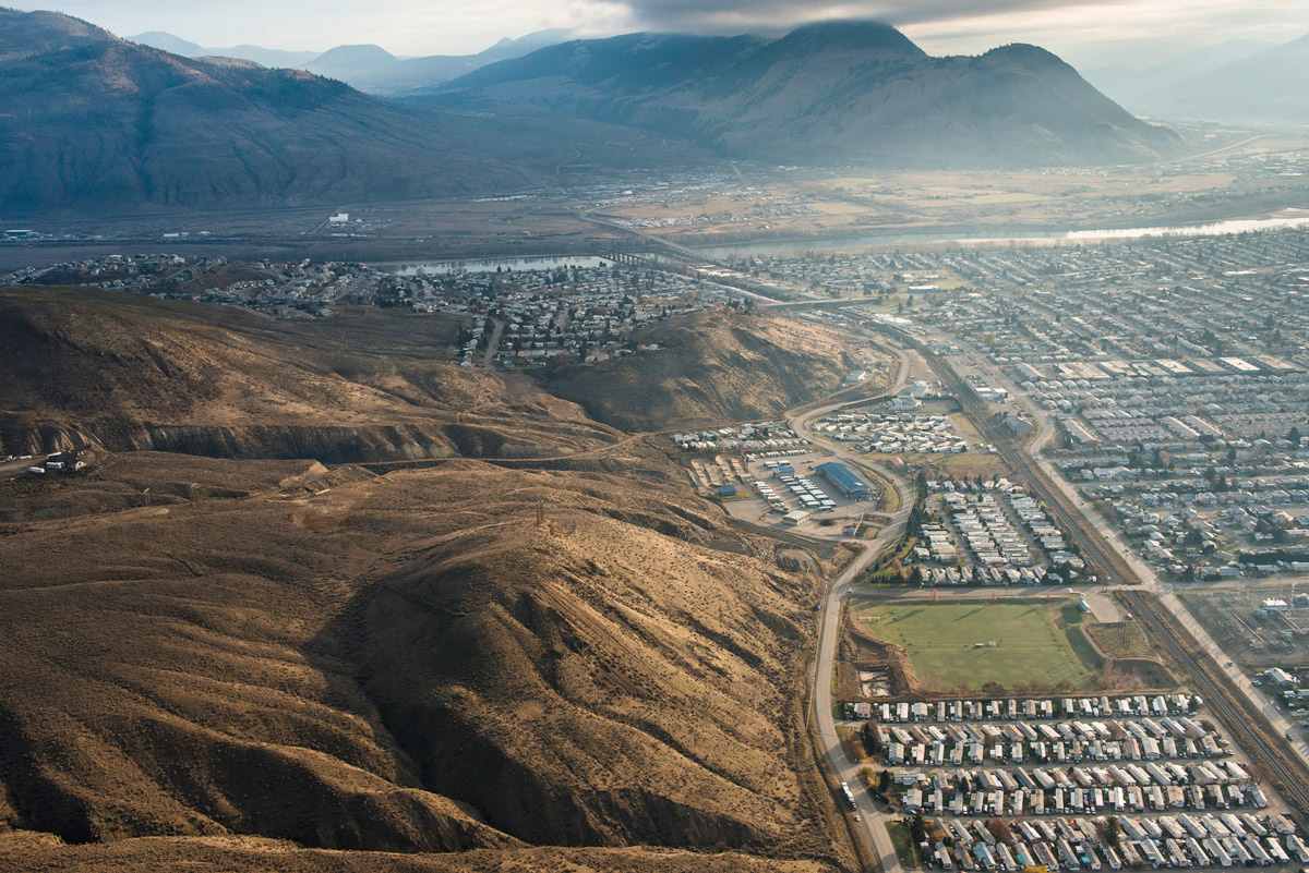
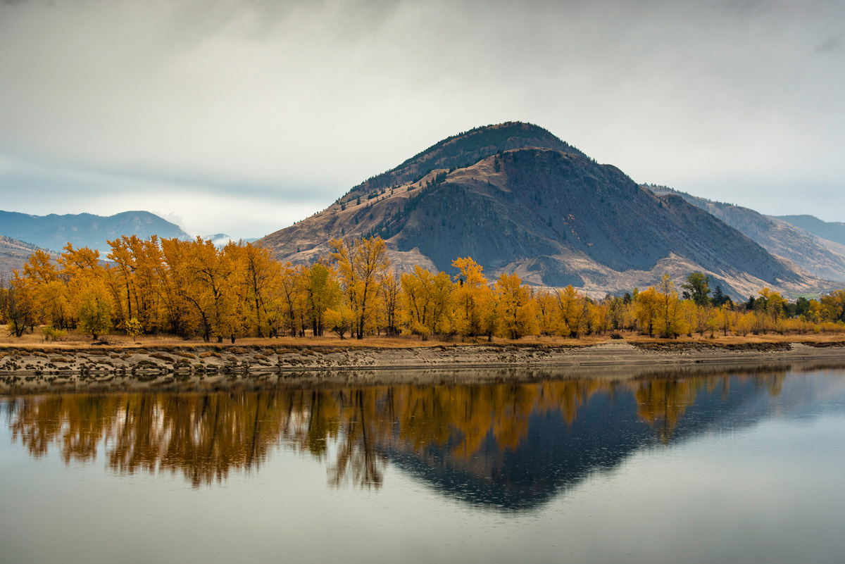
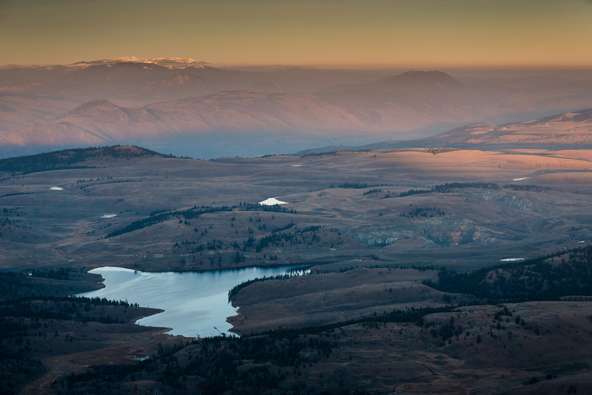
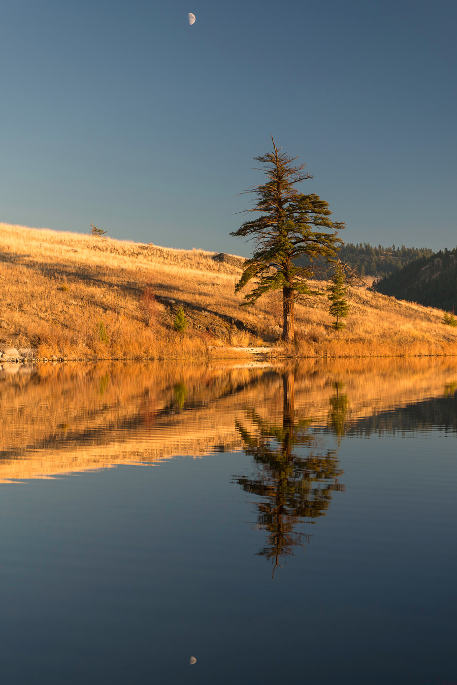
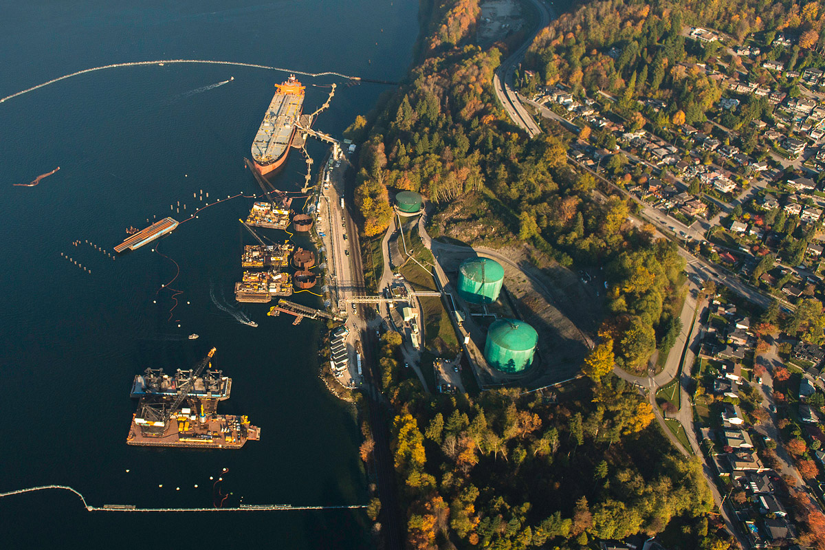
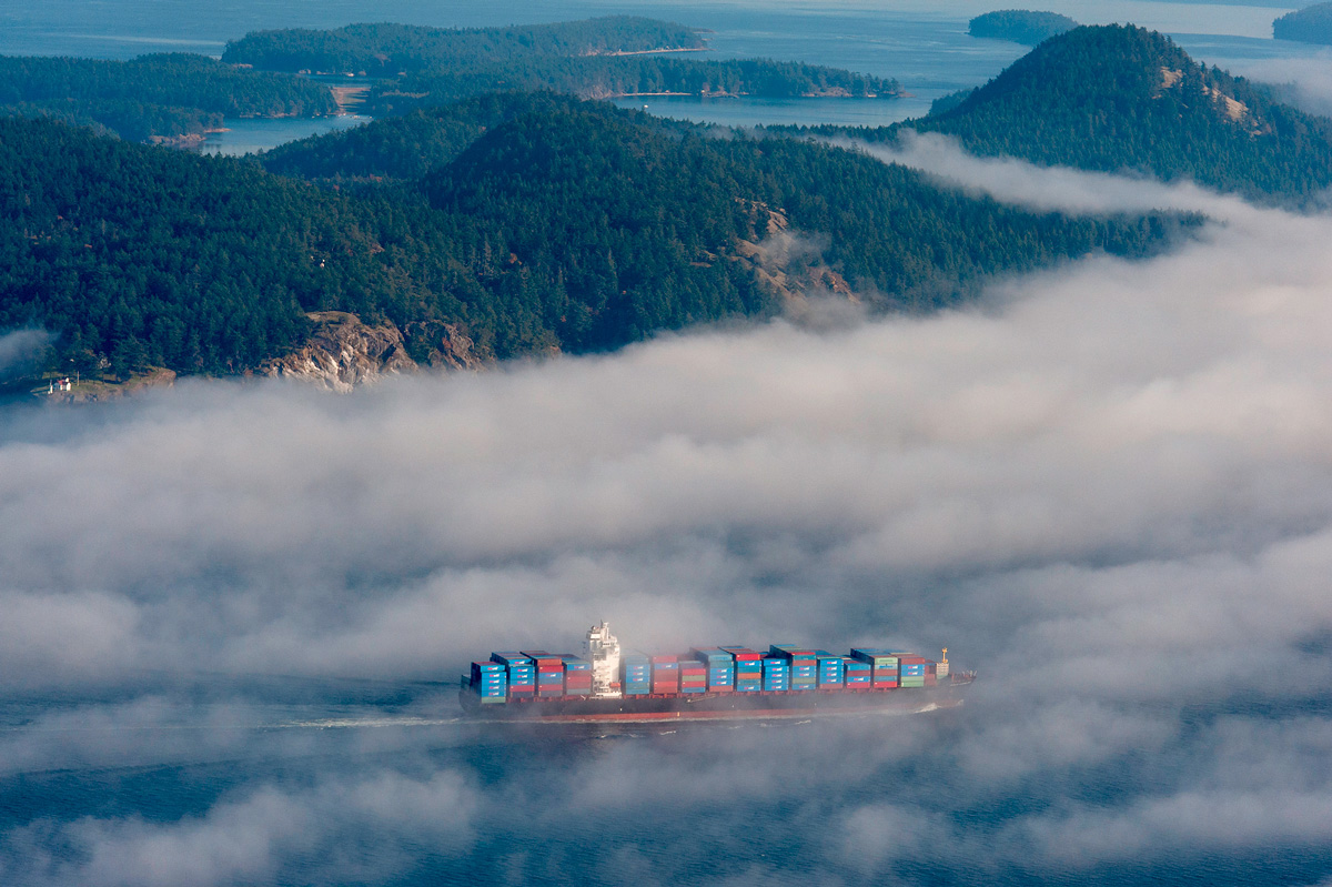
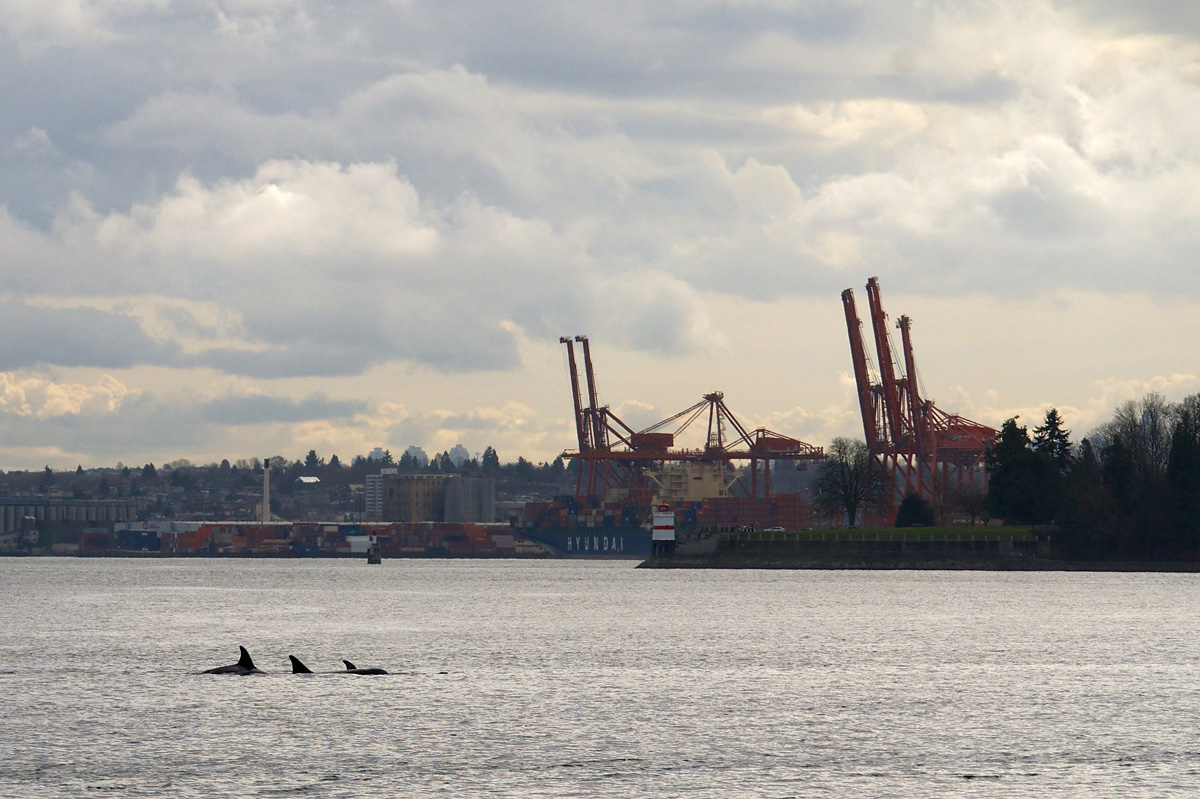
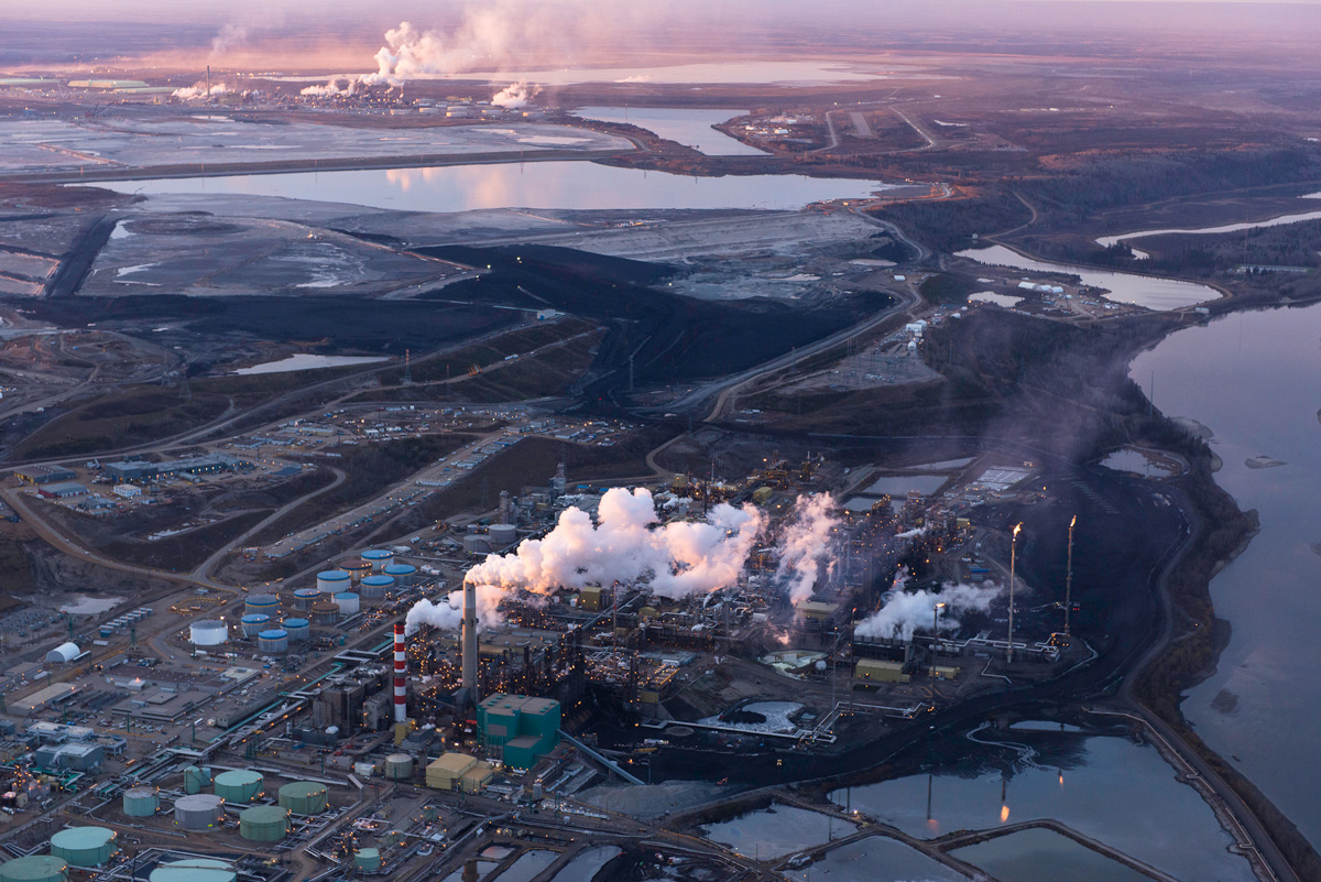
The TMX project essentially involves running a new pipeline parallel to the old one, tripling the volume of heavy oil that could be moved from Alberta to Burnaby and the Port of Vancouver. And parallel to the project’s sad financial prospects is another equally disturbing tale: that of the profound ecological and cultural threats posed by TMX.

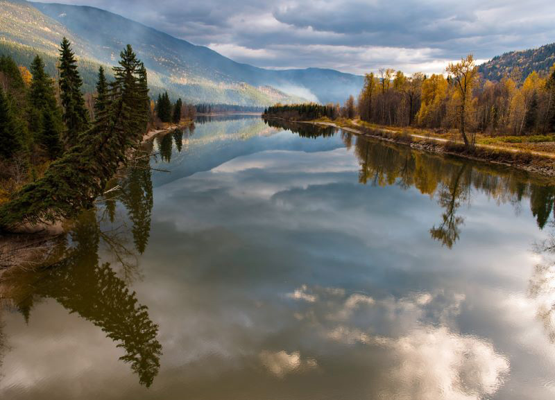
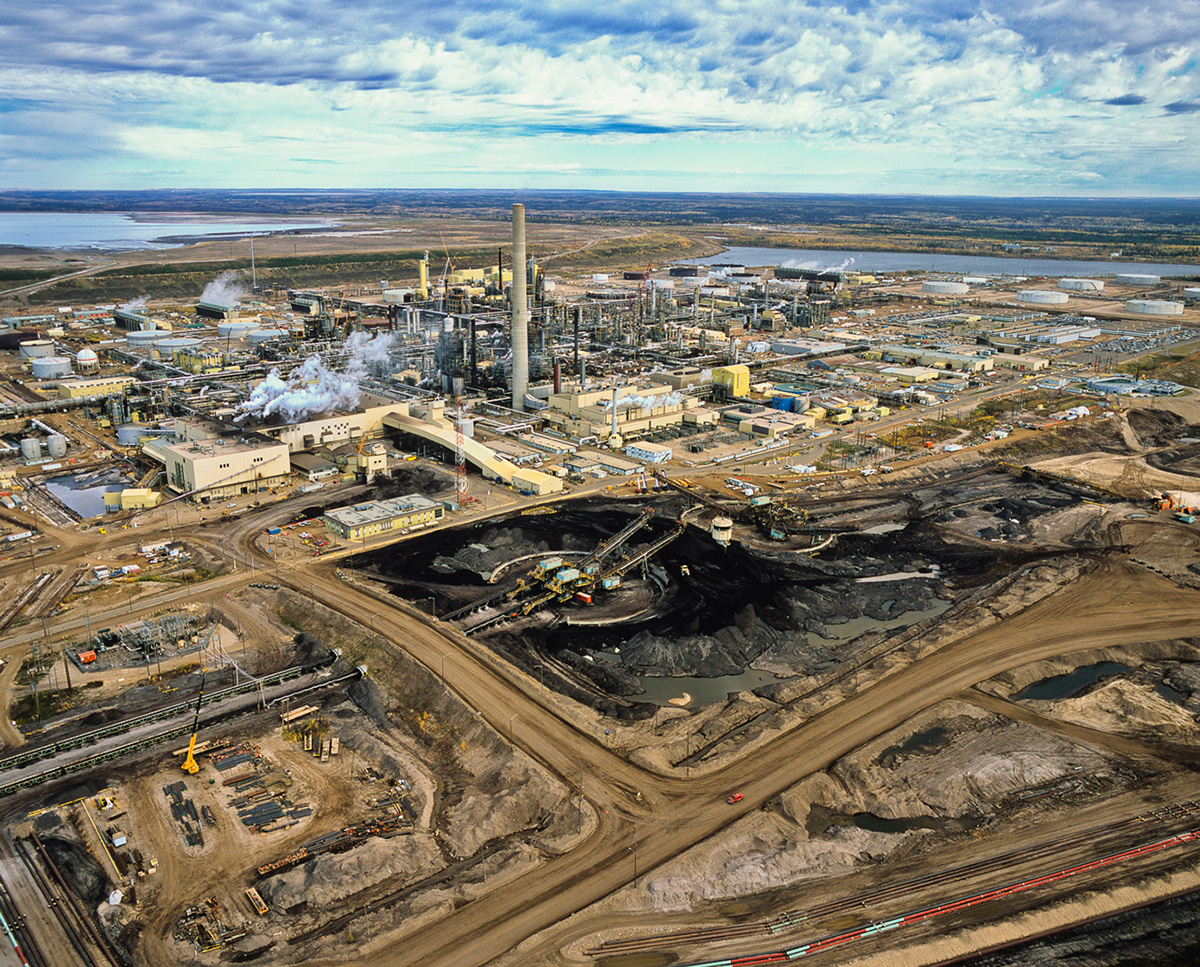
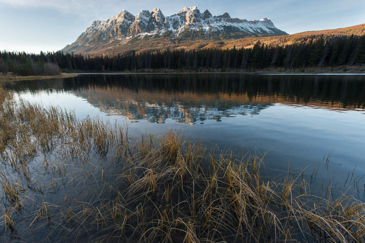
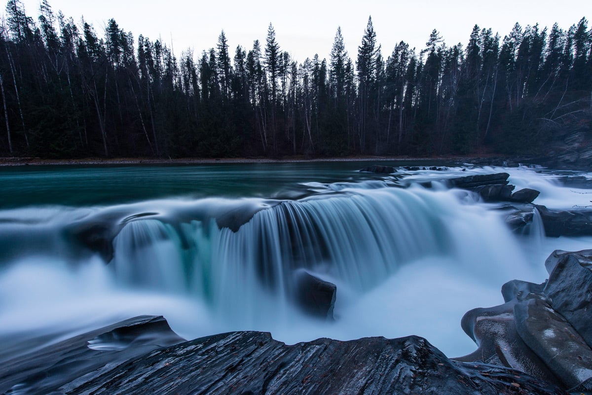
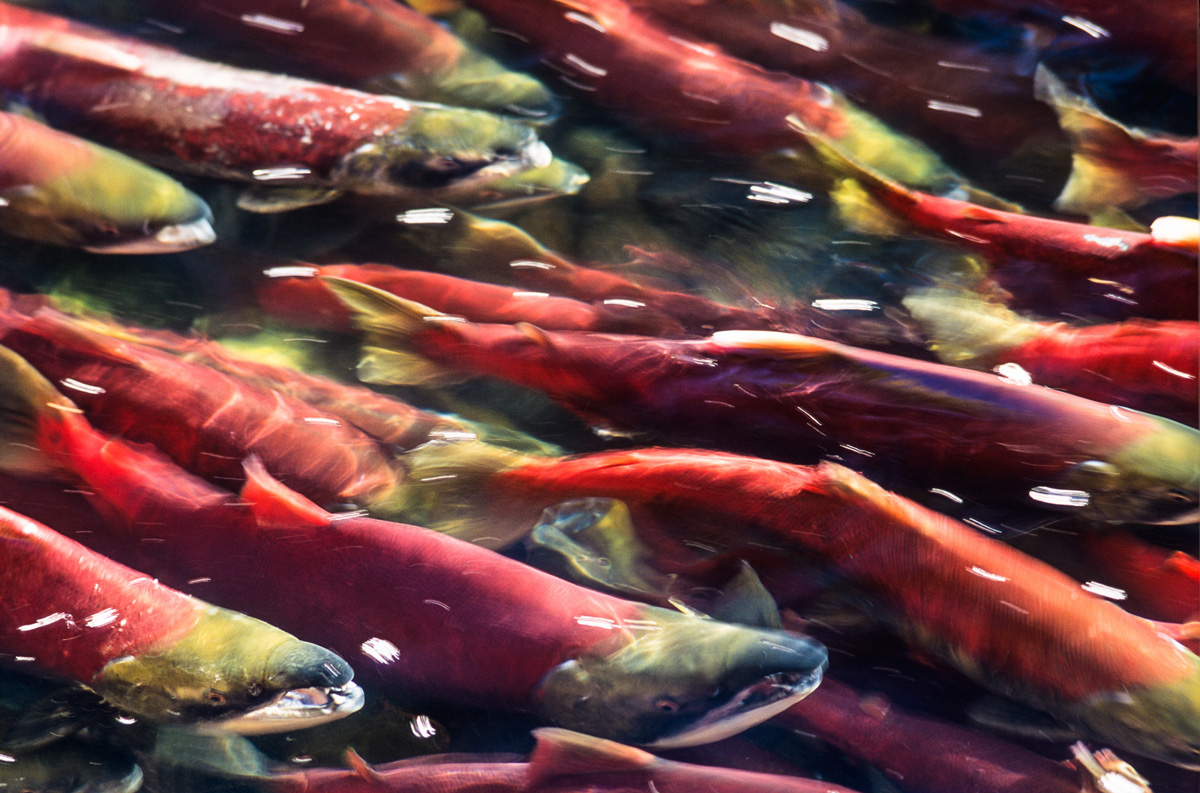
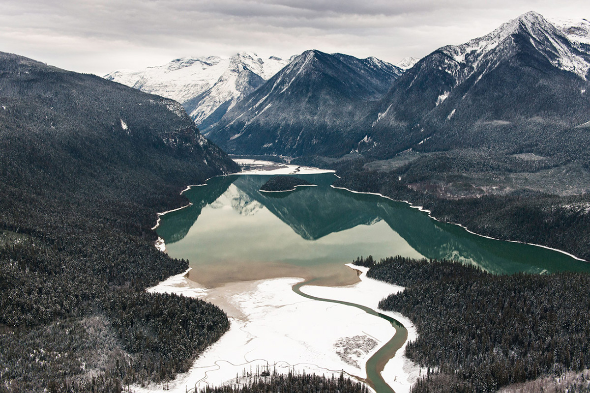
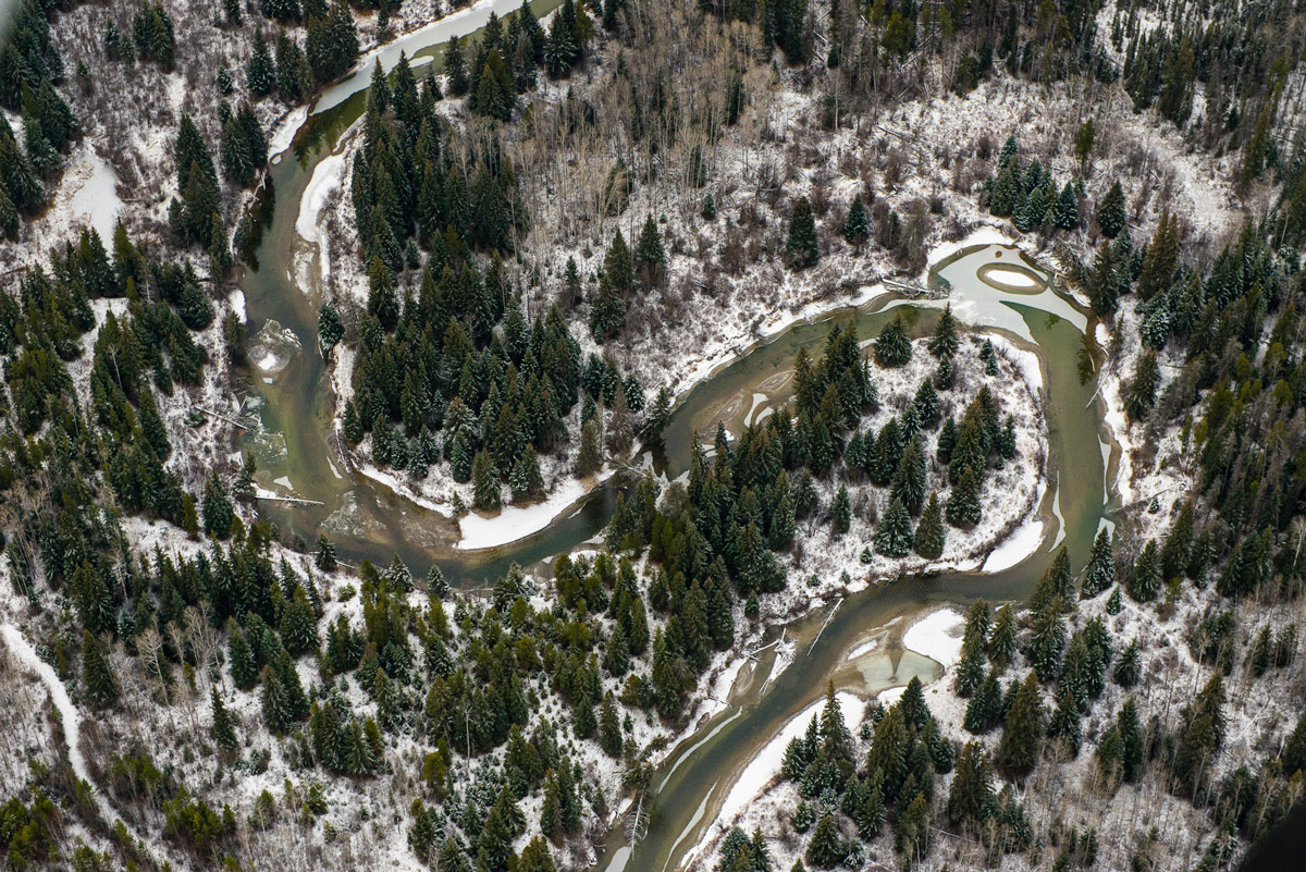
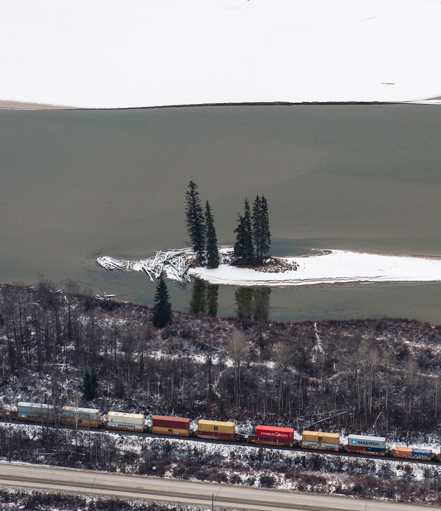
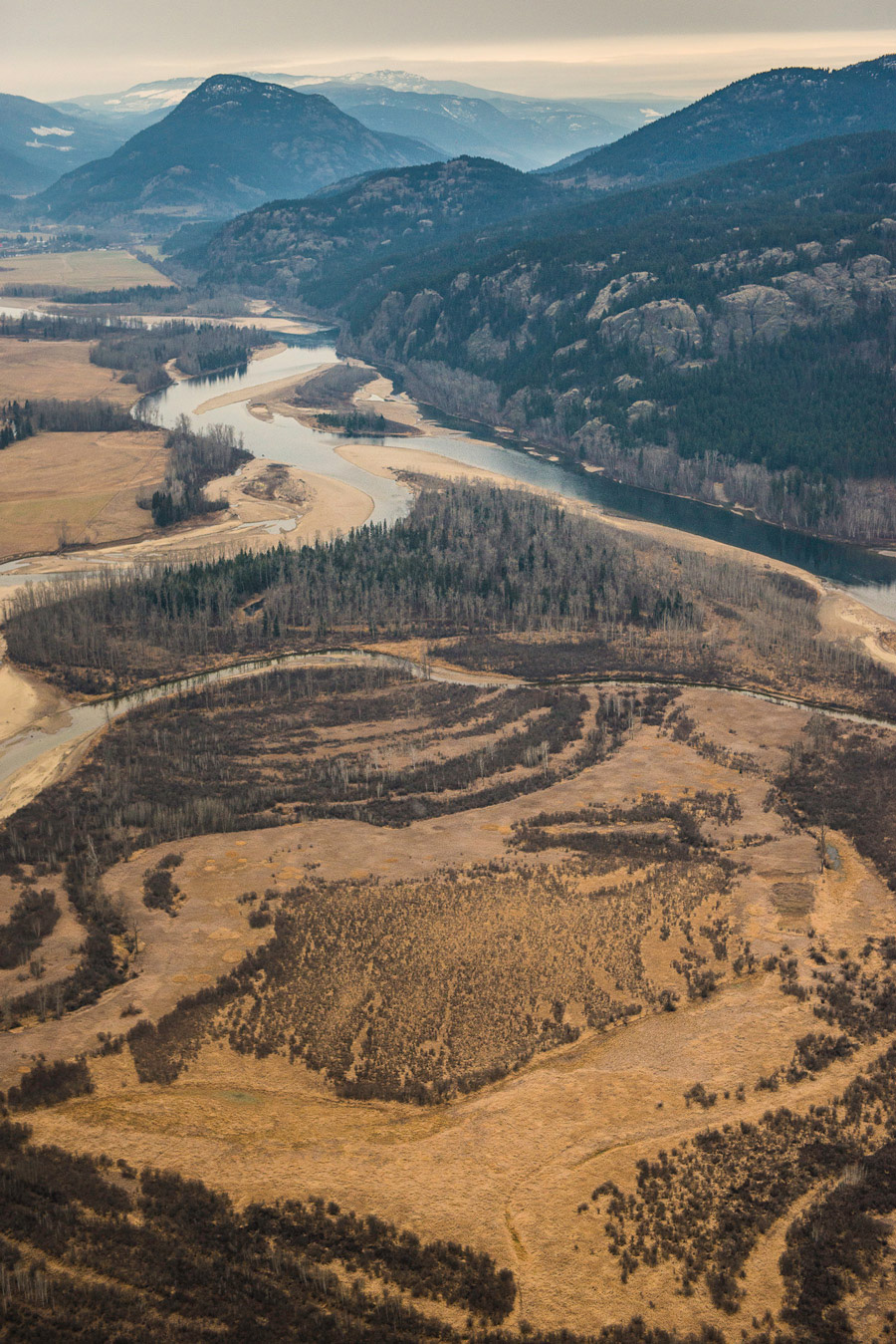
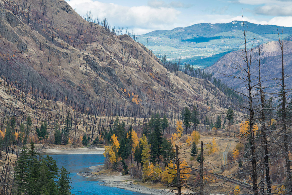
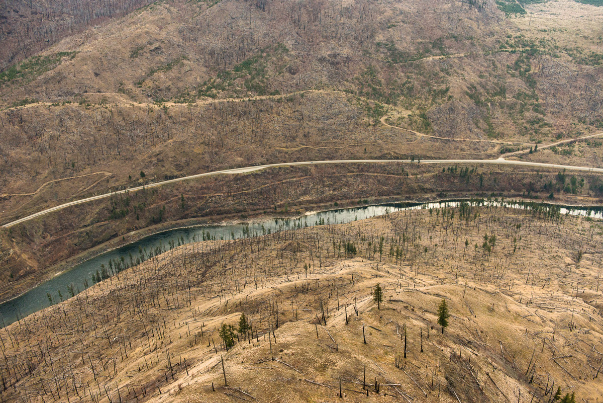
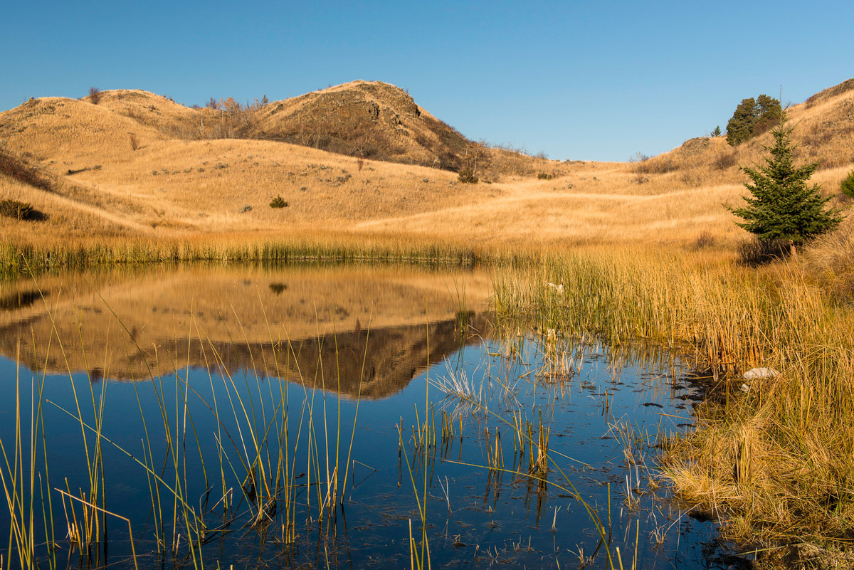
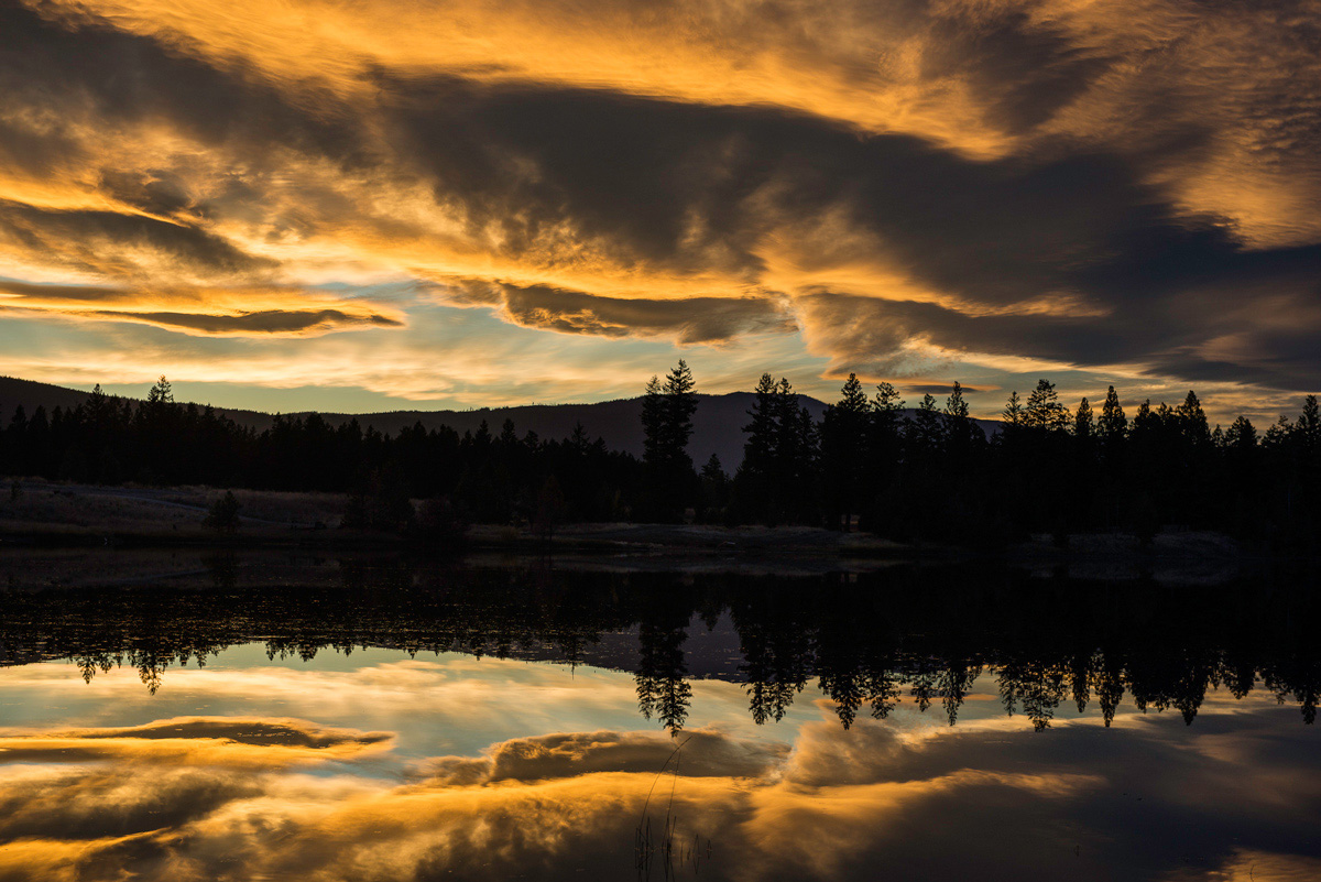
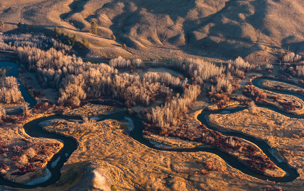
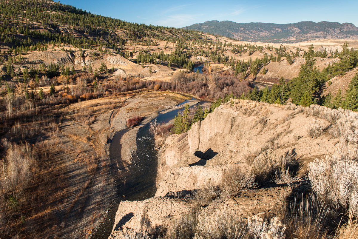
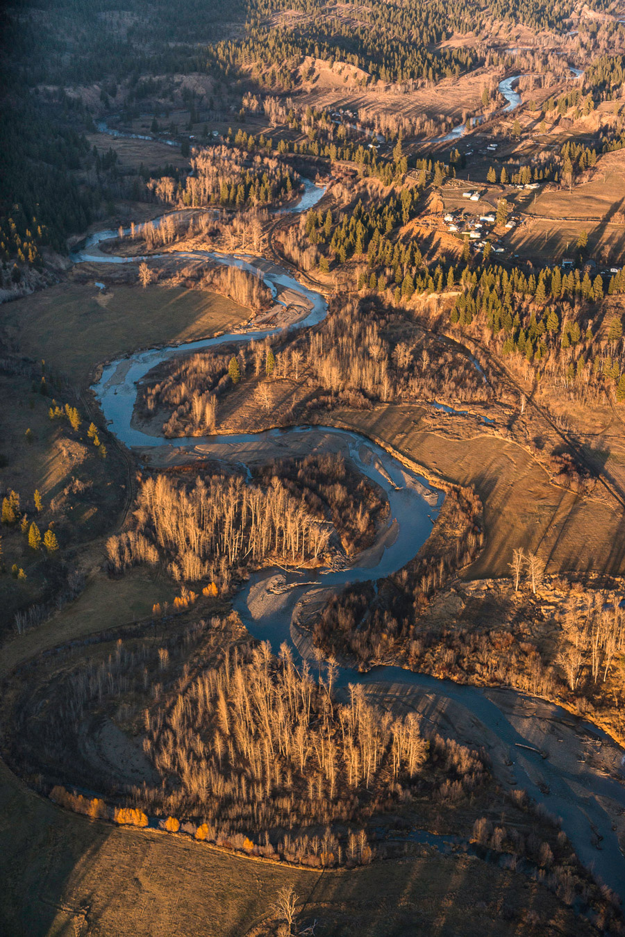
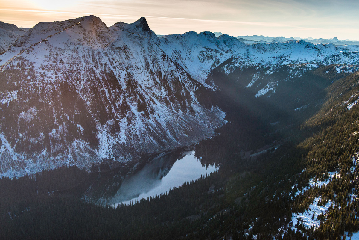
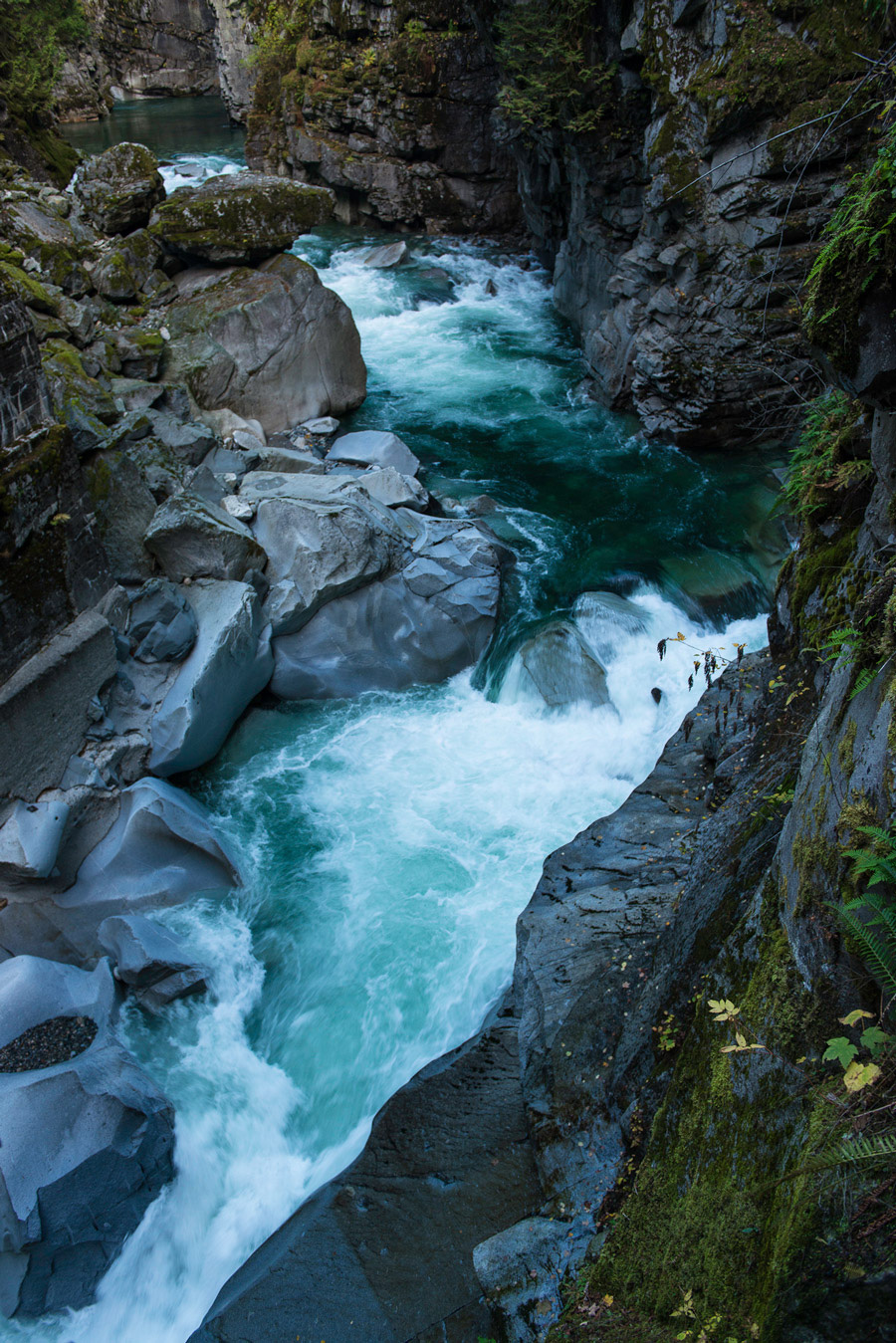
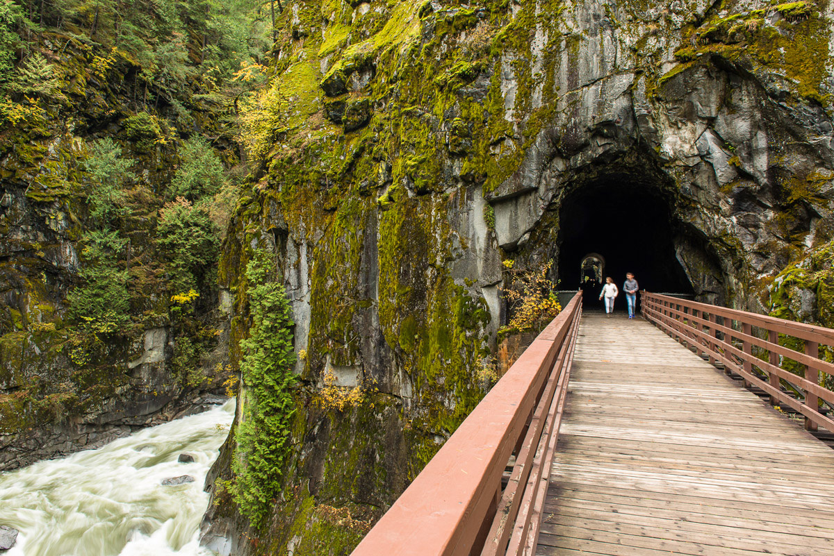
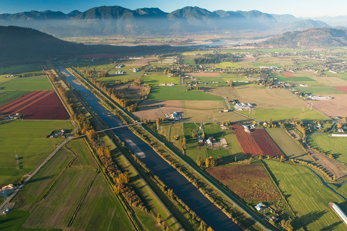
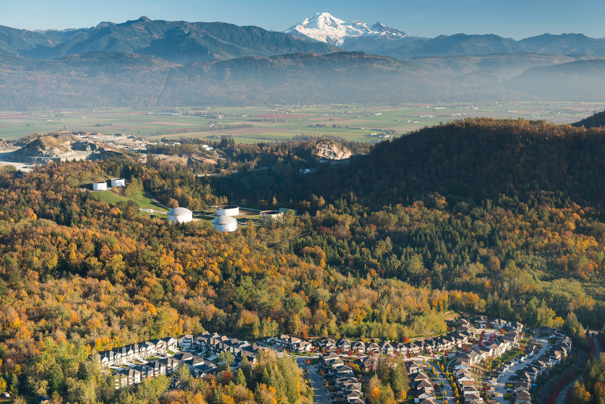
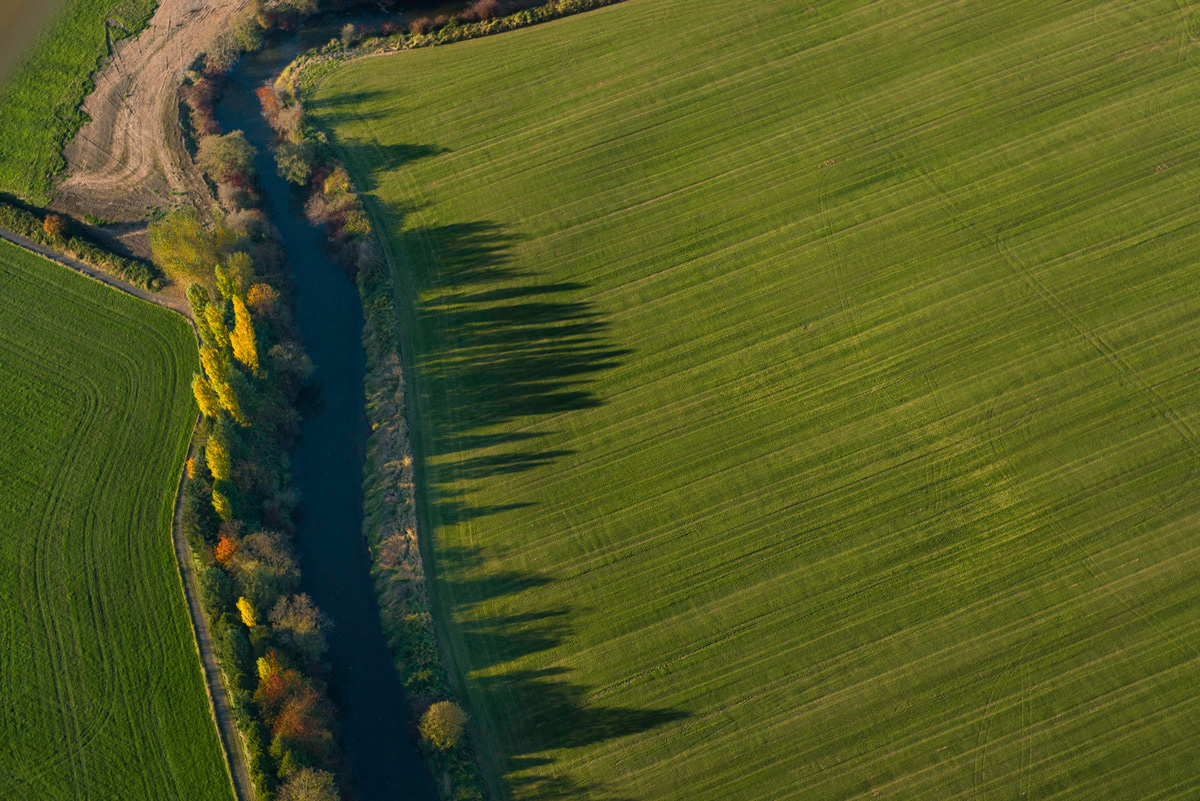
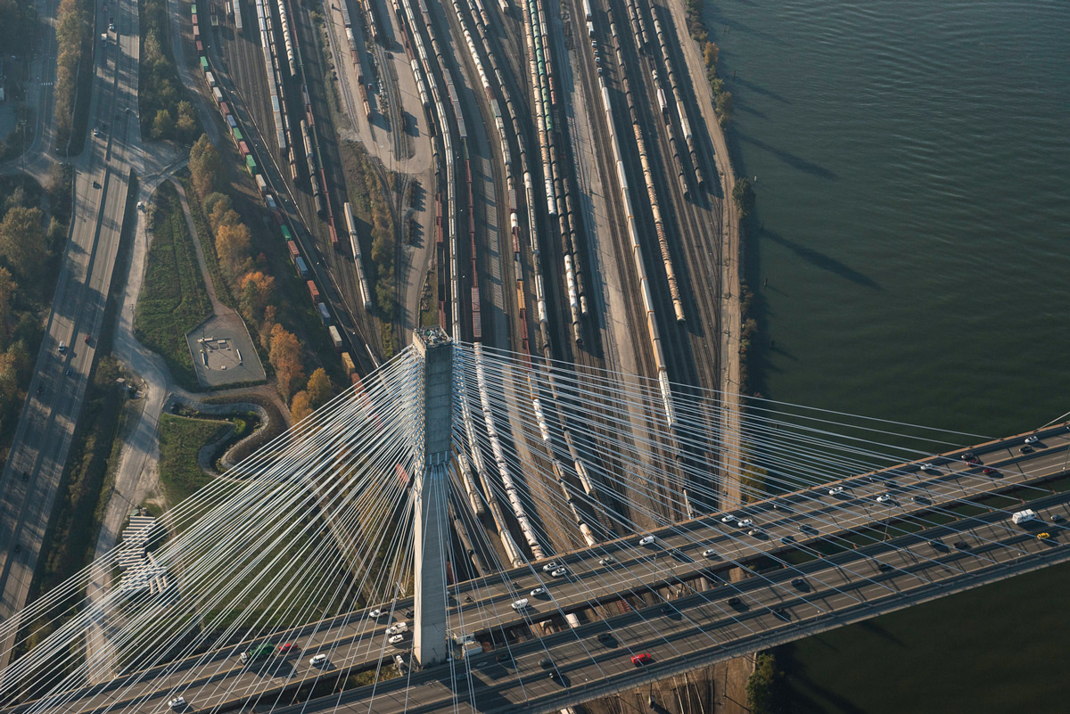
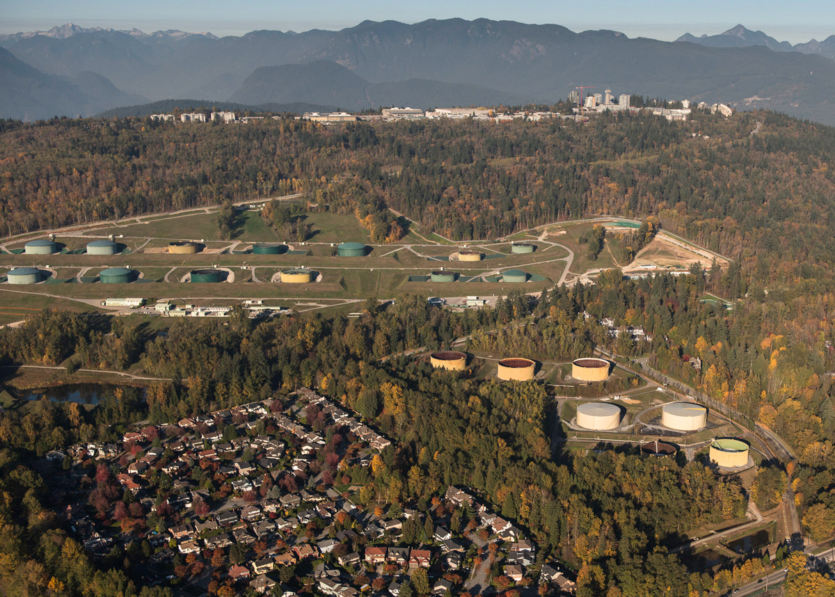
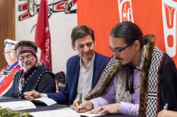
To shed light on that story, the Corporate Mapping Project asked Garth Lenz — an award-winning photographer who has spent decades documenting the ecological and climatic impacts of the fossil fuel industry — to explore the rich and varied landscapes that would be threatened by pipeline construction.

Several flights over those lands left Lenz humbled at what he saw.

The swath of land that this pipeline would pass through is uniquely beautiful, dramatic and rare and not something to be taken for granted or put at risk for such dubious gains as have been claimed by the fossil fuel industry and Canadian and Alberta governments. — Garth Lenz

His photographic journey begins here.

TMXAlbertaOilsandsAerial.jpg
Far from the Trans Mountain pipeline’s entry into British Columbia lie the Alberta oilsands: the planet’s largest energy project, Canada’s single largest and fastest growing source of greenhouse gas emissions, and the greatest concentration of capital the world has ever seen.
YellowheadLakeMountain.jpg
Yellowhead Lake and Yellowhead Mountain. Lying on the BC-Alberta border and the Continental Divide and the point where the pipeline would enter BC, this area is the source of the Fraser River. This photograph is taken almost on top of the proposed pipeline route.
851px version of RearguardFalls.jpg
Rearguard Falls Provincial Park, located along the Yellowhead Highway just south of Mount Robson Provincial Park, is the farthest upstream that salmon can travel during their spawning migration up the Fraser River system and lies very close to the pipeline route.
851px version of SockeyeSalmonFraserRiver.jpg
Sockeye salmon on their spawning migration in a tributary of the Fraser River. The Fraser River already faces numerous threats to its salmon population. Lying almost entirely within the Fraser River watershed, the pipeline could present the single greatest threat to the river’s salmon populations.
BlueRiverBlackSpruce.jpg
Just outside of the community of Blue River, the proposed pipeline route runs along the edge of Blue River Black Spruce Provincial Park. It is one of 22 parks and protected areas that the pipeline would cross.
851px version of McLennanRiverAerial.jpg
The McLennan River near Valemount, BC is a tributary of the Fraser River and also connects with nearby Swift Creek. The location pictured is near its confluence with the Fraser River and Swift Creek as well as where the Fraser is joined and crossed by the pipeline.
851px version of FreightCarsNorthThompsonRiver.jpg
Freight cars and the North Thompson River. Along this stretch of the proposed TMX between Clearwater and Blue River, the pipeline would cross the North Thompson River five times.
851px version of NorthThompsonRiverValley.jpg
North Thompson River and valley north of Barriere. The pipeline borders the North Thompson River, crossing it at various points, until it intersects with the Fraser River just north of Valemount.
BarriereWildfireCorridor.jpg
Near the community of Barriere. An intense wildfire here in 2003 caused massive damage and evacuations in the communities of Barriere, McClure, Louis Creek and surrounding areas. Intensifying wildfires are a reminder of the devastating climatic consequences of fossil fuel use. The pipeline would run just a few kilometres west of this corridor.
851px version of LouisCreekBarriere.jpg
A scene of the massive 2003 wildfire between Louis Creek and Barriere and just a few kilometres from the pipeline route.
851px version of LacDuBoisGrasslands.jpg
Lac du Bois Grasslands Protected Area. This protected area is located on the northwest border of the city of Kamloops. The pipeline would travel within the eastern border of the protected area and just west of the North Thompson River.
851px version of LacDuBoisGrasslandsProtectedArea.jpg
Lac du Bois Grasslands Provincial Protected area, Kamloops, and the North Thompson River. The pipeline would cut through the eastern section of this large protected area.
ThompsonRiverSouthShore.jpg
The south shore of the Thompson River in Kamloops, BC just upstream of where the pipeline would cross directly under the river.
851px version of JackoLakeAerial.jpg
Jacko Lake, south of Kamloops, is a lake of great cultural significance to the Secwepemc people. The pipeline would travel along its western shore.
851px version of JackoLake.jpg
A tree at Jacko Lake.
InksLake.jpg
Inks Lake. Located within about a kilometre of the pipeline route, this lake lies within the traditional territory of the Secwepemc Nation and is just west of Jacko Lake.
851px version of LowerNicolaRiver.jpg
The Lower Nicola River. The pipeline would cross the river here, just north of Merritt and south of Nicola Lake. The pipeline would pass through many reserves of the Lower Nicola First Nation, potentially threatening its aquifers.
851px version of NlakapamuxNationLand.jpg
Coldwater River and the traditional lands of the Nlaka’pamux Nation near the Coldwater First Nation reserve. The pipeline would cross the Coldwater River.
851px version of ColdwaterRiverAerial.jpg
Coldwater River just upstream from the Coldwater reserve. The Coldwater First Nation have successfully fought to prevent the pipeline from running through their aquifer and endangering their water supplies.
851px version of FallsLakeCoquihallaSummit.jpg
Falls Lake in the Coquihalla Summit recreation area. The pipeline would cut through this recreation area and rugged wilderness.
851px version of CoquihallaRiver.jpg
Coquihalla Canyon Provincial Park. This popular park is located just outside the community of Hope. The pipeline would run within about a kilometre of its northern border. Its dramatic canyon with its 300-foot sheer granite walls along the Coquihalla River required the creation of a series of tunnels in 1914 as part of the Kettle Valley Railway.
851px version of CoquihallaCanyonProvincialPark.jpg
The Coquihalla River in Coquihalla Canyon Provincial Park and a tributary of the Fraser. The existing pipeline crosses the Coquihalla 13 times in less than 20 kilometres. The proposed alternative route for the pipeline avoids those crossings but would be vulnerable to avalanches in this very rugged terrain.
FraserValleyChilliwackAerial.jpg
A little south of Hope the pipeline flows through the heart of the Fraser Valley, the province’s most fertile and productive agricultural area. The pipeline crosses Chilliwack/Vedder River near the community of Yarrow in the Fraser Valley.*
851px version of SumasTankFarmFraserValley.jpg
The pipeline’s Sumas Tank Farm with residential area, Fraser Valley agricultural land and Mount Baker in the background. A study commissioned by the cities of Abbotsford, Surrey, Coquitlam and Burnaby, and the township of Langley, found that an expanded pipeline would cost the five municipalities more than $93 million over 50 years.
851px version of SalmonRiverFortLangley.jpg
The Salmon River in Fort Langley near the point where this salmon producing tributary of the Fraser River is crossed by the pipeline. There have been multiple spills on the existing pipeline in Abbotsford in the last 11 years.
851px version of PortMannBridgeAerial.jpg
The south arm of the Fraser River and the Port Mann Bridge where the pipeline crosses the Fraser River in Surrey.
851px version of BurnabyTankFarm.jpg
The tank farm in Burnaby at the pipeline terminus would double from 13 to 26 tanks. Professional engineers as well as the deputy fire chief of the City of Burnaby have concluded that the expansion would result in the greatly increased likelihood of an inextinguishable tank fire that would threaten human health and property.
OilTankerBurrardInlet.jpg
An oil tanker fills up at the pipeline’s terminal in eastern Burrard Inlet in Burnaby — Tsleil-Waututh territory. The pipeline expansion would result in a seven-fold increase in tanker traffic in these already busy waters, including tankers carrying up to 120,000 tons of toxic diluted bitumen. That’s 3,000 times more potential pollutant than the spill by the cargo ship Marathassa in English Bay that fouled local beaches in 2015.
851px version of FreighterHaroStrait.jpg
Haro Strait and the Salish Sea near the Swartz Bay ferry terminal — busy waters that oil tankers would transect with the pipeline’s oil. Tankers five times heavier than cargo ships like this would travel 148 kilometres through these narrow waterways before reaching the open ocean. Clearly any kind of an oil spill in these waters would have devastating effects on a range of species but the iconic — and threatened — southern resident orca pod is most at risk.
851px version of CrabParkOrcas.jpg
Southern resident orca whales are already officially listed as endangered by the Canadian government. Increased oil tanker traffic will only make the species’ toehold on survival more precarious.
AerialIndustryOilsands.jpg
With recent reports showing climate change to be far worse than previously anticipated, and with major foreign players like Royal Dutch Shell, Marathon, Statoil and Conoco Phillips voting with their feet and running for the (oilsands) exits, is this really the time that we should be spending huge amounts of taxpayers’ money to buy and build pipelines that the industry sees as uneconomical?

Reassessment of Need for the Trans Mountain Pipeline Expansion Project: Production forecasts, economics and environmental considerations by David Hughes is available for download here.

This story is republished with permission from photographer Garth Lenz and the B.C. office of the Canadian Centre for Policy Alternatives, which first published it on its site Policy Note.

*Story updated on Nov. 18 at 11 a.m. to correct information about the Trans Mountain pipeline expansion's crossing of the Chilliwack/Vedder River.  [Tyee]

Read more: Energy, Environment

  • Share:

Facts matter. Get The Tyee's in-depth journalism delivered to your inbox for free

Tyee Commenting Guidelines

Comments that violate guidelines risk being deleted, and violations may result in a temporary or permanent user ban. Maintain the spirit of good conversation to stay in the discussion.
*Please note The Tyee is not a forum for spreading misinformation about COVID-19, denying its existence or minimizing its risk to public health.

Do:

  • Be thoughtful about how your words may affect the communities you are addressing. Language matters
  • Challenge arguments, not commenters
  • Flag trolls and guideline violations
  • Treat all with respect and curiosity, learn from differences of opinion
  • Verify facts, debunk rumours, point out logical fallacies
  • Add context and background
  • Note typos and reporting blind spots
  • Stay on topic

Do not:

  • Use sexist, classist, racist, homophobic or transphobic language
  • Ridicule, misgender, bully, threaten, name call, troll or wish harm on others
  • Personally attack authors or contributors
  • Spread misinformation or perpetuate conspiracies
  • Libel, defame or publish falsehoods
  • Attempt to guess other commenters’ real-life identities
  • Post links without providing context

LATEST STORIES

The Barometer

Are You Concerned about AI?

Take this week's poll